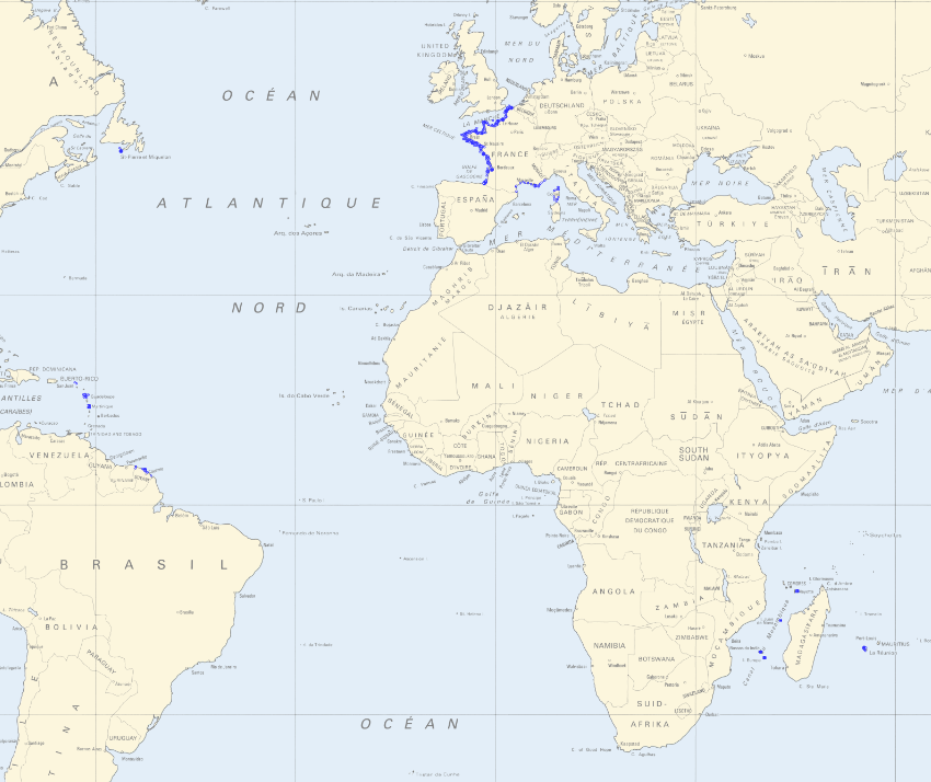
Maritime Altimetric References
In accordance with decree no. n°2019-165 of 5 March 2019, Shom measures and updates maritime altimetric datums or hydrographic datums for French ports in mainland France and overseas administrative departments and authorities. These datums are provided to allow for standardisation based on legal altimetric datum systems (e.g. IGN69).
Shom also disseminates typical tide figures for each port (lowest tide, mean tide, etc.).
The Marine Altimetric Reference Value (RAM) product is available for ports in mainland France and for overseas territories with a tidal observatory.
Simple
- Date (Creation)
- 2007-01-01
- Date (Revision)
- 2022-11-30
- Identifier
- http://www.shom.fr/MAREE_COURANTS/RAM
- Credit
- ©Shom
- Maintenance and update frequency
- As needed
- Type de jeux de donnée - ODATIS
-
- /Données dérivées/Données de type modèle
- Sous-regions marines
-
- National
- Thématiques - SIMM
-
- /Etat du Milieu/Hydrodynamique
- Theme
-
- chart datum
- tides
- typical levels
- fundamental references
- RGL
- Coastal Geographic Reference
- National
- product
- open data
- Use limitation
- Data may be freely used providing that the source is mentioned as follows "Shom, 2022. Références Altimétriques Maritimes"
- Use limitation
- The product is distributed under an Opendata license (version 2.0, April 2017), defined by the Etalab mission.
- Use limitation
- Data may be freely used providing that the source is mentioned as follows "Shom, 2022. Références Altimétriques Maritimes". Open licence Etalab v. 2.0 avril 2017.
- Access constraints
- License
- Use constraints
- Other restrictions
- Other constraints
- Open licence Etalab v. 2.0 avril 2017.
- Access constraints
- Other restrictions
- Other constraints
- No public access restrictions.
- Classification
- Unclassified
- Spatial representation type
- Text, table
- Metadata language
- freFrançais
- Character set
- utf8 UTF8
- Topic category
-
- Oceans
- Description
- Métropole et Outre Mer
))
- Unique resource identifier
- WGS 84 (EPSG:4326)
- Distribution format
-
-
PDF (Portable Document Format)
(
inapplicable
)
-
SHP (Shapefile)
(
inapplicable
)
-
CSV
(
inapplicable
)
-
PDF (Portable Document Format)
(
inapplicable
)
- OnLine resource
-
Shom geoportal
(
WWW:LINK-1.0-http--link
)
Shom geoportal
- OnLine resource
- RAM_BDD_WLD_WGS84G_WMS ( OGC Web Map Service )
- OnLine resource
- RAM_BDD_WLD_WGS84G_WFS:ram_3857 ( OGC Web Feature Service )
- OnLine resource
- Download service (PDF + SHP) ( WWW:LINK-1.0-http--link )
- OnLine resource
- Shom distribution space ( WWW:LINK-1.0-http--link )
- Hierarchy level
- Dataset
Conformance result
- Date (Publication)
- 2010-11-23
- Explanation
- Information sur la conformité au règlement d'interopérabilité des séries et des services de données géographiques.
- Pass
- Yes
- Statement
- These data are determined based on measurements taken at the various tide observatories or collected from partner organisations. Information on hydrographic datums is regularly updated. The former data comprise the Shom tide database, the source of this solution.
- File identifier
- MAREE_COURANTS_RAM.xml XML
- Metadata language
- Français
- Character set
- UTF8
- Hierarchy level
- Dataset
- Hierarchy level name
- Produit
- Date stamp
- 2023-01-13T13:54:40
- Metadata standard name
- ISO 19115:2003/19139
- Metadata standard version
- 1.0
Overviews


Spatial extent
))
Provided by

 Catalogue PIGMA