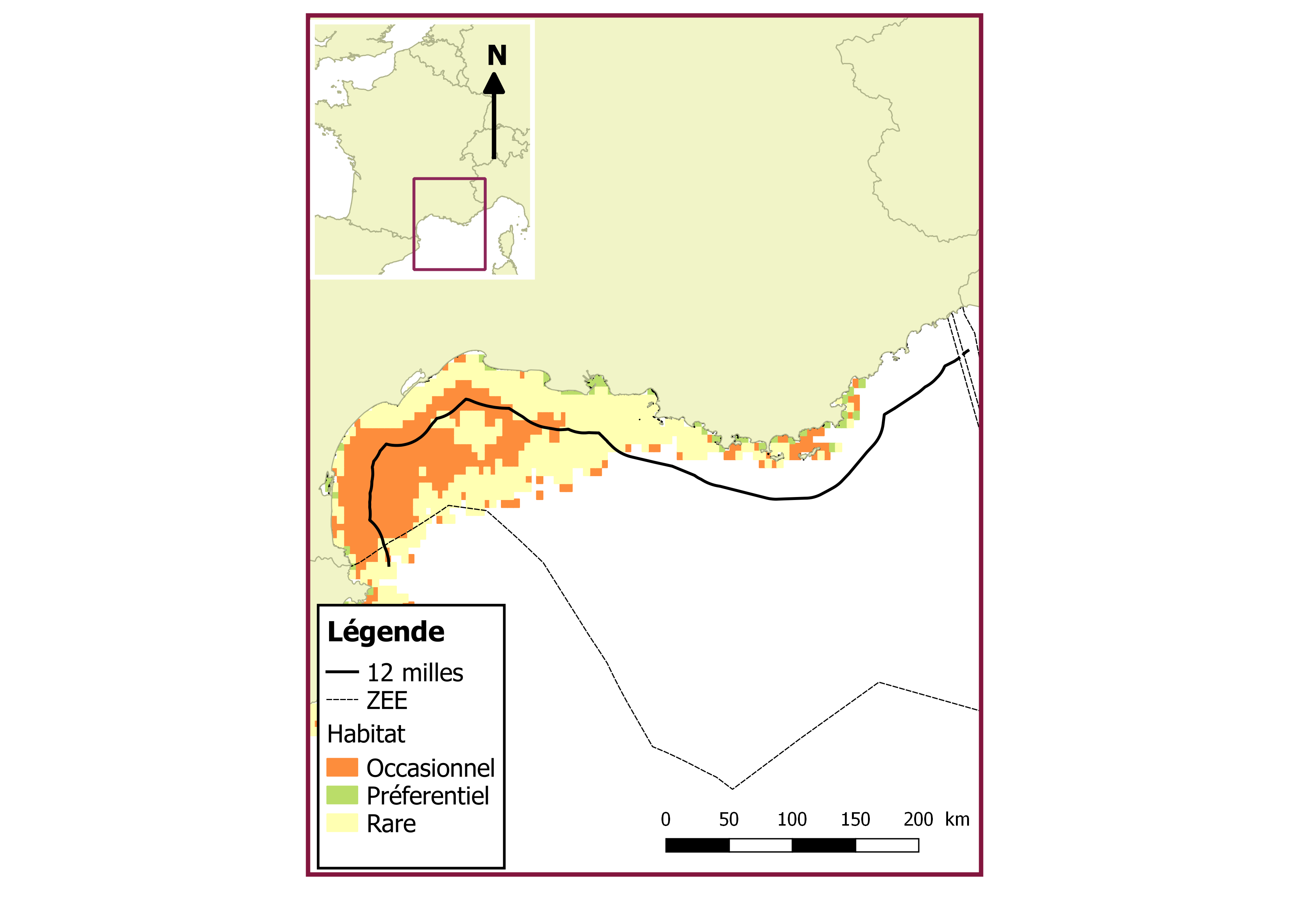
Nourricerie de maquereau en Méditerranée
Habitat Suitability Modeling to Identify the Potential Nursery Grounds of the Atlantic Mackerel and Its Relation to Oceanographic Conditions in the Mediterranean Sea
Simple
- Date (Publication)
- Identifier
- med_n_scomber
- Credit
- Giannoulaki M., Pyrounaki M. M., Bourdeix J.-H., Ben Abdallah L., Bonanno A., Basilone G., Iglesias M., Ventero A., De Felice A., Leonori I., Valavanis V. D., Machias A., Saraux C., (2017). Habitat Suitability Modeling to Identify the Potential Nursery Grounds of the Atlantic Mackerel and Its Relation to Oceanographic Conditions in the Mediterranean Sea. Frontiers in Marine Science, 4(230), 1-13 doi:10.3389/fmars.2017.00230
- Thèmes Sextant
-
- /Milieu biologique/Habitats
- GEMET - INSPIRE themes, version 1.0
-
- Habitats et biotopes
- Theme
-
- nourricerie
- maquereau
- zone fonctionnelle halieutique
- Cadre Réglementaire - SIMM
-
- Directive Cadre Stratégie pour le Milieu Marin (DCSMM)
- DCSMM : Descripteurs
-
- D1: Biodiversité - Céphalopodes
- D1: Biodiversité - Poissons
- Sous-regions marines
-
- /Métropole/Méditerranée occidentale
- Thématiques - SIMM
-
- /Activités et Usages/Pêche et Aquaculture
- /Etat du Milieu/Espèces
- /Etat du Milieu/Habitats
- Use limitation
- Giannoulaki M., Pyrounaki M. M., Bourdeix J.-H., Ben Abdallah L., Bonanno A., Basilone G., Iglesias M., Ventero A., De Felice A., Leonori I., Valavanis V. D., Machias A., Saraux C., (2017). Habitat Suitability Modeling to Identify the Potential Nursery Grounds of the Atlantic Mackerel and Its Relation to Oceanographic Conditions in the Mediterranean Sea. Frontiers in Marine Science, 4(230), 1-13 doi:10.3389/fmars.2017.00230
- Access constraints
- Other restrictions
- Use constraints
- Copyright
- Spatial representation type
- Vector
- Metadata language
- Français
- Character set
- UTF8
- Topic category
-
- Biota
N
S
E
W
))
- Reference system identifier
- EPSG / WGS 84 (EPSG:4326) / 8.6
- Geometric object type
- Complex
- Distribution format
-
-
ESRI Shapefile
(
1.0
)
-
ESRI Shapefile
(
1.0
)
- Protocol
- COPYFILE
- Name
- med_n_scomber
- Description
- Accès aux données
- Hierarchy level
- Dataset
Conformance result
- Date (Creation)
- 2012-01-16
- Explanation
- Non évalué
- File identifier
- b735cf4c-d509-48d3-9531-3b4e0d3b011c XML
- Metadata language
- Français
- Character set
- UTF8
- Parent identifier
- Zones fonctionnelles halieutiques d'importance (ZFHi) - Méditerranée d90bc6fa-5416-4064-97b6-8f671de3e407
- Hierarchy level
- Dataset
- Date stamp
- 2022-03-16T16:24:26.458Z
- Metadata standard name
- ISO 19115:2003/19139 - SEXTANT
- Metadata standard version
- 1.0
Overviews

Spatial extent
N
S
E
W
))
Provided by

Associated resources
Not available
 Catalogue PIGMA