 Catalogue PIGMA
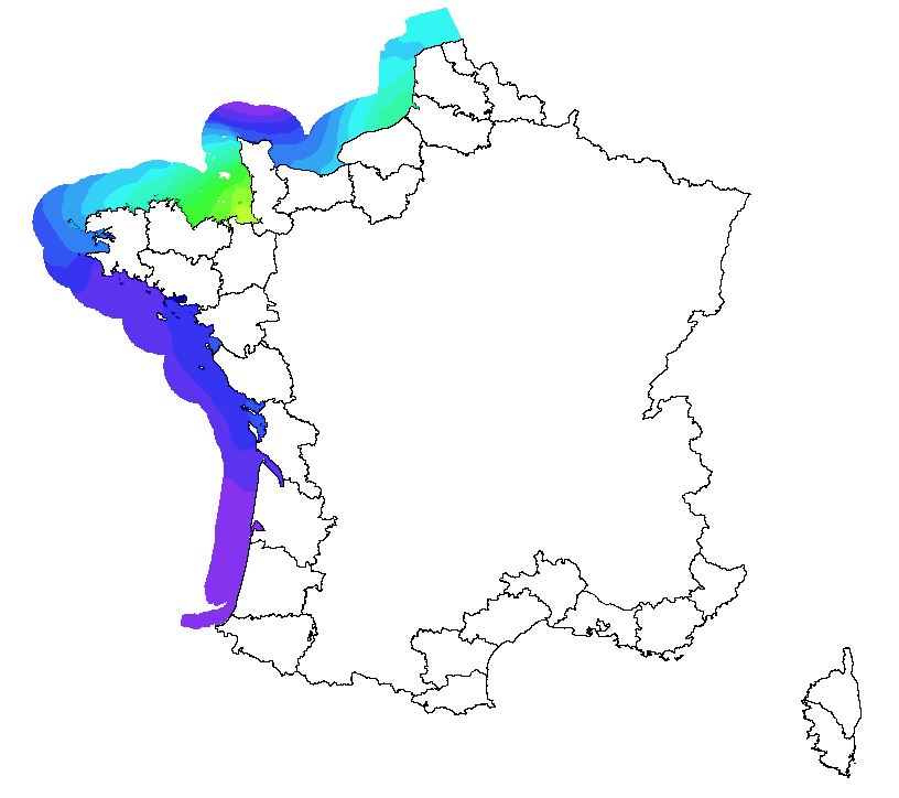
Marnage
Couche représentant les différentes hauteurs de marnage pour un coefficient de 95 en Manche et en Atlantique
Simple
- Date (Creation)
- 2014-09-01
- Identifier
- FR-177-606-654-0143-DT_marnage
- Status
- On going
- Maintenance and update frequency
- As needed
- GEMET - INSPIRE themes, version 1.0
-
- Hydrographie
- Use limitation
- Données sous Licence ouverte / Open licence : http://www.etalab.gouv.fr/pages/licence-ouverte-open-licence-5899923.html
- Access constraints
- Copyright
- Spatial representation type
- Vector
- Denominator
- 10000
- Metadata language
- Français
- Character set
- UTF8
- Topic category
-
- Oceans
N
S
E
W
))
- Reference system identifier
- EPSG / WGS 84 (3D) (EPSG:4329) / 7.9
- Topology level
- Geometry only
- Geometric object type
- Surface
- Distribution format
-
-
ESRI Shapefile
(
10
)
-
ESRI Shapefile
(
10
)
- OnLine resource
- http://www.geolittoral.developpement-durable.gouv.fr/ ( WWW:LINK )
- Hierarchy level
- Dataset
Conformance result
- Date (Creation)
- 2014-12-10
- Explanation
- Non évalué
- Pass
- No
- File identifier
- e7992b79-9c24-404a-a093-b77c15c7a946 XML
- Metadata language
- Français
- Character set
- UTF8
- Hierarchy level
- Dataset
- Date stamp
- 2018-01-18T13:07:49
- Metadata standard name
- ISO 19115:2003/19139 - SEXTANT
- Metadata standard version
- 1.0
Overviews
thumbnail
large_thumbnail
Spatial extent
N
S
E
W
Provided by

Associated resources
Not available