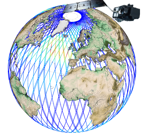
Produits altimétriques global Hauteur de vagues et vent (monomission, le long de la trace, niveau 3) NRT uniquement
Hauteurs significatives de vagues (SWH) et vitesse du vent, mesurées le long de la trace par les satellites altimétriques CFOSAT (nadir), Sentinel-3A et Sentinel-3B, Jason-3, Saral-AltiKa, Cryosat-2 et HY-2B, en temps quasi-réel (NRT), sur une couverture globale (-66°S/66+N pour Jason-3, -80°S/80°N pour Sentinel-3A et Saral/AltiKa).
Un fichier contenant les SWH valides est produit pour chaque mission et pour une fenêtre de temps de 3 heures. Il contient les SWH filtrées (VAVH), les SWH non filtrées (VAVH_UNFILTERED) et la vitesse du vent (wind_speed).
Les mesures de hauteurs de vagues sont calculées à partir du front de montée de la forme d'onde altimétrique. Pour Sentinel-3A et 3B, elles sont déduites de l'altimètre SAR.
Simple
- Date (Creation)
- 2017-06-15
- Credit
- E.U. Copernicus Marine Service
- Keywords
-
- vague, hauteur de vague
- Type de jeux de donnée ODATIS
-
- /Données d'observation/satellite
- Processing level
-
- Level 3
- ODATIS aggregation parameters and Essential Variable names
-
- Vagues
- Vent
- Use limitation
- Licence
- Access constraints
- Other restrictions
- Use constraints
- Other restrictions
- Other constraints
- Conditions of use are detailes in the licence : https://marine.copernicus.eu/services-portfolio/service-commitments-and-licence/
- Spatial representation type
- grid Grid
- Metadata language
- Français
- Character set
- utf8 UTF8
- Topic category
-
- Oceans
))
- Begin date
- 2017-07-07
- Reference system identifier
- EPSG / WGS 84 (EPSG:4326) / 7.4
- Geometric object type
- Complex
- Distribution format
-
-
(
)
-
(
)
- OnLine resource
- Plus d'information sur CMEMS ( DOI )
- OnLine resource
- Accès authentifié aux données via FTP ( WWW:LINK )
- Hierarchy level
- Dataset
- File identifier
- ef4a4f2f-cc96-4e8c-81a5-7ed579806a6b XML
- Metadata language
- Français
- Character set
- UTF8
- Hierarchy level
- Dataset
- Date stamp
- 2025-05-16T09:29:33.715303Z
- Metadata standard name
- ISO 19115-3 - SEXTANT ISO 19115-3 - SEXTANT
- Metadata standard version
- 1.0
Overviews

Spatial extent
))
Provided by

 Catalogue PIGMA