 Catalogue PIGMA
50000
Type of resources
Available actions
Topics
Keywords
Contact for the resource
Provided by
Years
Formats
Representation types
Update frequencies
status
Scale
Resolution
-
Conversion into the EMODnet format of the published grid for the Capbreton Canyon in 2007: http://dx.doi.org/10.12770/72e2f750-c255-11df-a9b6-005056987263
-
-
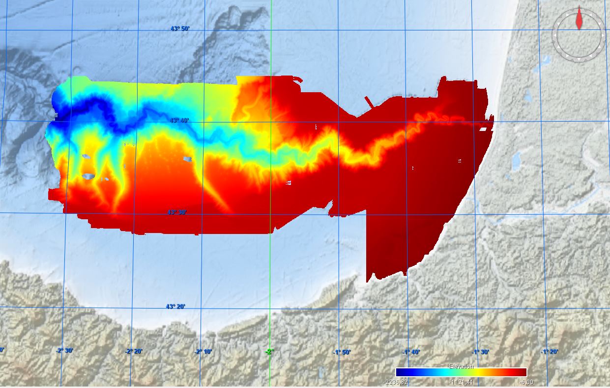
The product "Sea bed sediment 1:50 000" contains 2D surface objects geo-referenced digital data describing the nature of the geological seabed (nature of the sediment, including rock type seabed).
-

Multibeam bathymetry of Haifa Bay. Description of processed data sources: the data come from the Israel Oceanographic and Limnological Research R/V Etziona (www.ocean.org). Acquired with a Kongsberg-Simrad EM1002 (90 kHz, 111 beams). The data is the property of the Israeli Government, Ministry of National Infrastructures, which was renamed the Ministry of Energy and Water. The original data is classified. The navigation is all with real-time corrections and is <1 m. The appropriate oceanographic measurements were made with my AML CTD as well as a Valeport SV. The analysis was all done with CARIS HIPS/SIPS.
-
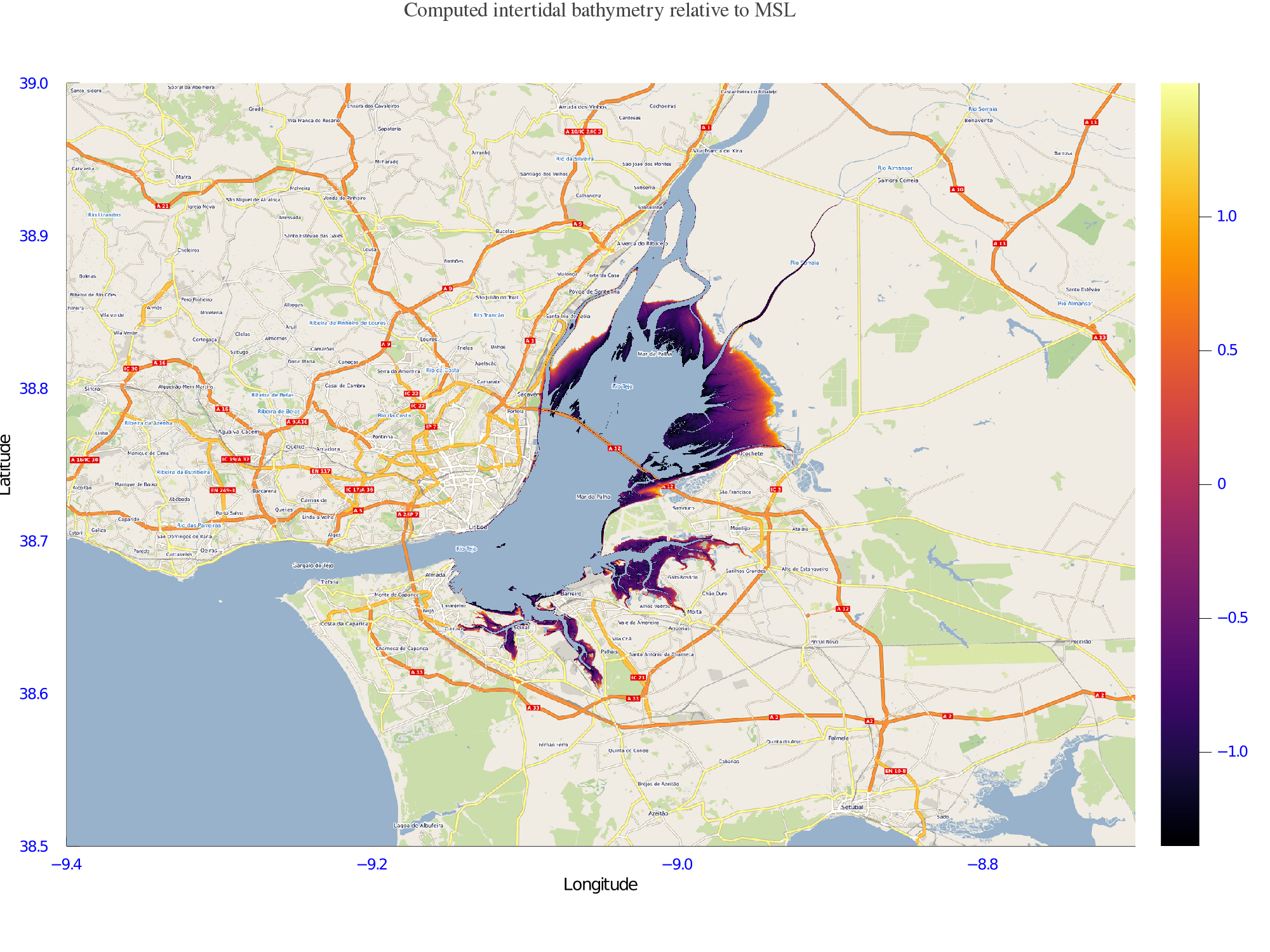
Satellite-derived intertidal bathymetry for the Tagus estuary near Lisbon Portugal
-
This British Geological Survey (BGS) marine geophysical and multibeam survey took place in June 2012 in the area of Ardmucknish Bay on board the RV White Ribbon. This was a follow up survey to the previous work carried out in this area (2011/4 and 2012/5). QICS (Quantifying and monitoring potential ecosystem impacts of geological carbon storage) was a scientific research project funded by NERC; its purpose was to improve the understanding of the sensitivities of the UK marine environment to a potential leak from a carbon capture storage (CCS) system. Sea floor bathymetry data were collected using a Kongsberg EM3002D multibeam system.
-

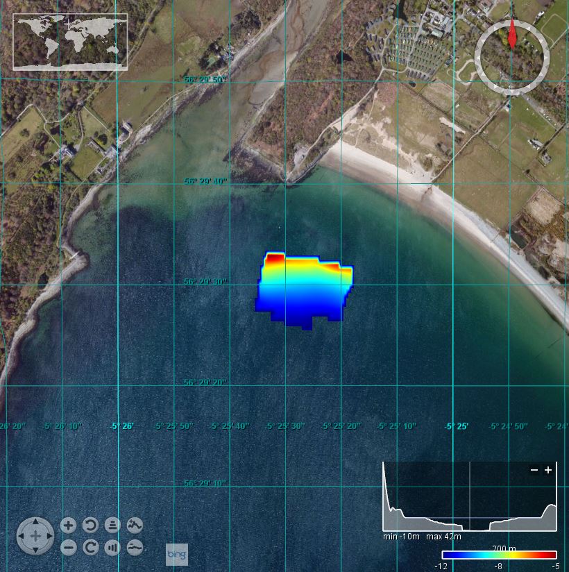
This marine multibeam survey took place in March 2013 within the MPA (Marine Protected Area) proposal area of the Lochs Duich, Long and Alsh and the additional area of the Kyle of Rhea on board the RV White Ribbon. The survey was carried out by the British Geological Survey (BGS) on behalf of Scottish Natural Heritage (SNH). The White Ribbon was equipped with a Kongsberg EM3002D dual head, multibeam echosounder system (MBES). Data were acquired using the Kongsberg SIS operating system, logging raw .ALL files. These data were processed offline by BGS using CARIS HIPS and SIPS 7.1 SP2.
-
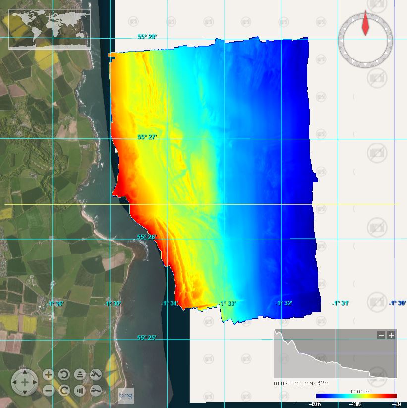
This British Geological Survey (BGS) marine geophysical and multibeam survey took place in January/Febuary 2012 in the area of the Moray Firth on board the RV White Ribbon. The purpose was to enable BGS to reconstruct the glacial history of the areas and place it in the wider context of the dynamics of the British Ice Sheet. Sea floor bathymetry data were collected using a Kongsberg EM3002D multibeam system.
-
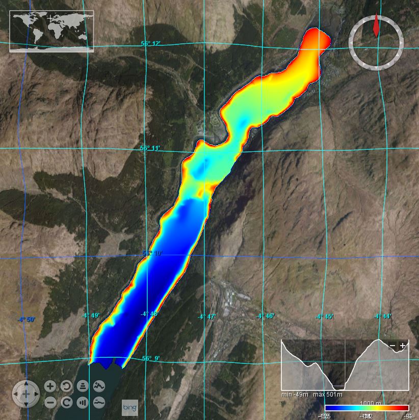
This marine multibeam and geophysical survey took place from 09/02/2015 – 18/02/2015 in the northern area of Loch Long on board the RV White Ribbon. The survey was carried out by the British Geological Survey (BGS). Bathymetric data on MV White Ribbon was acquired using a Kongsberg EM3002D multibeam echosounder system. Kongsberg Seafloor Information System (SIS) version 3.9.2 (build 187) was used for online data logging. A Trimble SPS461 and a Kongsberg Seatex Seapath 200 provided vessel position, heading and attitude. Offline data processing was performed using CARIS HIPS version 8.1.5.
-
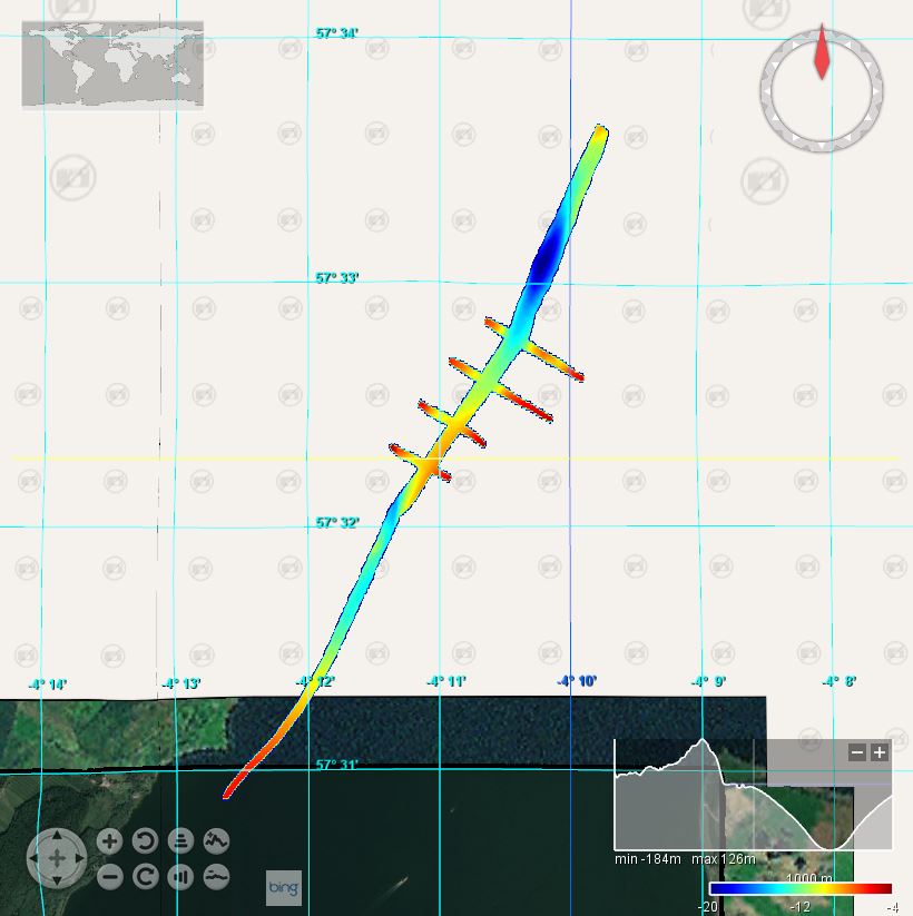
This marine multibeam and geophysical survey took place from 26 September – 5 October 2014 in the area of the North East coast of England near Craster on board the RV White Ribbon. The survey was carried out by British Geological Survey (BGS) in collaboration with English Heritage and Wessex Archaeology. Bathymetric data on MV White Ribbon was acquired using a Kongsberg EM3002D multibeam echosounder system. Kongsberg Seafloor Information System (SIS) version 3.9.2 (build 187) was used for online data logging. A Trimble SPS461 and a Kongsberg Seatex Seapath 200 provided vessel position, heading and attitude. Offline data processing was performed using CARIS HIPS version 8.1.5.