 Catalogue PIGMA
500000
Type of resources
Available actions
Topics
Keywords
Contact for the resource
Provided by
Years
Formats
Representation types
Update frequencies
status
Scale
Resolution
-
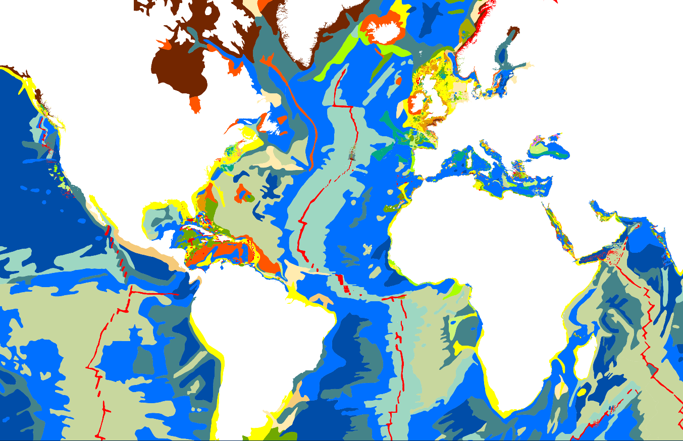
The “World Seabed Sediment Map” product contains geo-referenced digital data, describing the nature of the sediment encountered in different seas and oceans of the world. The objects are all surface areas and the description of an object includes in particular the nature of the sediment including rock-type bottoms.
-
The definitive coastal information system, Quadrige stores coastal observation and monitoring network data. In order to manage coastal monitoring data, Ifremer developed the Quadrige² information system. Quadrige is one element of the Water Information System (SIE) http:// www.eaufrance.fr, et à ce titre, contribue aux travaux du Secrétariat d'Administration National des Données Relatives à l'Eau (SANDRE) http://www.sandre.eaufrance.fr. Quadrige Marine Zones is a reference source unique to the Quadrige system. It is used to break down the coast of the French mainland and overseas territories into large areas and to connect each one with observation and monitoring locations.
-
-
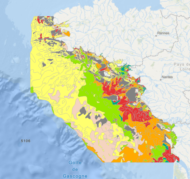
Map of surficial sediments of the northern continental shelf of the Bay of Biscay at 1:500000 by Philippe BOUYSSE, Patrick LESUEUR, André KLINGEBIEL et al., 1986, conducted jointly by the BRGM and Ifremer.
-
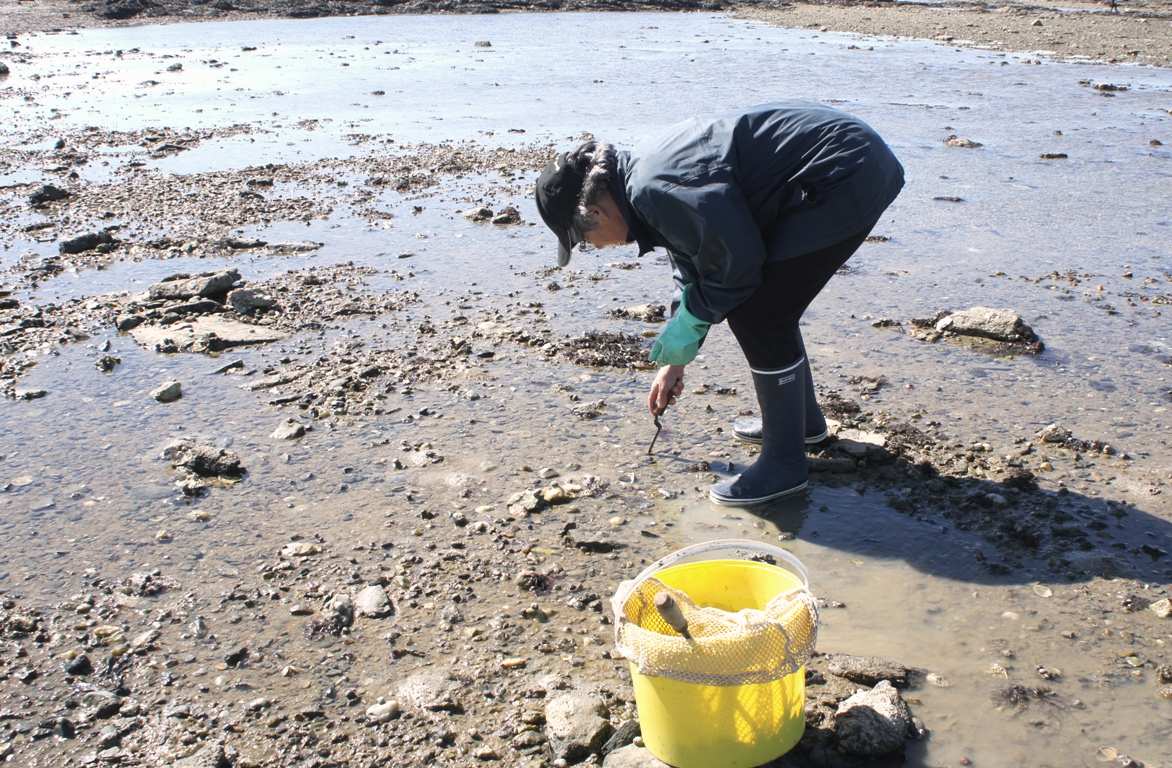
The effect of Maerl extraction on Benthic Communities in the Glénan Archipelago.
-

Geomorphologic map at 1 : 500 000 of the French metropolitan EEZ produced in the work-package 4 (sea-floor geology / geomorphology) of the European project EMODnet Geology. This version of the dataset corresponds to the phase IV of the project.
-
-

Sea bed sediment maps for the 4 marine sub-regions prepared as part of the initial evaluation of the MSFD (Marine Strategy Framework Directive).
-
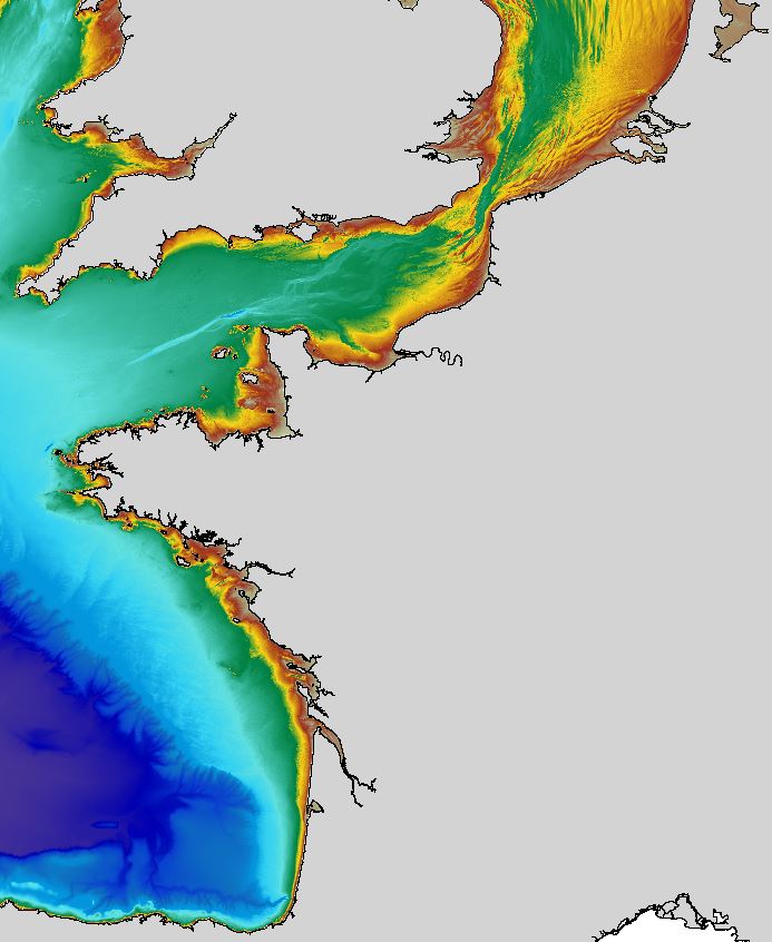
The regional bathymetric Atlantic – Channel – North-Sea DTM has a resolution of 0.001° (~111m). Its geographic coverage includes the Bay of Biscay, the English Channel and a part of the North Sea. The DTM extends from the coast to the continental slope (about of 4800m deep). This DTM is produced in the framework of the HOMONIM project which aims at improving operational forecast capabilities for the national coastal flood warning system. This DTM is offered openly on the Shom diffusion website (http://diffusion.shom.fr/produits/bathymetrie/mnt-facade-atl-homonim.html). http://dx.doi.org/10.17183/MNT_ATL100m_HOMONIM_WGS84
-
The observation of the increase in Carbon Dioxide (CO2) content in the atmosphere certainly significantly influenced the emergence of questioning, on the part of both the scientific community and society as a whole, when faced with global and regional climate changes. Within this context, measuring CO2 flow between the ocean and the atmosphere has become a priority for the oceanographic community. This flow has been found to be highly variable in, in both spatial and temporal terms. This means that flows can be measured independently of oceanographic campaigns. Systems have been developed to be used on ships of opportunity or on Lagrangian or Eulerian tracers. The CARIOCA buoy is automated and designed to measure CO2 concentration at the surface of the ocean in order to qualify the exchanges between the atmosphere and the ocean. The buoy can be either drifting or fixed. It is 2m high and includes : • 1 salinometer • 1 fluorometer • 1 CO2 sensor • 1 anemometer • 2 temperature sensors (air and sea) It is also equipped with an ARGOS transition module and an electric supply module which powers the buoy for year, taking measurements every hour.