ASC
Type of resources
Available actions
Topics
Keywords
Contact for the resource
Provided by
Years
Formats
Representation types
Update frequencies
status
Resolution
-

Carbon parameters along the track of merchant ships
-

Seawater samples (500 mL) were taken during the PIRATA FR-32 cruise to measure surface inorganic carbon and alkalinity. The analyses were realised by potentiometric titration using a closed-cell at the SNAPO-CO2, LOCEAN in Paris.
-

The fugacity of CO2 (fCO2) was measured underway during the PIRATA FR-32 cruise in the Eastern Tropical Atlantic using an infrared detection technique.
-

The data sets presented here result from the long-term monitoring of individual growth patterns in anchovy and sardine in the Bay of Biscay, from 2000 to 2018. They derived from the PELGAS survey series (Doray et al., 2018), which monitors annually the Bay of Biscay pelagic ecosystem since 2000. The survey is performed in May during the peak spawning of anchovy and main spawning of sardine. Among the many data collected, anchovy and sardine populations are assessed by combining acoustic records with pelagic trawl hauls catches and ICES survey protocoles are used, as detailed in Doray et al. (2021). Briefly, fish acoustic backscatter are recorded along survey transect lines and pelagic trawl hauls undertaken opportunistically to identify echotraces to species and collect fish samples for acquiring biometric data. At each trawl haul and for each species, a random subsample of individuals is taken to establish the species’ length distributions. For anchovy and sardine, this subsample is further subsampled, spanning the whole length range, to take individual fish measurements. These amount to extracting otoliths and measuring individuals’ age, length, weight, sexual maturity and other parameters. Individual measurements are taken on fourty individuals of anchovy and sardine when the species are present in the catch. For each individual fish, the two otolith sagittae are extracted on board, mounted in leukit for age reading on board when permitting and/or on land in the laboratory. Growth patterns in the otoliths were analysed on land with a binocular stereomicroscope under reflected natural light. For anchovy, otoliths’ growth was measured for all individuals in all the hauls. For sardine, trawl hauls were selected and all individual otoliths were measured in each selected haul. The selection was made using the geographical stratification defined in Petitgas et al. (2018) based on the ecosystem spatial structure. An average of two to three hauls in each of the four strata were selected per year. The otoliths mounted in leukit were imaged and growth-at-age in the otoliths was measured with the software TNPC (Traitement numérique des pièces calcifiées: Mahé et al., 2009). Under the binocular microscope and natural light, the otoliths showed hyaline (aragonite-poor) rings corresponding to winter periods of low growth and between the rings, white opaque (aragonite-rich) portions corresponding to annual growth periods. The annual ring determination, the age assignment and the measurement of annual ring diameters followed ICES protocoles and guidelines for anchovy and sardine (ICES, 2010; 2011). The age was estimated as the number of hyaline rings. If the edge was hyaline, it was counted as a ring as a hyaline edge observed within the first half of the year is assumed to represent the last winter. The diameter of each annual ring was measured from middle of the hyaline ring on one side to the middle of the ring on the opposite side along the major elongated axis of the otolith and passing through its centre. The distance was expressed in mm after calibration of the stereomiscroscope and the pixel images. Such diameter corresponded to growth-at-age. Ages 0 to 4 were considered (diameters R1 to R5). The total diameter of the otolith was also measured. The data sets span 19 years, from 2000 to 2018 and comprise 20,186 and 8,624 individual fish analyzed at 535 and 235 trawl hauls for anchovy and sardine, respectively. These data sets were used by Boëns et al. (2021 and 2023) to analyse changes in growth patterns and growth-selective mortality at age in anchovy and sardine under environmental and fishing pressures. References: Doray, M., Boyra, G. and Van Der Kooij, J. (eds) (2021). ICES Survey Protocols – Manual for acoustic surveys coordinated under ICES Working Group on Acoustic and Egg Surveys for Small Pelagic Fish (WGACEGG). 1st Edition. ICES Techniques in Marine Environmental Sciences, 64. https://doi.org/10.17895/ices.pub.7462 Doray, M., Petitgas, P., Romagnan, J.-B., Huret, M., Duhamel, E., Dupuy, Ch., Spitz, J., Authier, M., Sanchez, F., Berger, L., Doremus, G., Bourriau, P., Grellier, P. and Masse, J. (2018). The PELGAS survey: ship-based integrated monitoring of the Bay of Biscay pelagic ecosystem. Progress In Oceanography, 166, 15-29. https://doi.org/10.1016/j.pocean.2017.09.015 ICES (2010). Report of the Workshop on Age reading of European anchovy (WKARA), 9-13 November 2009, Sicily, Italy. ICES CM 2009/ACOM: 43. 122 pp. https://doi.org/10.17895/ices.pub.19280525 ICES (2011). Report of the Workshop on Age Reading of European Atlantic Sardine (WKARAS), 14-18 February 2011, Lisbon, Portugal. ICES CM 2011/ACOM:42. 91 pp. https://doi.org/10.17895/ices.pub.19280855 Petitgas, P., Huret, M., Dupuy, Ch., Spitz, J., Authier, M., Romagnan, J.-B. and Doray, M. (2018). Ecosystem spatial structure revealed by integrated survey data. Progress In Oceanography, 166, 189-198. https://doi.org/10.1016/j.pocean.2017.09.012 Mahe, K., Bellail, R., Dufour, J.-L., Boiron-Leroy, A., Dimeet, J., Duhamel, E., Elleboode, R., Felix, J., Grellier, P., Huet, J., Labastie, J., Le Roy, D., Lizaud, O., Manten, M.-L., Martin, S., Metral, L., Nedelec, D., Verin, Y. and Badts, V. (2009). Synthèse française des procédures d'estimation d'âge / French summary of age estimation procedures. https://archimer.ifremer.fr/doc/00000/7294/ Boëns, A., Grellier, P., Lebigre, Ch. and Petitgas, P. (2021). Determinants of growth and selective mortality in anchovy and sardine in the Bay of Biscay. Fisheries Research, 239, 105947. https://doi.org/10.1016/j.fishres.2021.105947 Boëns, A., Ernande, B., Petitgas, P. and Lebigre, Ch. (2023). Different mechanisms underpin the decline in growth of anchovies and sardines of the Bay of Biscay. Evolutionary Applications, 16: 1393–1411. https://doi.org/10.1111/eva.13564
-

The Mediterranean Sea is a natural laboratory to address questions about the formation and evolution of continental margins and the relationship between surface and deep processes. Different regional to local events have influenced the Neogene stratigraphic evolution of the Valencia and Menorca basins. The evaporites deposited during the Messinian Salinity Crisis (MSC) strongly impact its sedimentary and geomorphological evolution. Here we present a compilation of the main regional seismic stratigraphic markers from the continental platform to the deep sea. We provide in xyz format (z in second twt) the original picking files, (not interpolated) and interpolated grid of: i) the top of the Mesozoic formation, the base of the Neogene formations including the early Miocene volcanic features, ii) the top Burdigalian, Langhian, and Serravallian seismic horizons, iii) the seismic horizons related to the Messinian Salinity Crisis, iv) the Pliocene and Pleistocene seismic horizons v) the depth of the Seafloor. The available reflection seismic dataset results from the compilation and processing of vintage seismic profiles of previous works and from the Instituto Geologico y Minero de Espana (IGME). This compilation is currently the first available in literature and provides a useful contribution to the scientific community working on sedimentary, tectonics and geodynamics within the Western Mediterranean basins.
-
Le MNT RGE ALTI® est un modèle numérique de terrain maillé diffusé aux pas de 1 m et 5m. Il décrit la forme et l’altitude normale de la surface du sol. Il est conçu pour une utilisation à des échelles comprises entre le 1 : 3 000 et le 1 : 20 000. Mots-clés : Altitude, Données ouvertes
-
Le MNT RGE® ALTI est un modèle numérique de terrain maillé au pas de 1 m. Il décrit la forme et l’altitude normale de la surface du sol. Il est conçu pour une utilisation à des échelles comprises entre le 1 : 1 000 et le 1 : 50 000.
-

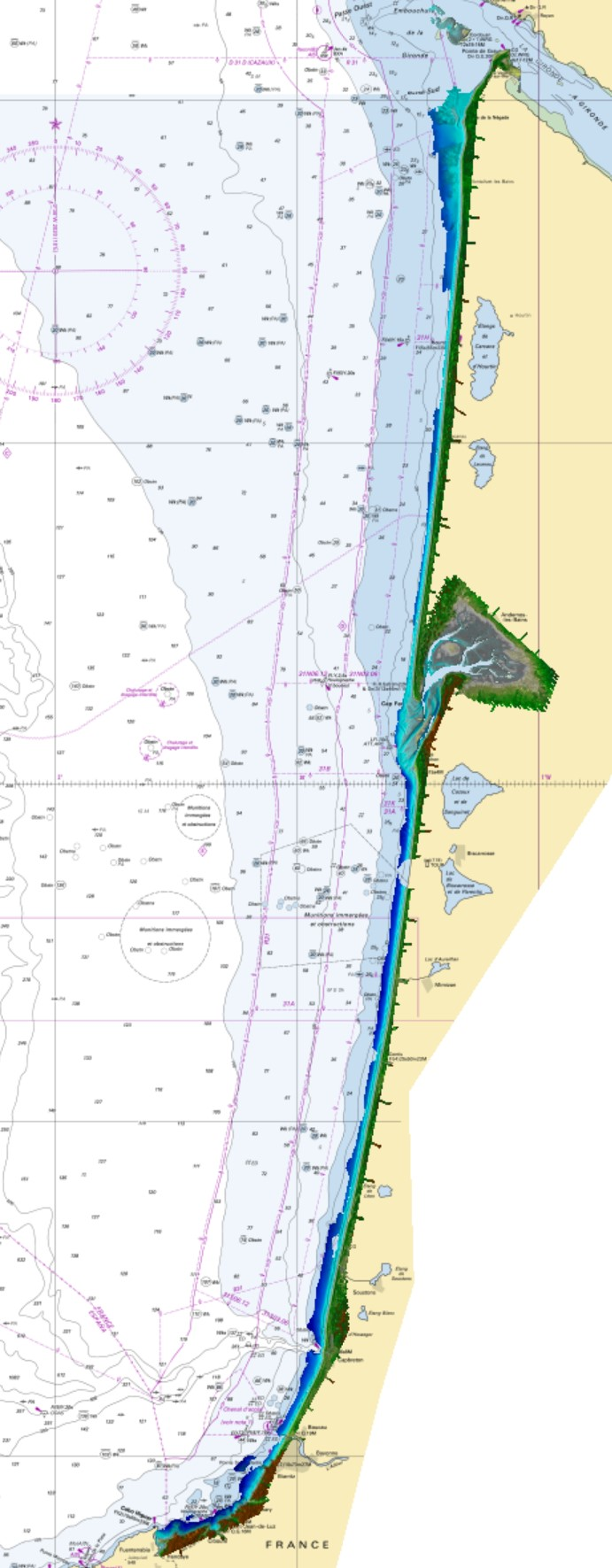
Litto3D marine part is a unique and continuous land-sea database which can provide 3D models of the shape and location of french coastal terrain. Surveys are carried out by airborne lidar bathymetry over the sea side and airborne lidar topography over the land side up to 400m inland. Litto3D marine part digital models are available in two formats: a set of 3D points and a qualified terrain mesh. The product "Litto3D marine part - Nouvelle-Aquitaine 2020-2022" covers the geographical area from the Sèvre Niortaise to the Spanish border.
-
Le MNT 2021 de la Charente Maritime est un modèle numérique de terrain maillé diffusé aux pas de 1 m. Il décrit la forme et l’altitude normale de la surface du sol. Les données ont été acquises en août et septembre 2021. Les données sont issues d'un vol LIDAR avec un minimum de 10 points / m² Les données sont téléchargeables sur demande (commandable) au format ".asc" et au format ".tif" Mots-clés : Altitude, Modèle Numérique de Terrain
-

Litto3D provides 3D, continuous sea-land description of French coastal areas. Data is acquired by airborne topo-bathymetric LiDARs. Litto3D products come in 3D point clouds and digital terrain models formats. The product "Litto3D - Nouvelle-Aquitaine 2020-2022" covers the geographical area from the Charente-Maritime to the Spanish border. For the maritime part, the data produced by Shom extend offshore down to signal extinction, approximatively 20 depth when environmental conditions are optimal. On land, the data are truncated at a limit that ensures the product retain its coastal character.
 Catalogue PIGMA