shape ESRI
Type of resources
Available actions
Topics
Provided by
Years
Formats
Representation types
Scale
-
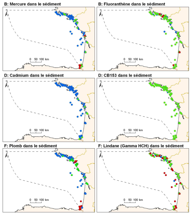
Levels of metal concentration (lead, cadmium, mercury), organochlorine (PCB153 and HCHg Lindane), PAHs (Fluoranthene) in surficial sediments (1 cm) of the sub-region Bay of Biscay and Iberian Coast.
-
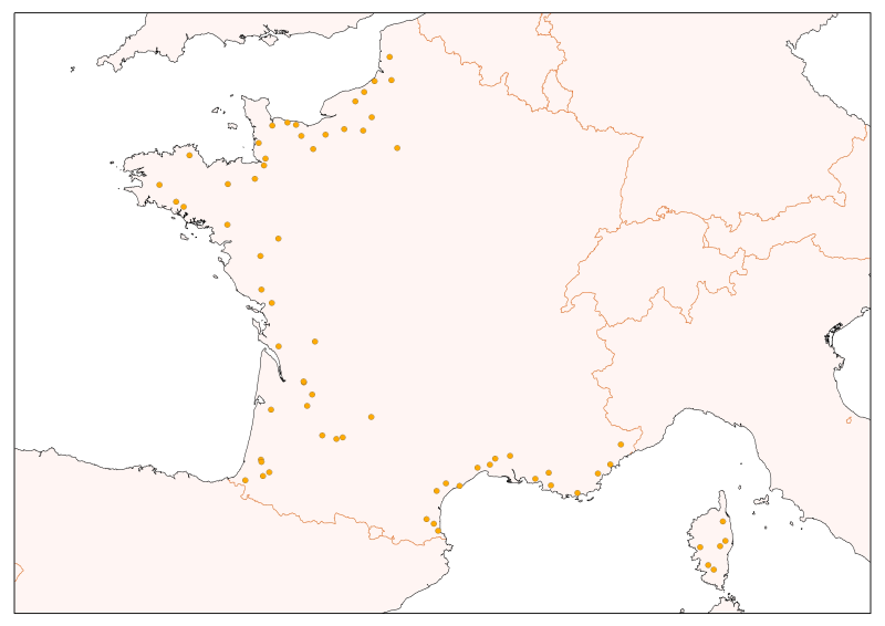
Selection of flow gauging stations of the French rivers (accessible via the central bank administered by the HYDRO SCHAPI) on the basis of hydrological function and monitoring stations. The data bank HYDRO stores measurements of water depth (variable time step) from 3500 stations (including 2400 which are currently in service) located on French rivers and provides access to descriptive data stations (main purpose, precise location, measurement quality, history, data available ...)
-
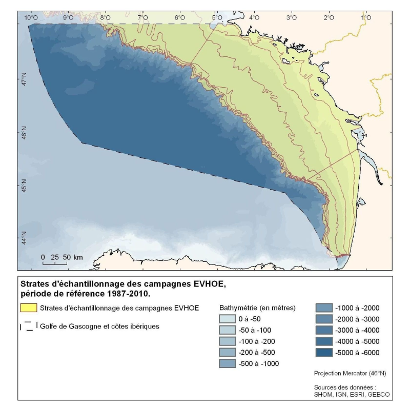
Polygons defined for the distribution of the sampling points of the EVHOE (Evaluation of Fish Stocks in Western Europe) campaigns in the Bay of Biscay and the Celtic Sea.
-
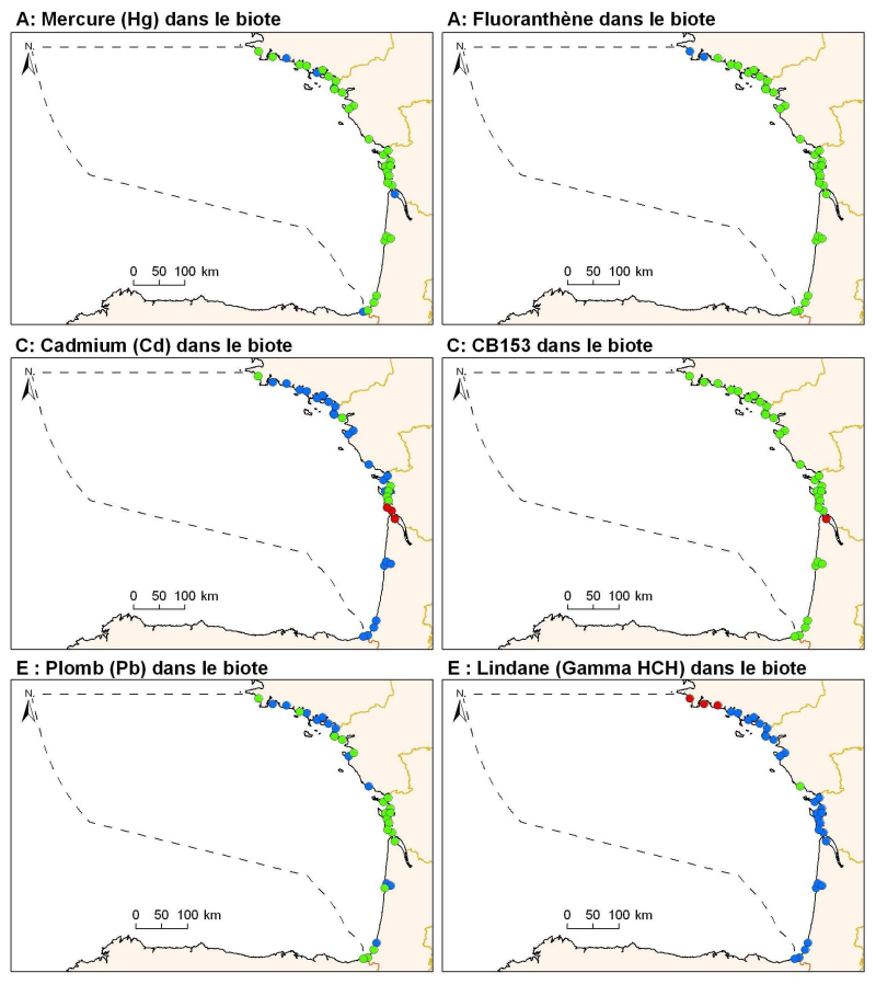
Levels of metal concentration (lead, cadmium, mercury), organochlorine (PCB153 and HCHg Lindane), PAHs (Fluoranthene) in mussels and oysters on the coast of the sub-regions Bay of Biscay and Iberian Coast.
-
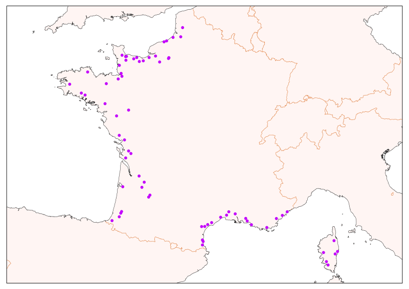
Physico-chemical monitoring stations are part of a network under the responsibility of the water agencies. Regarding the scope of strict thematic contribution "Hydrology," the monitoring stations do not come into account because they only measure the physico-chemical quality of the rivers. These stations are used only for calculations under fluvial inputs of pollutants / nutrients.
-
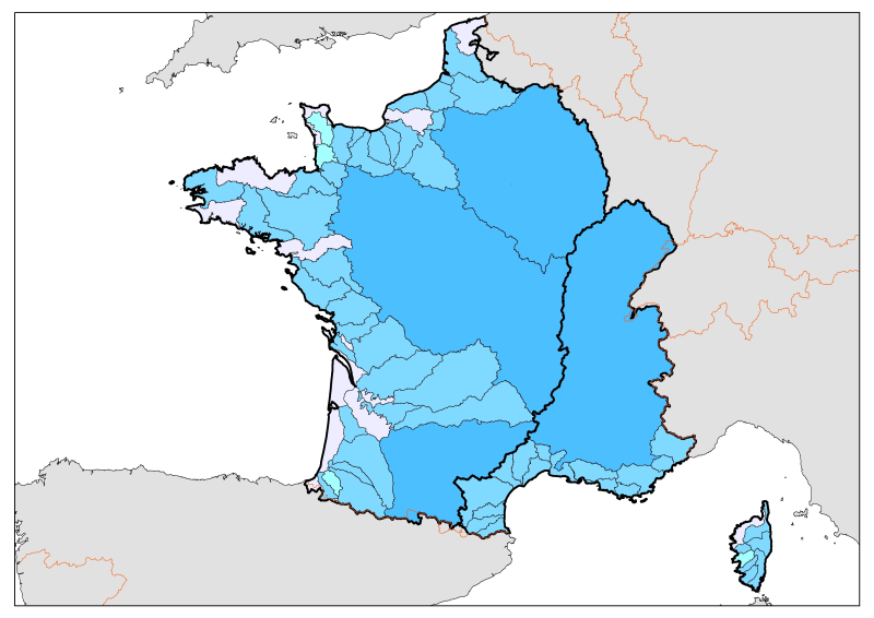
Division of French metropolitan territories to define the zones contributing to the pollutant flow carried by rivers to the sea.
-
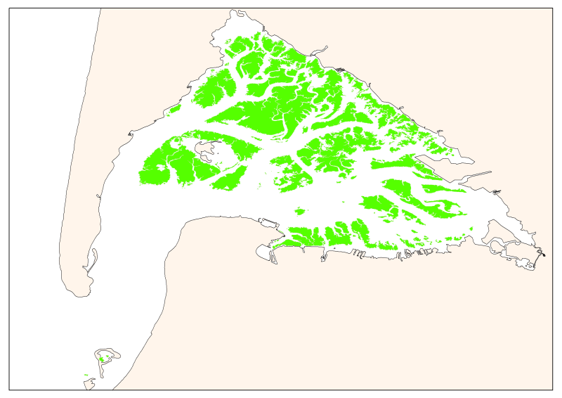
Map of the maximum extent of the seagrass Zostera noltti of Arcachon acquired in 2007-2008, under the supervisory control of the WFD (EU Water Framework Directive). Funded by the AEAG (Agence de l'Eau Adour Garonne) and Ifremer.
 Catalogue PIGMA