/Biological Environment/Habitats
Type of resources
Available actions
Topics
Keywords
Contact for the resource
Provided by
Years
Formats
Representation types
Update frequencies
status
Scale
Resolution
-

-

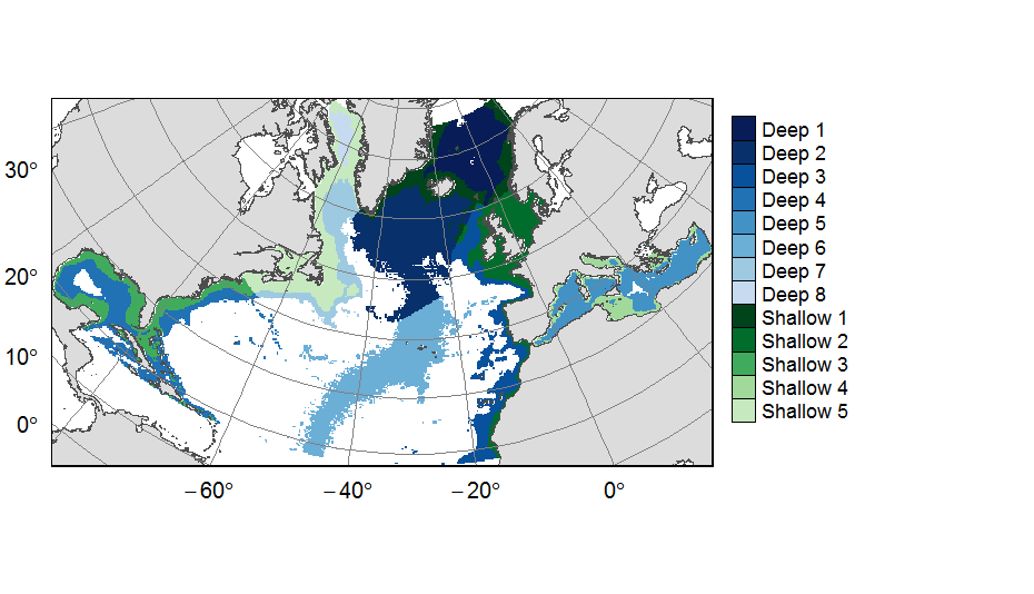
Planning units layers used for ATLAS EU prioritization scenarios on the North Atlantic (18°N to 76°N and 36°E to 98°W). This raster layer is designed on a grid of 25km * 25km resolution, that served to extract all the spatial data used prioritization. The 31 518 planning units (cells with value) corresponded to areas containing depths shallower or equal to 3500m, even if they could also contain deeper areas locally. For connectivity scenarios, only the planning units matching with the extent of available connectivity data were selected. One layer allocates planning units to the 13 geographical provinces (values ranging from 1 to 13) created for the purpose of prioritization. This dataset was built to feed a basin-wide spatial conservation planning exercise, targeting the deep sea of the North Atlantic. The goal of this approach was to identify conservation priority areas for Vulnerable Marine Ecosystems (VMEs) and deep fish species, based on the distribution of species and habitats, human activities and current spatial management.
-
The analysis focuses on monitoring the ecological status of the coastal and transitional waters of the Western Channel and the Bay of Biscay. The ecological status of a coastal water body within the meaning of the European Water Framework Directive (WFD) is determined by the biological state, physicochemical state and hydromorphological state of the water mass, water. The statement is determined according to the rules described in the decree of 25 January 2010.
-

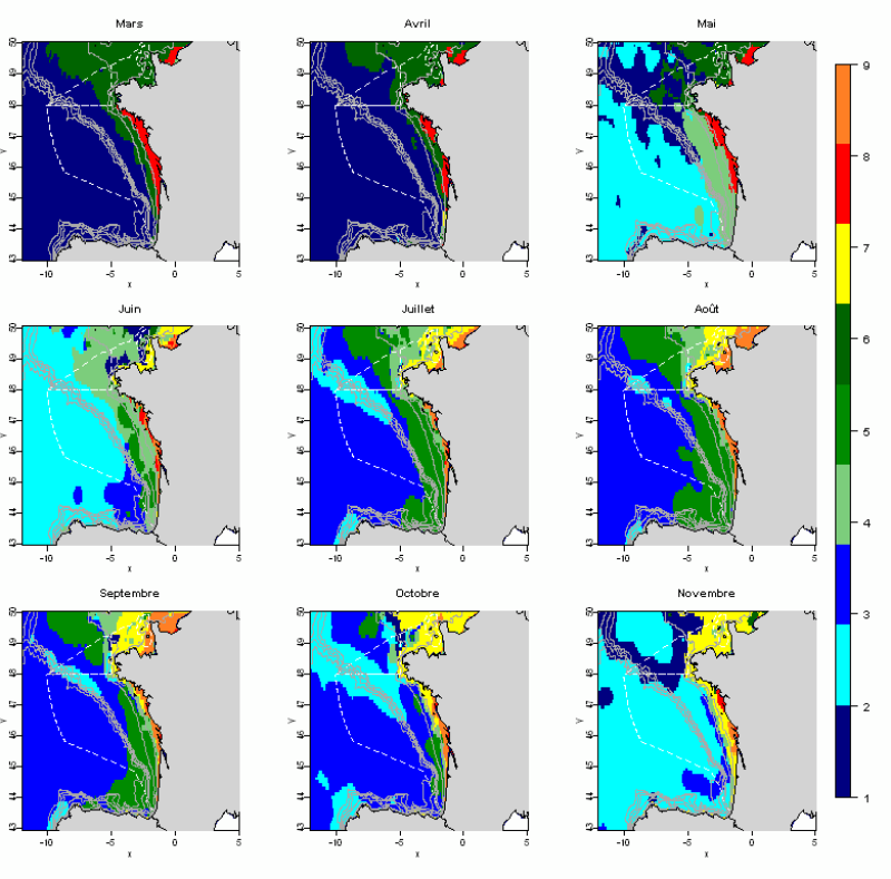
The statistical analysis used (Principal Component Analysis followed by a classification method) to identify groups common to all months and describe the evolution of these groups during the year. The data used allows for monthly tables showing the selected parameters, calculated over the entire geographic area with a resolution of 0.1 °. This method identifies 10 hydrological landscapes present at various times of the year, and characterized by homogeneous hydrological conditions.
-

The code and files contained in this repository support replication of a broad-scale benthic habitat classification of the South Atlantic produced by McQuaid et al. (2023). We used statistical clustering algorithms to classify broad-scale (10km2) environmental data into distinct habitat classes, which reflect variation in physical conditions and we assume support distinct biological communities. We request that any use of the input data is referenced as per the table below, and that classification outputs are referenced as: McQuaid K. A. Bridges A. E. H., Howell K. L., Gandra T. B. R., de Souza V., Currie J. C., Hogg O. T., Pearman T. R. R., Bell J. B. B., Atkinson L. J., Baum D., Bonetti J., Carranza A., Defeo O., Furey T., Gasalla M. A., Golding N, Hampton S. L., Horta S., Jones D. O. B., Lombard A. T., Manca E., Marin Y., Martin S., Mortensen P., Passdore C., Piechaud N., Sink K. J. & Yool A. 2023. Broad-scale benthic habitat classification of the South Atlantic. Progress in Oceanography. DOI: https://doi.org/10.1016/j.pocean.2023.103016
-
The analysis concerns the assessment of the overall state of the coastal and transitional waters of the Western Channel and the Bay of Biscay. It results from the combination of the ecological status and the chemical status of each water body according to the rules of the European Water Framework Directive (WFD). The most recent assessment of the state is presented in the DCE Loire-Bretagne atlas. Earlier reports are available in annual archives.
-
These rasters correspond to the environmental predictors used in the production of Mediterranean bioregions of megabenthic communities
-
The shapefile corresponds to areas where predicted bioregions were extrapolated for lack of benthic in-situ observations.
-
The raster corresponds to the predicted Mediterranean bioregions of megabenthic communities.
-

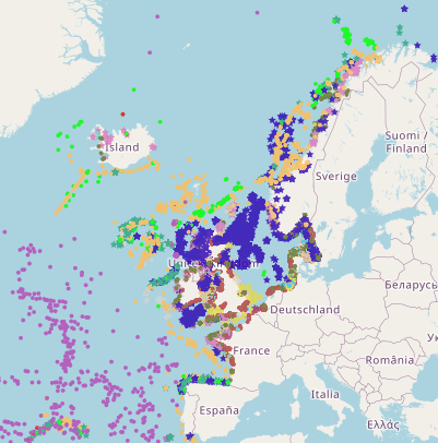
This is a compilation of OSPAR habitat point data for the northeast Atlantic submitted by OSPAR contracting parties. The compilation is coordinated by the UK's Joint Nature Conservation Committee, working with a representative from each of the OSPAR coastal contracting parties. This public dataset does not contain records relating to sensitive species (e.g. Ostrea edulis) in specific areas, or where data are restricted from public release by the owner's use limitations. This version (v2020) was published in July 2021.
 Catalogue PIGMA