/Physical oceanography/Waves
Type of resources
Available actions
Topics
Keywords
Contact for the resource
Provided by
Years
Representation types
Update frequencies
status
Scale
-

The European Marine Observation and Data Network (EMODnet) is a long-term, marine-data initiative funded by the European Maritime and Fisheries Fund which, together with the Copernicus space programme and the Data Collection Framework for fisheries, implements the EU’s Marine Knowledge 2020 strategy. EMODnet Physics (www.emodnet-physics.eu) is one of the seven domain-specific portals of the European Marine Observation and Data Network (EMODnet). EMODnet-Physics map portal (www.emodnet-physics.eu/map) provides a single point of access to validated in situ datasets, products and their physical parameter metadata of European Seas and global oceans. More specifically, time series and datasets are made available, as recorded by fixed platforms (moorings, tide gauges, HF radars, etc.), moving platforms (ARGO, Lagrangian buoys, ferryboxes, etc.) and repeated observations (CTDs, etc.). The available themes are the temperature of the water column, the salinity of the water column, horizontal velocity of the water column, sea level and sea level trends, wave height and period, wind and atmospheric pressure, optical properties (e.g. light attenuation, back scattering, turbidity, etc.), underwater sound pressure level (acoustic pollution), river runoff, other biogeochemical data (e.g. chlorophyll, dissolved oxygen, etc.), sea-ice coverage. Acquisition of these physical parameters is largely an automated process based on a “federated” network infrastructure linking data providers and other marine data aggregating infrastructure. In particular, EMODnet Physics is strongly federated with two other European data aggregating infrastructures. One is the Copernicus Marine Environment Monitoring Service - In Situ Thematic Assembly Centre for operational data flow, while historical validated datasets are organised in collaboration with SeaDataNet and its network of National Oceanographic Data Centres. The NRT data go through a stricter quality control before NODCs validate the datasets for long-term storage and stewardship. This validation process ends when the metadata of the processed dataset are published in a CDI (Common Data Index). CMEMS-INSTAC and SDN-NODC subsets are integrated with other available sources to make the most comprehensive physical parameter data catalogues available. Thanks to international collaborative relationships to provide data access to – and preview for – coastal data in non-European areas (e.g. NOAA platforms for the US, IAPB platforms for the Arctic area, IMOS for Australia and others), EMODnet Physics catalogues are going beyond European borders to offer an even more exhaustive entry point to global-ocean physical observations.
-

The Copernicus Marine Service (or Copernicus Marine Environment Monitoring Service) is the marine component of the Copernicus Programme of the European Union. It provides free, regular and systematic authoritative information on the state of the Blue (physical), White (sea ice) and Green (biogeochemical) ocean, on a global and regional scale. It is funded by the European Commission (EC) and implemented by Mercator Ocean International. It is designed to serve EU policies and International legal Commitments related to Ocean Governance, to cater for the needs of society at large for global ocean knowledge and to boost the Blue Economy across all maritime sectors by providing free-of-charge state-of-the-art ocean data and information. It provides key inputs that support major EU and international policies and initiatives and can contribute to: combating pollution, marine protection, maritime safety and routing, sustainable use of ocean resources, developing marine energy resources, blue growth, climate monitoring, weather forecasting, and more. It also aims to increase awareness amongst the general public by providing European and global citizens with information about ocean-related issues.
-

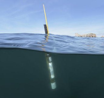
Argo is a global array of 3,000 free-drifting profiling floats that measures the temperature and salinity of the upper 2000 m of the ocean. This allows, for the first time, continuous monitoring of the temperature, salinity, and velocity of the upper ocean, with all data being relayed and made publicly available within hours after collection. The array provides 100,000 temperature/salinity profiles and velocity measurements per year distributed over the global oceans at an average of 3-degree spacing. Some floats provide additional bio-geo parameters such as oxygen or chlorophyll. All data collected by Argo floats are publically available in near real-time via the Global Data Assembly Centers (GDACs) in Brest (France) and Monterey (California) after an automated quality control (QC), and in scientifically quality controlled form, delayed mode data, via the GDACs within six months of collection.
 Catalogue PIGMA