CDS-IS-CORIOLIS
Type of resources
Available actions
Topics
Keywords
Contact for the resource
Provided by
Years
Formats
Representation types
Update frequencies
status
Scale
-

The European Union’s Copernicus-funded TRUSTED project (Towards Fiducial Reference Measurements of Sea-Surface Temperature by European Drifters) has deployed over 100 state of the art drifting buoys for improved validation of Sea Surface Temperature (SST) from the Sentinel-3 Sea and Land Surface Temperature Radiometers (SLSTR). These buoys are manufactured by NKE. The TRUSTED drifting buoys data and metadata are distributed in qualtity control NetCDF files, as a subset of DBCP drifting buoys GDAC (Global Data Assembly Centre). Coriolis DAC (Data Assembly Centre) routinely collects, decodes, quality controls, preserves and distributes data and metadata as NetCDF-CF files. The TRUSTED buoys have specific features managed by Coriolis DAC python data processing chain: a high resolution temperature sensor in addition to the classic drifting buoy temperature sensor. The high sampling and high resolution observations are distributed in specific variables TEMP_HR, TEMP_HR_SPOT, TEMP_HR_XX (XX is the percentile sample).
-

X : eXpendable; B : Bathy; T: Thermograph. Thermal profile measurement with real-time transmission
-

Observations of Sea surface temperature and salinity are now obtained from voluntary sailing ships using medium or small size sensors. They complement the networks installed on research vessels or commercial ships. The delayed mode dataset proposed here is upgraded annually as a contribution to GOSUD (http://www.gosud.org )
-

The COriolis Ocean Dataset for Reanalysis (hereafter "CORA") product is a global dataset of in situ temperature and salinity measurements. The CORA observations comes from many different sources collected by Coriolis data centre in collaboration with the In Situ Thematic Centre of the Copernicus Marine Service (CMEMS INSTAC). The observation integrated in the CORA product have been acquired both by autonomous platforms (Argo profilers, fixed moorings , gliders , drifters, sea mammals) , research or opportunity vessels (CTDs, XBTs, ferrybox). From the near real time CMEMS In Situ Thematic Centre product validated on a daily and weekly basis for forecasting purposes, a scientifically validated product is created. It s a "reference product" updated on a yearly basis since 2007. This product has been controlled using an objective analysis (statistical tests) method and a visual quality control (QC). This QC procedure has been developed with the main objective to improve the quality of the dataset to the level required by the climate application and the physical ocean re-analysis activities. It provides T and S weekly gridded fields and individual profiles both on their original level with QC flags and interpolated level. The measured parameters, depending on the data source, are : temperature, salinity. The reference level of measurements is immersion (in meters) or pressure (in decibars). CORA contains historical profiles extracted from the EN.4 global T&S dataset, World Ocean Atlas, SeaDataNet, ICES and other data aggregators . The last version of the CORA product are also available freely from the Copernicus WEB site : - Global Ocean- CORA- In-situ Observations Yearly Delivery in Delayed Mode - Global Ocean- Delayed Mode gridded CORA- In-situ Observations objective analysis in Delayed Mode
-
GOSUD aims at assembling in-situ observations of the world ocean surface collected by a variety of ships and at distributing quality controlled datasets. At present time the variables considered by GOSUD are temperature and salinity. The GOSUD data are mostly collected using thermosalinographs (TSG) installed on research vessels, on commercial ships and in some cases on sailing exploration ships. GOSUD manages both near-real time (RT and NRT) data and delayed mode (DM-reprocessed) data. The GOSUD GDAC is hosted by the Coriolis data centre (France) and a back-up (permanent archived) is performed on a daily basis by NCEIS (NOAA's National Centers for Environmental Information).
-

French Research vessels have been collecting thermo-salinometer (TSG) data since the early 2000 in contribution to the GOSUD programme. The set of homogeneous instruments is permanently monitored and regularly calibrated. Water samples are taken on a daily basis by the crew and later analysed in the laboratory. We present here the delayed mode processing of the time series intiated in 2001 dataset and an overview of the resulting quality. The careful calibration and instrument maintenance, complemented with a rigorous adjustment on water samples lead to reach an accuracy of a few 10-² PSS in salinity or evenless. Global comparison with the ISAS13 ARGO gridded product shows an excellent agreement of the datasets. The SSS-Fresh dataset appears as highly valuable for the "calibration and validation" of the new satellite observations delivered by SMOS, Aquarius and SMAP.
-

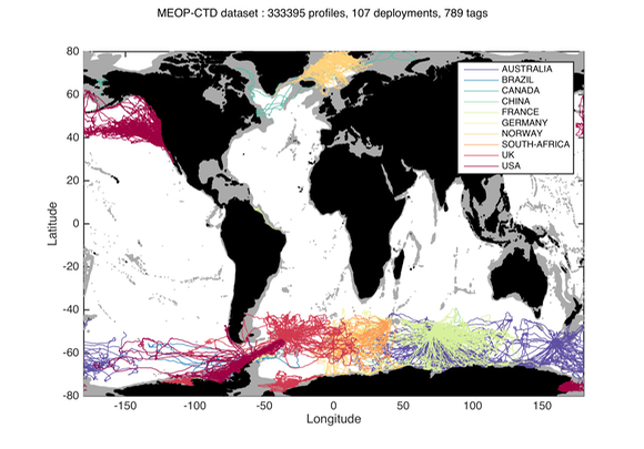
Since 2004, several hundred seals have been equipped with conductivity-temperature-depth (CTD) sensors in the Southern Ocean for both biological and physical oceanographic studies. A calibrated collection of seal-derived hydrographic data is now available from Coriolis, currently consisting of more than 300,000 temperature/salinity profiles. Delayed mode data, December 2014 http://dx.doi.org/10.12770/0a82d60c-683d-47b8-8bd1-24933ec24983 on the Coriolis ftp server, in /ifremer/marine_mammals/. In a near future (summer 2015), seal data will be updated daily, and a monthly snapshot of the full database will be produced. through the Coriolis data selection tool (Sea mammal or Animal profiles).
-

This dataset is an aggregation of all availale in situ data from Coriolis and Copernicus in situ data centres, observed in the French DCSMM area. It contains 5167 NetCDF CF files from 1903 to 2017. Each file contains the observations of a specific platform (e.g. vessel, mooring site, sea level station). Observed parameters are temperature, salinity, pressure, oxygen, nitrate, chlorophyll (and other bio-geo-chemicals), current, wave, sea level, river flow.
-

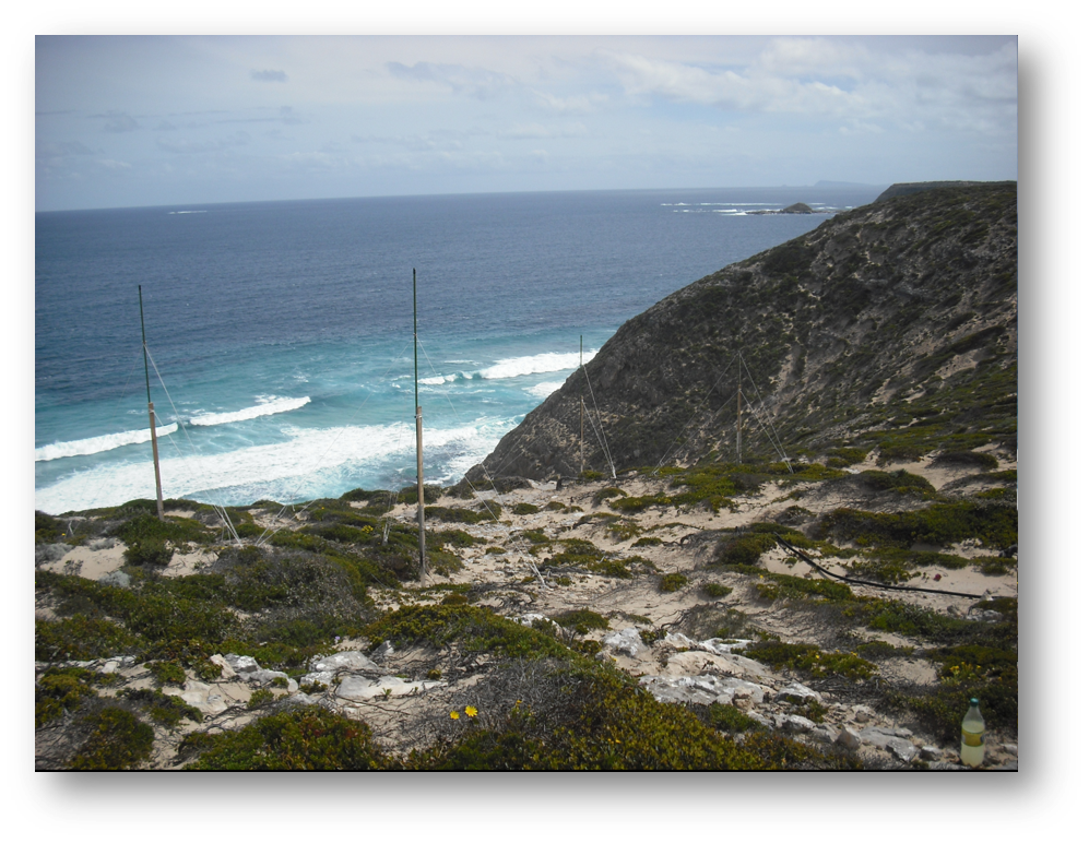
Observation of surface currents by HF radars. This system of HF radars makes it possible to compile, continuously and over long periods, maps of surface marine currents, up to 100km and with a spatial resolution of 3km.
-

The Coriolis Ocean Dataset for Reanalysis for the Ireland-Biscay-Iberia region (hereafter CORA-IBI) product is a regional dataset of in situ temperature and salinity measurements. The latest version of the product covers the period 1950-2014. The CORA-IBI observations comes from many different sources collected by Coriolis data centre in collaboration with the In Situ Thematic Centre of the Copernicus Marine Service (CMEMS INSTAC). The observations integrated in the CORA-IBI product have been acquired both by autonomous platforms (Argo profilers, fixed moorings, gliders, drifters, sea mammals, fishery observing system from the RECOPESCA program), research or opportunity vessels ( CTDs, XBTs, ferrybox). This CORA-IBI product has been controlled using an objective analysis (statistical tests) method and a visual quality control (QC). This QC procedure has been developed with the main objective to improve the quality of the dataset to the level required by the climate application and the physical ocean re-analysis activities. It provides T and S individual profiles on their original level with QC flags. The reference level of measurements is immersion (in meters) or pressure (in decibars). It is a subset on the IBI (Iberia-Bay-of-Biscay Ireland) of the CMEMS product referenced hereafter. The main new features of this regional product compared with previous global CORA products are the incorporation of coastal profiles from fishery observing system (RECOPESCA programme) in the Bay of Biscay and the English Channel as well as the use of an historical dataset collected by the Service hydrographique de la Marine (SHOM).
 Catalogue PIGMA