Catalogue PIGMA
Celtic Seas
Type of resources
Available actions
Topics
Keywords
Contact for the resource
Provided by
Years
Formats
Representation types
Update frequencies
status
Scale
Resolution
-

Ireland’s Marine Atlas is developed and maintained by the Marine Institute with funding by the Government of Ireland. This work is part supported by the Irish Government and the European Maritime & Fisheries Fund as part of the EMFF Operational Programme for 2014-2020. The atlas provides a one-stop-shop to view and download marine environmental data relevant to reporting under Ireland’s Marine Strategy Framework Directive (MSFD). The aim of the European Union’s MSFD directive is to protect more effectively the marine environment across Europe through the establishment of “good marine waters”. Data in Ireland’s Marine Atlas has been guided by the European Directive on harmonising environmental data across Europe within a spatial data infrastructure known as INSPIRE. INSPIRE Data Specifications (Data Models) have been used to manage data to the categories visible under THEMES in the atlas. Many of the layers displayed in the Atlas are also used in the National Marine Planning Framework (NMPF). This framework aims to bring together all marine-based human activities, outlining the government’s vision, objectives and marine planning policies for each marine activity. The NMPF report details how these marine activities will interact with each other in an ocean space that is under increasing spatial pressure, ensuring the sustainable use of our marine resources to 2040. Please read the following information carefully as it sets out the terms and conditions that govern the use of products and services on this website. Once you have read these terms and conditions click the "Agree" button at the bottom of the page to proceed. By clicking the "Agree" button you will be deemed to have accepted the terms and conditions, our legal notices and privacy statement.
-
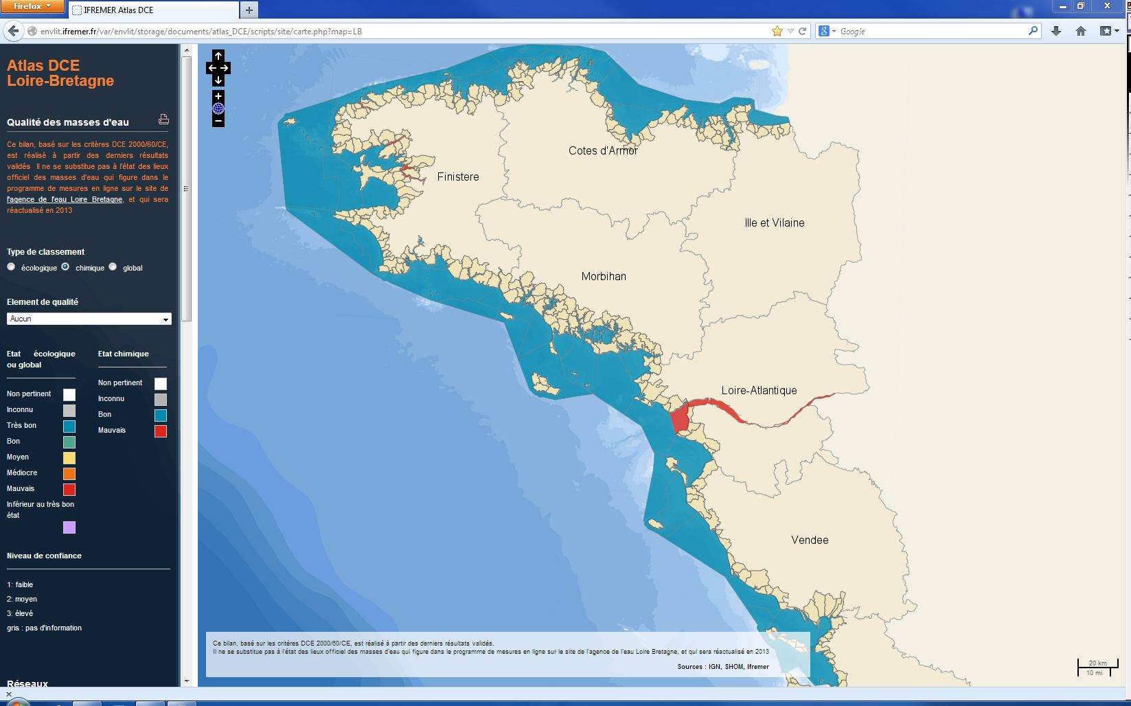
The chemical status of a coastal water body (coastal water or transition water) is determined by the most declassing of the defined states for heavy metals, pesticides, industrial pollutants and other pollutants taken into account by the WFD . The assessment is done once per management plan (once every six years). The most recent assessment of the state of the chemical state is presented in the DCE Loire-Bretagne atlas. Earlier reports are available in annual archives.
-
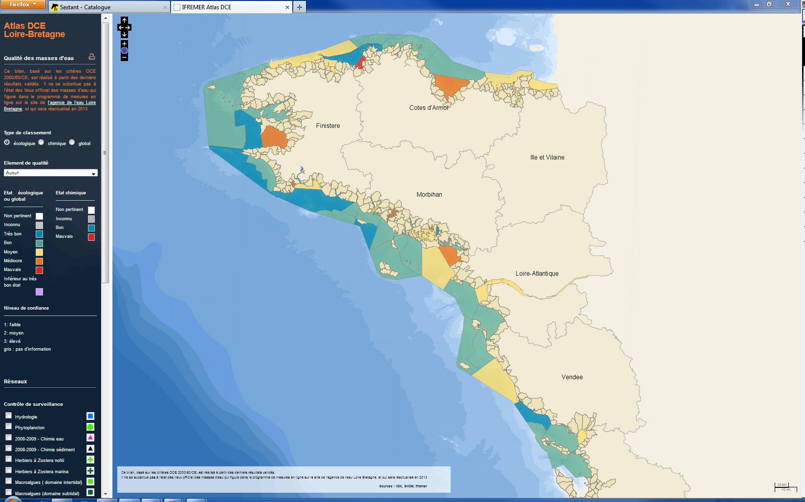
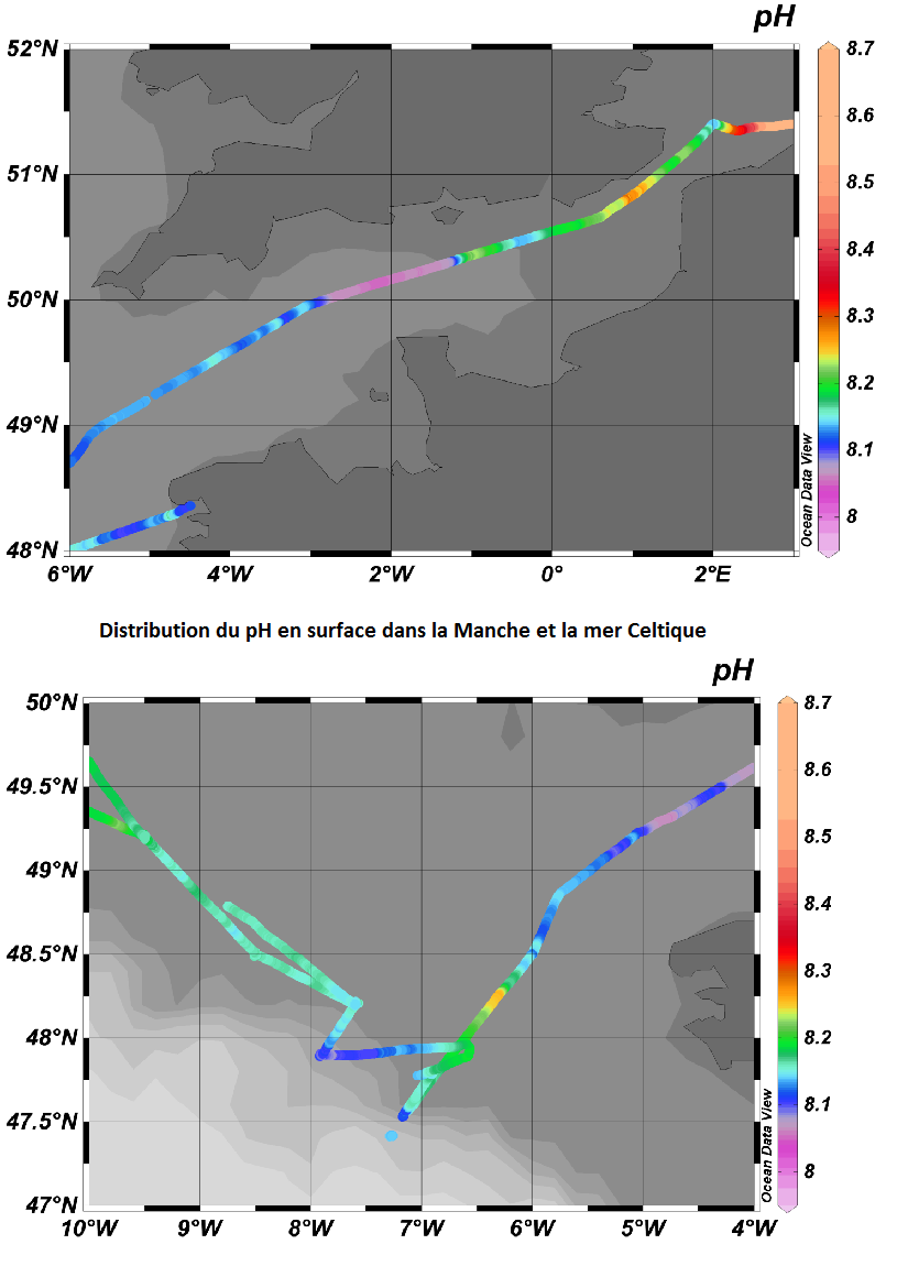
The analysis focuses on monitoring the ecological status of the coastal and transitional waters of the Western Channel and the Bay of Biscay. The ecological status of a coastal water body within the meaning of the European Water Framework Directive (WFD) is determined by the biological state, physicochemical state and hydromorphological state of the water mass, water. The statement is determined according to the rules described in the decree of 25 January 2010.
-
Excel file containing CPR data from Standard Areas B4,C3,C4,D3,D4,D5,E4,F4 for the plankton Calanus finmarchicus and helgolandicus, total traverse (small) copepods, total large copepods, Phytoplankton Colour Index and Cnidaria (presence denoted by a 1, absence by a zero). All taxa are from 1980, except Cnidaria which are from 2011. Dataset is in the format of sample level data, with each row being a discrete sample, with a sample being 3m3 filtered seawater, and 10nm of tow. For each row, a sample has the following information, starting at column a: Standard area of sample, sample id, latitude (decimal degrees) of sample mid point, longitude (decimal degrees) of sample midpoint, sample midpoint date and local time, year of sample, month of sample, then plankton abundance values (or PCI index or cnidaria presence/absence). All taxa have been looked for during the period this dataset spans, so zero values represent true absence.
-
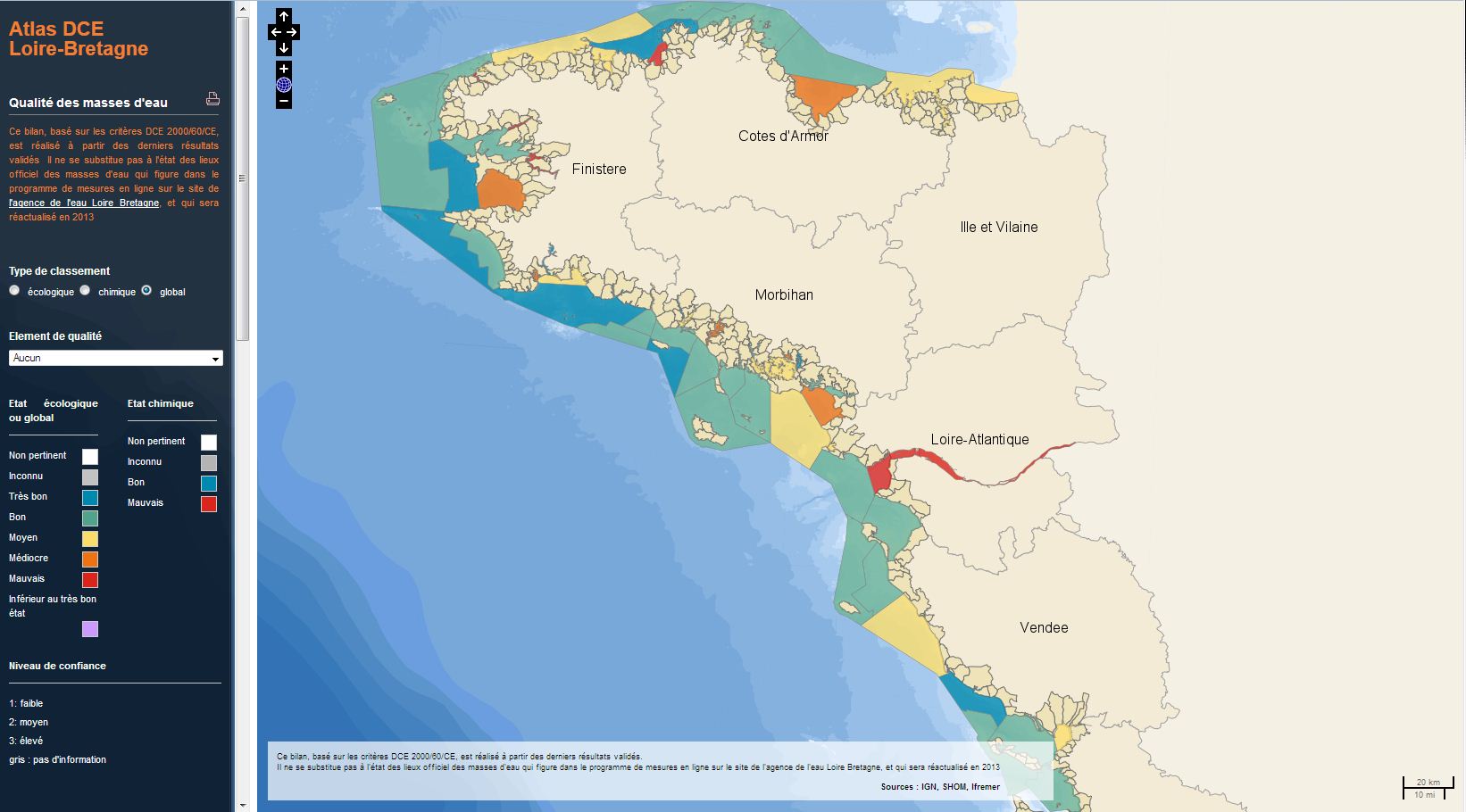
The analysis concerns the assessment of the overall state of the coastal and transitional waters of the Western Channel and the Bay of Biscay. It results from the combination of the ecological status and the chemical status of each water body according to the rules of the European Water Framework Directive (WFD). The most recent assessment of the state is presented in the DCE Loire-Bretagne atlas. Earlier reports are available in annual archives.
-
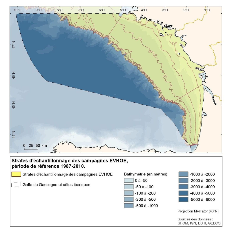
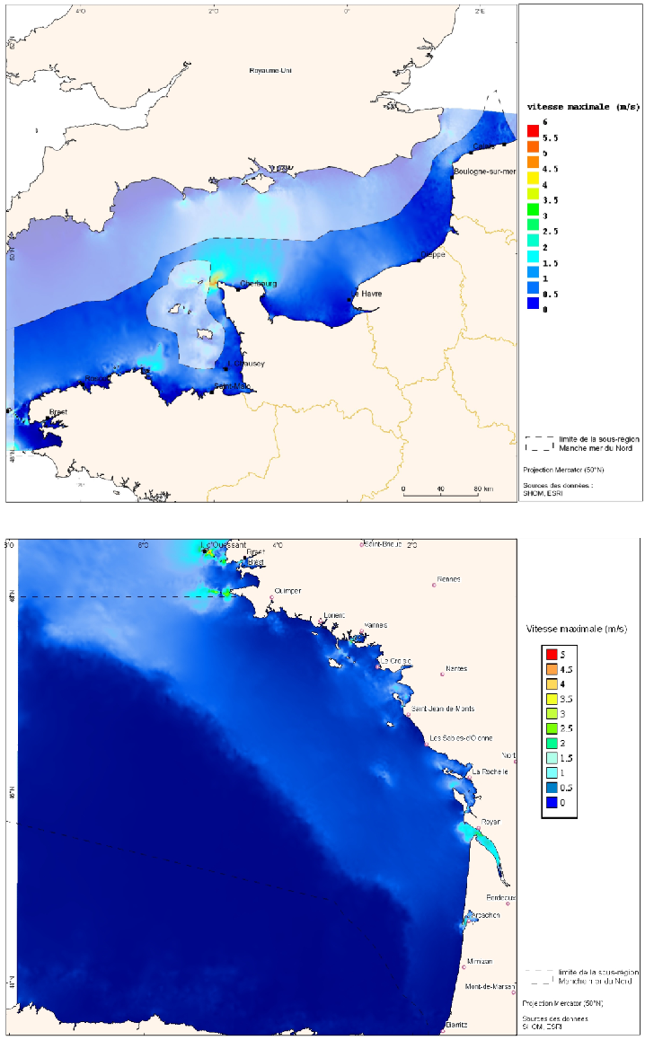
Polygons defined for the distribution of the sampling points of the EVHOE (Evaluation of Fish Stocks in Western Europe) campaigns in the Bay of Biscay and the Celtic Sea.