Mineral resources
Type of resources
Available actions
Topics
Keywords
Contact for the resource
Provided by
Years
Formats
Representation types
Update frequencies
status
Scale
Resolution
-

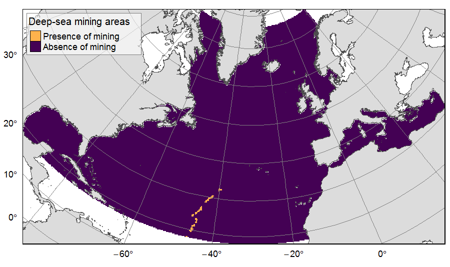
Presence of deep-sea mining exploration zones on the North Atlantic (18°N to 76°N and 36°E to 98°W). These areas correspond to the three polymetallic sulphides exploration contracts on the Mid-Atlantic Ridge, attributed to Poland, France and Russia. Each of the three contract areas is divided into 100 squares of 10km by 10km. Source polygons originated from the International Seabed Authority. The presence (value=1) of deep-sea mining was extracted in 25km * 25km gridsquares. This dataset was built to feed a basin-wide spatial conservation planning exercise, targeting the deep sea of the North Atlantic. The goal of this approach was to identify conservation priority areas for Vulnerable Marine Ecosystems (VMEs) and deep fish species, based on the distribution of species and habitats, human activities and current spatial management.
-

-
-
-

-

-
Réseaux de distribution d'eau potable du département des Pyrénées-Atlantiques (Etat des lieux, Observatoire de l'eau des Pays de l'Adour 1996-2003 ; Optimisation de la production d'eau potable sur le bassin de vie "Adour, Côte basque", Saunier Techna, 2004 ; Schéma départemental d'alimentation en eau potable, SCE, 2004)
-
Ouvrages d'alimentation en eau potable (source, réservoir, vannes, surpresseur…). Inventaire réalisé par le bureau d'études SCE, dans le cadre de l'étude générale sur l'alimentation en eau potable du département lancé en 2004 (Schéma départemental d'alimentation en eau potable)
 Catalogue PIGMA