CLS
Type of resources
Available actions
Topics
Keywords
Contact for the resource
Provided by
Years
Formats
Representation types
Update frequencies
status
Scale
Resolution
-
Specification of the desirable and recommended product attributes for generating time series of sea level trend for the last 10 years for the Mediterranean basin for each NUTS3 region along the coast.
-
Specifications of the desirable and recommended product attributes for generating spatial layers of sea level trend for the last 10 years for the Mediterranean basin and for each NUTS3 region along the coast.
-
Description of attributes for time series of sea level trend for the last 10 yrs for the Mediterranean basin and for each NUTS3 region along the coast.
-

'''Short description:''' For the Atlantic Ocean - The product contains daily Level-3 sea surface wind with a 1km horizontal pixel spacing using Near Real-Time Synthetic Aperture Radar (SAR) observations and their collocated European Centre for Medium-Range Weather Forecasts (ECMWF) model outputs. Products are updated several times daily to provide the best product timeliness. '''DOI (product) :''' https://doi.org/10.48670/mds-00331
-

'''Short description:''' For the Mediterranean Sea - The product contains daily Level-3 sea surface wind with a 1km horizontal pixel spacing using Near Real-Time Synthetic Aperture Radar (SAR) observations and their collocated European Centre for Medium-Range Weather Forecasts (ECMWF) model outputs. Products are updated several times daily to provide the best product timeliness. '''DOI (product) :''' https://doi.org/10.48670/mds-00334
-
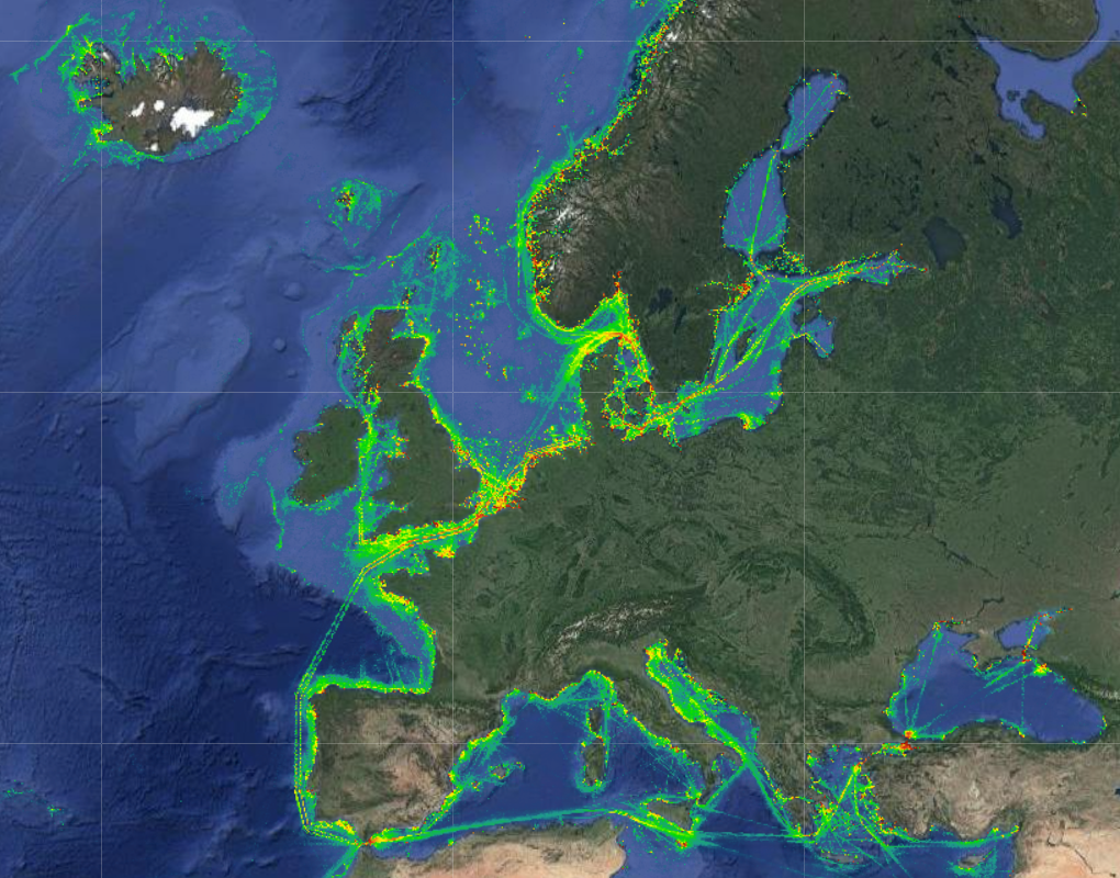
The Vessel Density maps in the EU were created in 2019 by Cogea for the European Marine Observation and Data Network (EMODnet). The dataset is updated every year and is available for viewing and download on EMODnet Human Activities web portal (www.emodnet-humanactivities.eu). The maps are based on AIS data yearly purchased from Collecte Localisation Satellites (CLS) and ORBCOMM. The maps, GeoTIFF format, show shipping density in 1x1km cells of a grid covering all EU waters and some neighbouring areas. Density is expressed as hours per square kilometre per month. The following ship types are available:0 Other, 1 Fishing, 2 Service, 3 Dredging or underwater ops, 4 Sailing, 5 Pleasure Craft, 6 High speed craft, 7 Tug and towing, 8 Passenger, 9 Cargo, 10 Tanker, 11 Military and Law Enforcement, 12 Unknown and All ship types. Data are available by month of year. Yearly averages are also available.
-
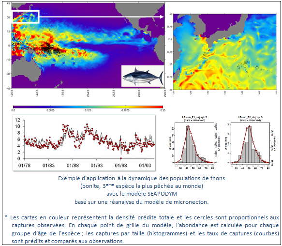
Monitoring and understanding of marine ecosystems, marine population dynamics, commercial species and protected species. Themes covered: - Functional ecology - marine population dynamics - Impact of climate variability - Ecosystem management - Spatialised operational management System functions - Definition of key areas and configuration of the population dynamics model - Acquisition of satellite data and in situ ocean data - Data processing and production of geographical layers - Data management and storage - Data distribution Coverage - Oceans worldwide - Ocean basins - Ocean regions - Mediterranean sea Specifics (see functioning, qualification system, custom services for users) - Customised services for users
-
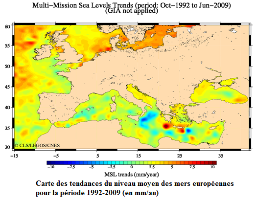
Système DUACS d’acquisition, de valorisation et d’information de l’altimétrie
-
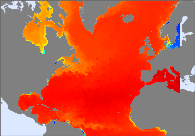
This dataset contains a set of 2D and 3D ocean parameters from the PSY2V3 Mercator Ocean operational numerical model. The product grid is a reinterpolation on a Mercator projection 1/6° grid from the 1/12° native grid. This dataset covers the North Atlantic Ocean. For more information concerning this product, see <a href="http://www.mercator-ocean.fr/html/produits/description/produits_numeriques/gp_num_psy2v3_en.html
 Catalogue PIGMA
