 Catalogue PIGMA
IFREMER SIH
Type of resources
Available actions
Topics
Keywords
Contact for the resource
Provided by
Years
Representation types
Update frequencies
status
Scale
-
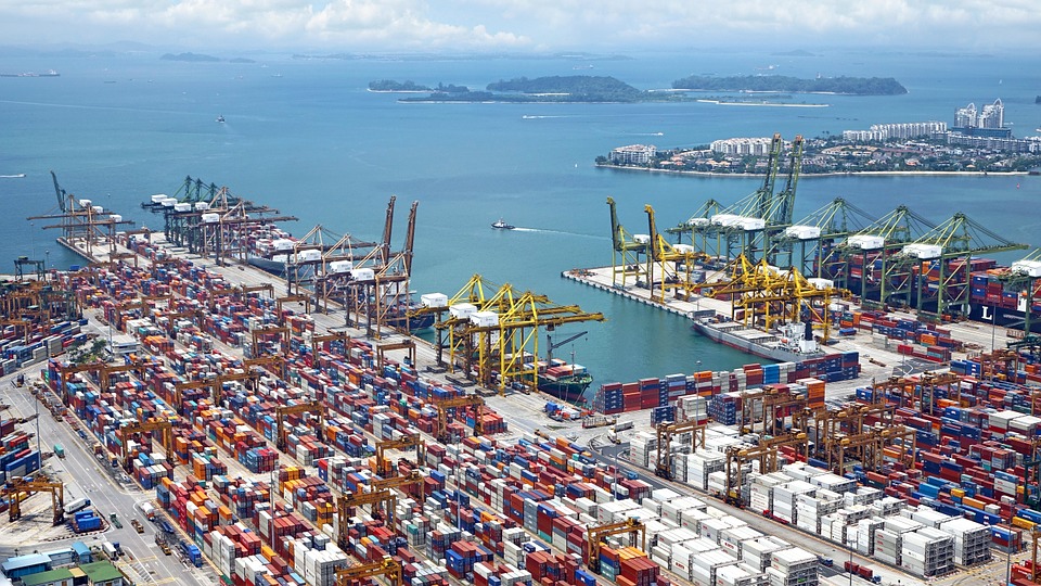
World list of seaports. In its 2021 version, the repository includes 13709 ports for 187 countries. The list of seaports has been drawn up on the basis of the information available in the European reference system of places used in the framework of the Common Fisheries Policy and, more particularly, by the Electronic Recording and Reporting System (ERS), the list of ports identified by the UNECE (2021-1). An assessment of the infrastructures present along the coastline made it possible to identify other ports that were not listed. Each geographical position has been verified with Google Earth in WGS84. Each port is associated with information relating to the country (ISO 3 coding), the UNECE or ERS 5-character coding, the name, the geographical position in WGS84 (latitude and longitude), the status of the port indicating whether it is referenced by Unece (UNECE), by the EU/ERS (ERS) or by both (UNECE/ERS) In case the port is not referenced by UNECE or ERS, the status is N/A. For French ports, the reference system integrates the ports of the French overseas departments and territories with the national codification. Inland ports have also been integrated in 2021.
-
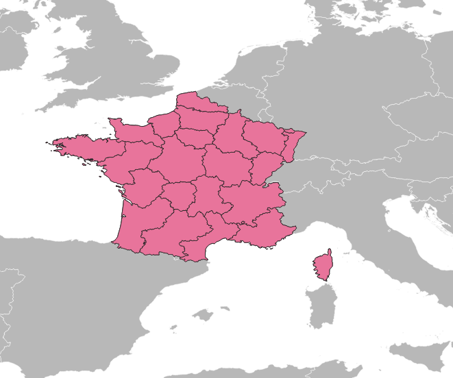
Avant le 1er janvier 2016, la France comptait 27 régions : - 22 régions en France métropolitaine (en comptant la Corse). - 5 régions d'outre mer : la Guadeloupe, la Martinique, la Guyane, la Réunion et Mayotte (depuis 2011). Bien qu'obsolète, ce référentiel est conservé dans le Système d'Informations Halieutiques pour les données historiques.
-

Le référentiel des espèces exploitées d’intérêt commercial du Système d’Informations Halieutiques reprend le référentiel ASFIS de la FAO enrichi d’espèces ayant un fort intérêt commercial en France (métropole et outre-mer).
-
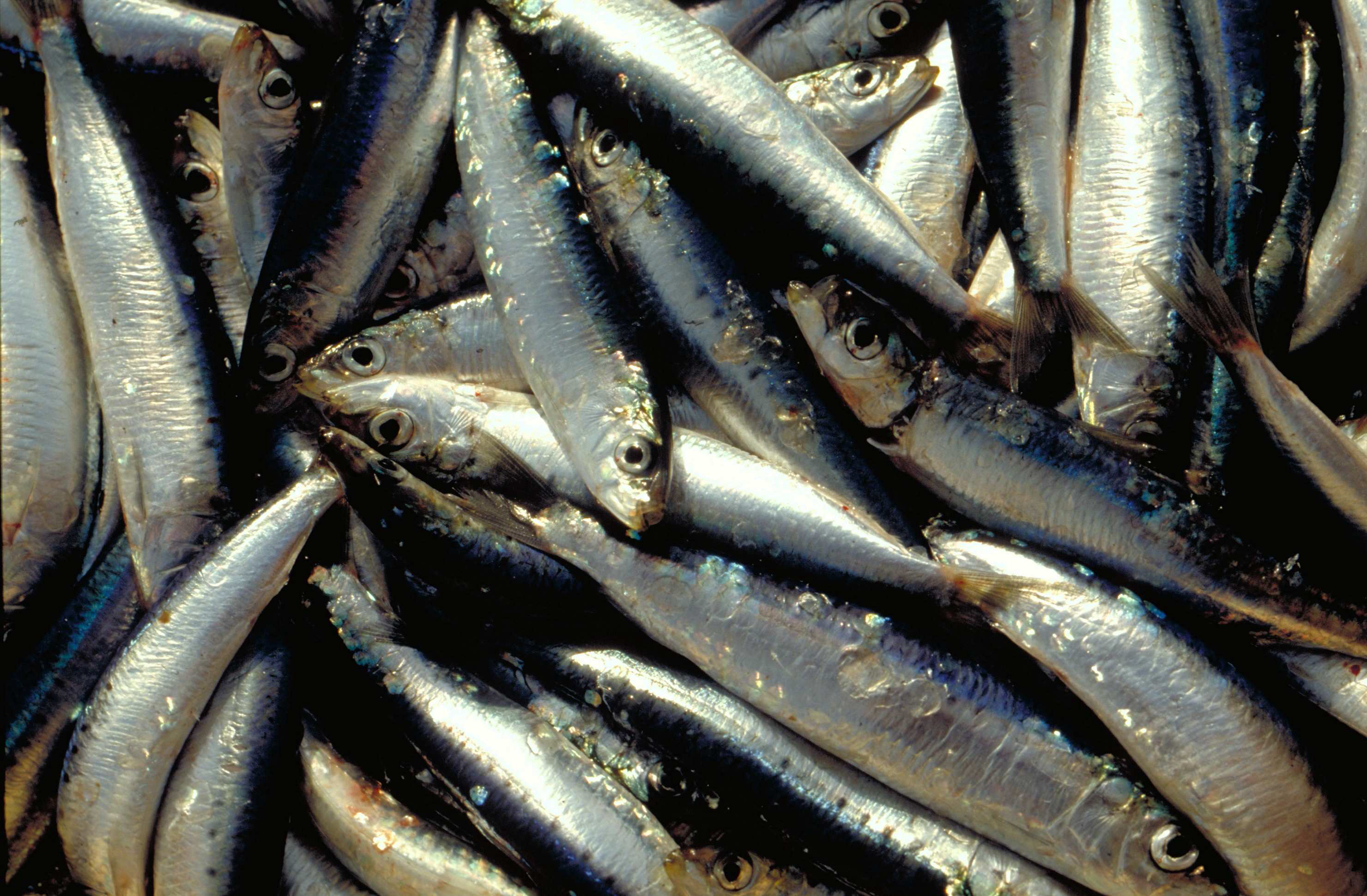
La campagne annuelle d'évaluation des ressources halieutiques PELMED (PELagiques MEDiterranée) est menée par le Laboratoire Halieutique Méditerranée de la station Ifremer de Sète. Les objectifs de ces campagnes sont : 1. Évaluer la biomasse des petits pélagiques (anchois, sardines) par méthode directe. Pour cela, la campagne doit alterner entre prospection acoustique et chalutages d'identification. Un signal acoustique est envoyé depuis un sondeur fixé sous le navire et chaque fois qu'il rencontre le fond ou des bancs de poissons, il est réfléchi et retransmis aux sondeurs. Ainsi, on peut observer en continu la forme et l'intensité de ces échos qui matérialisent les bancs de poissons. Des chalutages d'identification des espèces sont effectués afin de définir la proportion des espèces présentes dans les échos détectés. 2. Collecter le plus grand nombre de paramètres biologiques possible sur les espèces cibles de petits pélagiques (anchois, sardines, sprats) pour mieux comprendre la dynamique de population de ces espèces. Pour cela, des mesures morphométriques, ainsi que la détermination du sexe et du stade de maturité des poissons sont réalisées. Enfin, des otolithes sont prélevés afin de pouvoir déterminer l'âge des poissons. Ces paramètres biologiques sont très importants pour compléter l'évaluation de biomasse et avoir une meilleure compréhension des processus sous-jacents à la variabilité de ces populations. Cela permet par exemple de déterminer la structure en âge ou en taille des populations, d'avoir une idée de leurs réserves énergétiques, etc. 3. Mieux comprendre l'écosystème pélagique dans son ensemble, du plancton aux prédateurs supérieurs. La campagne PELMED a pour but premier d'évaluer les stocks de petits pélagiques, mais elle s'attache également à accumuler le plus de données possible sur les différents compartiments de l'écosystème pélagique, allant des paramètres physiques (température, salinité) aux prédateurs supérieurs (mammifères marins, oiseaux), en passant par les différents niveaux trophiques inférieurs (phyto- et zooplancton, poissons petits pélagiques). Ainsi, après chaque chalutage, une station hydrologique est réalisée avec la mesure de la température et de la salinité le long de la colonne d'eau via une CTD, des prélèvements d'eau et de phytoplancton avec une bouteille Niskin et des prélèvements de zooplancton à l'aide d'un trait vertical de WP2. Enfin, tout au long de la campagne nous réalisons l'observation et le comptage des oiseaux et mammifères marins. En plus de la compréhension de l'écosystème, ceci devrait permettre de fournir un certain nombre d'indicateurs nécessaires au suivi du milieu marin dans le cadre de la DCSMM (Directive Cadre sur le Milieu Marin).
-
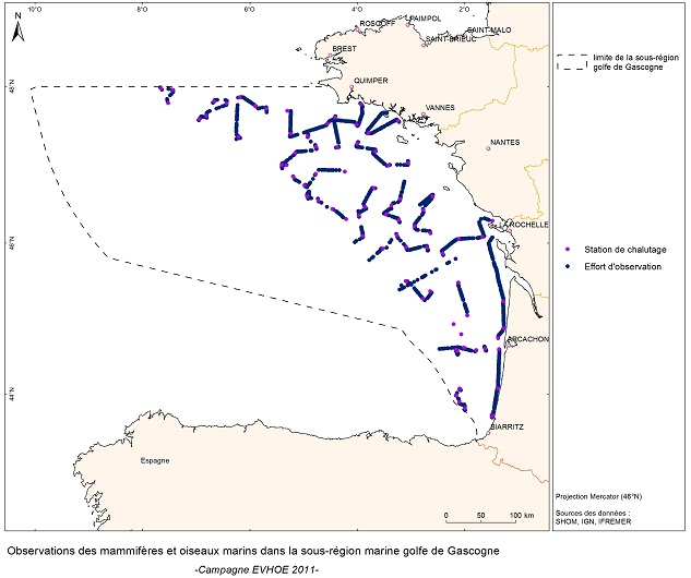
EVHOE est une enquête pluriannuelle dont les objectifs sont les suivants : - Etablir des séries chronologiques d'indices d'abondance pour les principales espèces dermiques et benthiques de la mer Celtique et du golfe de Gascogne. - Mesurer l'évolution interannuelle de leur recrutement. - Cartographier les distributions spatiales des espèces et leurs variations interannuelles, ainsi que rechercher l'origine de cette variabilité (paramètres biotiques et/ou abiotiques, impact de la pêche). - Dans le cadre du défi "Golfe de Gascogne", les données collectées sont essentielles pour comprendre les changements dans les communautés fauniques.
-
Les données de "Marées" du flux déclaratif correspondent aux données de captures et d'effort de pêche déclarées par les professionnels dans les journaux de bord (log-books) pour les navires dont la longueur hors-tout est supérieure ou égale à 10 mètres, et les fiches de pêche pour les navires dont la longueur hors-tout est inférieure à 10 mètres.
-

Un métier dans le Système d’Informations Halieutiques est une pratique de pêche définie par un engin de pêche et une espèce cible. Ils sont utilisés à des fins statistiques afin d’évaluer les stratégies et les efforts de pêche.
-
Acquisition de données et connaissances pour l’élaboration d’aides à la Gestion Intégrée des Populations de Bar de l’Atlantique du Nord-Est.
-

Pour certaines espèces commerciales, des coefficients appelés équivalent poids vifs permettent de calculer le poids vif du poisson à partir du poids enregistré au débarquement, ou à partir du poids net des divers produits transformés préparés à bord ou dans des usines installées sur le littoral.
-

Le projet NourDem vise à réaliser des campagnes annuelles de chalutage dans les trois estuaires de la Seine, de la Loire et de la Gironde.