 Catalogue PIGMA
geoscientificInformation
Type of resources
Available actions
Topics
Keywords
Contact for the resource
Provided by
Years
Formats
Representation types
Update frequencies
status
Scale
Resolution
-
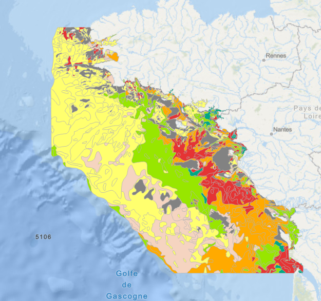
Position théorique du trait de côte (pied de dune) estimée en 2020, sans les ouvrages (sauf ouvrages majeurs du Verdon, de l'Adour et de l'Artha à St-Jean-de-Luz), uniquement sur la côte sableuse. (métadonnée en cours)
-
-
-

-- Warning, deliverable only available in French -- Delivrable D02.05 of the FEM PHYSIC 2015 project WP 2: Definition of the data acquisition strategy Task 2: Choice of measuring instruments
-
-- Warning, deliverable only available in French -- Delivrable D02.05 of the FEM PHYSIC 2015 project WP 2: Definition of the data acquisition strategy Task 2: Choice of measuring instruments
-
Position théorique du trait de côte (pied de dune) 2009 Aquitain sans les ouvrages (sauf ouvrages majeurs du Verdon, de l'Adour et de l'Artha à St-Jean-de-Luz) et description de l'aléa érosion. Concerne uniquement la côte sableuse.
-
Map of surficial sediments of the northern continental shelf of the Bay of Biscay at 1:500000 by Philippe BOUYSSE, Patrick LESUEUR, André KLINGEBIEL et al., 1986, conducted jointly by the BRGM and Ifremer.
-
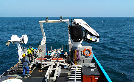
Raw siescan sonar data archived at SISMER, acquired: - by oceanographic vessels and national equipment managed by the French Oceanographic Fleet (FOF) - by foreign oceanographic vessels in collaboration with Ifremer - by Ifremer's historic vessels (Jean Charcot, Nadir, Suroit) operated before the FOF was set up
-

-- Warning, deliverable only available in French -- Delivrable D02.05 of the FEM PHYSIC 2015 project WP 2: Definition of the data acquisition strategy Task 2: Choice of measuring instruments
-

-- Warning, deliverable only available in French -- Delivrable D02.05 of the FEM PHYSIC 2015 project WP 2: Definition of the data acquisition strategy Task 2: Choice of measuring instruments