 Catalogue PIGMA
repository
Type of resources
Available actions
Topics
Keywords
Contact for the resource
Provided by
Years
Formats
Representation types
status
-

The ODIS "Catalogue of Sources" aims to be an online browsable and searchable catalogue of existing ocean related web-based sources/systems of data and information as well as products and services. It will also provide information on products and visualize the landscape (entities and their connections) of ocean data and information sources. It will contribute to the objectives of the Agenda 2030, and in particular the UN Decade for Ocean Science for Sustainable Development. The Catalogue is not an ocean database or metadata repository. The catalogue includes descriptive information such as the URL, title, description, language, point of contact, geographic scope, available technologies for machine-to-machine interaction, keywords, etc. and can be searched on many of these fields. The IODE network of NODCs has been collecting, managing and serving data for decades. This effort has yielded an extensive, but distributed and heterogeneous collection of data and information sources. Additionally, the low threshold for technical capabilities required to offer data and information over the Internet means that many of the hosted resources are not readily discoverable through NODCs, regional or international data and information systems ODIS will provide an online catalogue of (ideally) all online data/information sources (and, where possible, metadata on off-line sources as well). Many regional and international programmes and projects have developed online data/information services but there is currently no "one-stop shop" where users are offered an overview and/or common data/information discovery interface. There are currently 3090 sources (2172 are searchable) catalogued in the system.
-

Marine data sharing and preservation, managed & operated by the National Oceanography Centre. Part of the UK's National Oceanography Centre, BODC provide instant access to over 130,000 unique data sets. BODC data helps provide answers to both local questions such as the likelihood of coastal flooding, or global issues such as the impact of climate change. Data categories include: - Acoustics - Bathymetry and topography - Currents — horizontal and vertical velocity, Lagrangian currents and water transport rates - Meteorology — Radiosonde, Met. stations and data buoys - Optical properties — pigments, turbidity, irradiance - Sea level - Water column temperature and salinity - Water column chemistry — nutrients, carbons, oxygen - Waves — statistics and spectra
-

Several climate indices, regarding Atlantic Basin: - North Atlantic Oscillation - Southern Oscillation Index - Bivariate ENSO Timeseries - Tropical Northern Atlantic Index - Tropical Southern Atlantic Index - Oceanic Niño Index - Multivariate ENSO Index (MEI V2) - North Tropical Atlantic SST Index - ENSO precipitation index - Northeast Brazil Rainfall Anomaly - Solar Flux (10.7cm) - Global Mean Lan/Ocean Temperature
-
The Western Channel Observatory (WCO) is an oceanographic time-series and marine biodiversity reference site in the Western English Channel. In situ measurements are undertaken weekly at coastal station L4 and fortnightly at open shelf station E1 using the research vessels of the Plymouth Marine Laboratory and the Marine Biological Association. These measurements are complemented by PML's recognised excellence in ecosystem modelling and satellite remote sensing science. By integrating these different observational disciplines we can begin to disentangle the complexity of the marine ecosystem. The WCO measures several key parameters important to the functioning of the marine ecosystem such as light, temperature, salinity and nutrients. Station L4 has some of the longest time-series in the world for zooplankton and phytoplankton, and fish trawls have been made by the MBA for a century. Station E1 has a hydrographic series dating from 1903. These long series are complemented by hourly measurements made at our moorings situated at both stations. These can elucidate changes not captured by the routine weekly sampling.
-
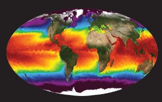
NASA's Physical Oceanography Distributed Active Archive Center (PO.DAAC) is located at NASA's Jet Propulsion Laboratory in Pasadena, California. PO.DAAC manages and provides tools and services for NASA's oceanographic and hydrologic data (satellite, airborne, and in-situ) to enable a greater understanding of the physical processes and conditions of the global ocean. Measurements include gravity, ocean winds, sea surface temperature, ocean surface topography, sea surface salinity, and circulation. The data support a wide range of applications including climate research, weather prediction, resource management, policy, and the stewardship of ocean data resources.
-

GBIF, the Global Biodiversity Information Facility, is an international network and data infrastructure funded by the world's governments and aimed at providing anyone, anywhere, open access to data about all types of life on Earth. Coordinated through its Secretariat in Copenhagen, the GBIF network of participating countries and organizations, working through participant nodes, provides data-holding institutions around the world with common standards and open-source tools that enable them to share information about where and when species have been recorded. This knowledge derives from many sources, including everything from museum specimens collected in the 18th and 19th century to geotagged smartphone photos shared by amateur naturalists in recent days and weeks. The GBIF network draws all these sources together through the use of data standards, such as Darwin Core, which forms the basis for the bulk of GBIF.org's index of hundreds of millions of species occurrence records. Publishers provide open access to their datasets using machine-readable Creative Commons licence designations, allowing scientists, researchers and others to apply the data in hundreds of peer-reviewed publications and policy papers each year. Many of these analyses, which cover topics from the impacts of climate change and the spread of invasive and alien pests to priorities for conservation and protected areas, food security and human health, would not be possible without this. GBIF arose from a 1999 recommendation by the Biodiversity Informatics Subgroup of the Organization for Economic Cooperation and Development's Megascience Forum. This report concluded that "An international mechanism is needed to make biodiversity data and information accessible worldwide", arguing that this mechanism could produce many economic and social benefits and enable sustainable development by providing sound scientific evidence.
-

The primary aim of the Fisheries and Resources Monitoring System (FIRMS) is to provide access to a wide range of high-quality information on the global monitoring and management of fishery marine resources. FIRMS draws together a unified partnership of international organizations, regional fishery bodies and, in the future, national scientific institutes, collaborating within formal agreement to report and share information on fisheries resources. For effective fisheries information management, FIRMS also participates in the development and promotion of agreed standards. FIRMS system is part of the Fisheries Global Information System (FIGIS). Information provided by the partners is organized in a database and published in the form of fact sheets. This system provides the data owner with tools to ensure controlled dissemination of high quality and updated information.
-
Accredited through the MEDIN partnership, and core-funded by the Department for the Environment, Food and Rural Affairs (Defra) and the Scottish Government, DASSH provides tools and services for the long-term curation, management and publication of marine species and habitats data, within the UK and internationally. Below are a selection of projects, outputs and deliverables that DASSH and the MBA Data Team have been involved in recently. - NE Data Management: DASSH have been contracted by the Marine team at Natural England (NE) to support NE data dissemination. We have been digitising datasets used in Article 17 reporting and helping them input data to Marine Recorder and MEDIN guidelines. In addition, DASSH is running a 2-day workshop with the marine data team in October 2014 on data management and standards. The aims of the workshop are to present MEDIN data guidelines and standards and to run practicals on quality assurance (QA) issues with data, creating MEDIN formatted data, and creation of MEDIN metadata. - MCZ Data Archiving: DASSH staff have been working with Defra, JNCC, Natural England, Cefas and the other MEDIN DAC's in the development and implementation of a strategy for the archiving and dissemination of MCZ survey data. This involves the archives of many terrabytes of data from the survey work undertaken at 127 sites. DASSH is currently working with the other DACs archiving the data from several MCZ sites before taking delivery of the complete survey catalogue. - Non-Natives Data Management: DASSH staff work with other members of the KE team to help deliver the MBA contribution to the GB Non-native Species Information Portal. The data team ensure the validation of records submitted and raise alerts when records of Invasive Non-Native Species of concern and in disseminating information about species distribution via DASSH and the NBN. DASSH staff continue to liaise with organisations to ensure the prompt flow of marine non-native species distribution data to the public domain. The KE team facilitated the identification of two new marine invasive non-native species in 2014 and have subsequently created the identification sheet for these species. Hemigrapsus sanguineus (from volunteer records sent in for identification) and Hemigrapsus takanoi (first recorded by the John Bishop Group survey team). - EMODNet Biology: The Data Team are part of a consortium led by the Flanders Marine Institute (VLIZ) for the biological data component of EMODNet (European Marine Observation and Data Network). The Data Team will lead a work package relating to biological traits and indicator species as identified for Marine Strategy Framework Directive (MSFD) reporting, bringing an additional €130k of funding. - VALMER: The Data Team led a key work package in a £3.7 million (ca. €260k for the MBA) INTERREG project to "Develop, trial and refine methodologies that will be used to quantify and communicate the value (economical, social and environmental) of marine and coastal ecosystem services". The research identified an operational framework to value marine ecosystem services, and which could be used to enhance marine planning and policy decisions.
-

The World Bank Group works in every major area of development. It provides a wide array of financial products and technical assistance, and it helps countries share and apply innovative knowledge and solutions to the challenges they face.
-
EMODnet (European Marine Observation and Data Network) is the long term marine data initiative supported by the European Commission since 2009 to ensure that European marine data will become easily accessible, interoperable, and free on restrictions on use. EMODnet Chemistry provides access to standardized, harmonized and validated chemical data collections for water quality evaluation at a regional scale, as defined by the Marine Strategy Framework Directive (MSFD). The data portal has adopted and adapted SeaDataNet standards and services, establishing interoperability between the data sets from the many different providers (more than 60 in EMODnet Chemistry network). Concentration maps of nutrients, chlorophyll-a and dissolved oxygen are computed on a standard grid, providing information at a regular time interval, per season and over several vertical layers, including the deepest one. Dedicated OGC standard services for browsing, viewing and downloading chemistry observation, data and data products for the European waters have been developed, and are actively maintained and monitored.