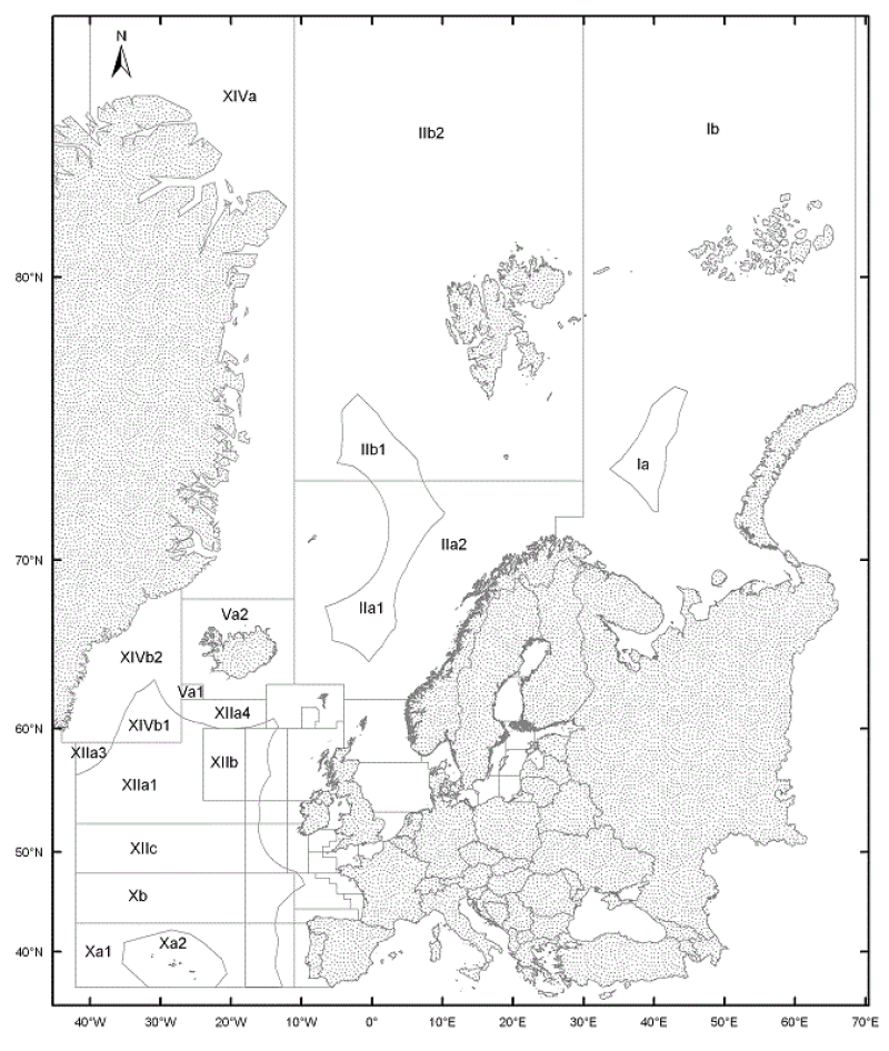
ICES Statistical Areas
The ICES Statistical Areas delineates the divisions and subdivisions of FAO Major Fishing area 27
Simple
- Date (Publication)
- 2005-11-03T12:24:00
- Edition
- 20051103
- Identifier
- ICES_Areas_20051103.shp
- Presentation form
- Digital map
- Purpose
- The ICES Statistical Areas are used as bounding areas for calculation of fish statistics, e.g. catch per unit effort (CPUE) and stock estimates.
- Credit
- ICES
- Status
- Completed
- Maintenance and update frequency
- As needed
- Thèmes Sextant
-
- /Regulation and Management/Usage Regulations/Fisheries/Fishing Area Limits
- Theme
-
- ICES statistical areas
- Place
-
- FAO Major Fishing Area 27
- GEMET - INSPIRE themes, version 1.0
-
- Administrative units
- Use limitation
- Data is available under the terms of the ICES Data Policy. (See: http://geo.ices.dk/ices_dp.html )
- Access constraints
- Other restrictions
- Use constraints
- Other restrictions
- Other constraints
- Data is available under the terms of the ICES Data Policy. (See: http://geo.ices.dk/ices_dp.html )
- Spatial representation type
- Vector
- Metadata language
- English
- Character set
- UTF8
- Topic category
-
- Boundaries
N
S
E
W
))
- Reference system identifier
- EPSG:4326
- Distribution format
-
-
ESRI shape
(
ArcGIS 9.3.1
)
-
ESRI shape
(
ArcGIS 9.3.1
)
- OnLine resource
- site internet Ifremer dédié à la Directive Cadre Stratégie pour le Milieu Marin ( WWW:LINK )
- Hierarchy level
- Dataset
- Statement
- http://www.ices.dk/aboutus/icesareas.asp
- File identifier
- 0002bf0d-0555-4697-ac80-2df0e2b76c40 XML
- Metadata language
- English
- Character set
- UTF8
- Hierarchy level
- Dataset
- Date stamp
- 2020-06-04T00:36:45
- Metadata standard name
- ISO 19115:2003/19139 - SEXTANT
- Metadata standard version
- 1.0
Point of contact
ICES
-
Hans Mose Jensen
(
)
H.C. Andersens Blv. 44-46
,
Copenhagen V
,
DK-1553
,
Denmark
Overviews

Spatial extent
N
S
E
W
))
Provided by

Associated resources
Not available
 Catalogue PIGMA