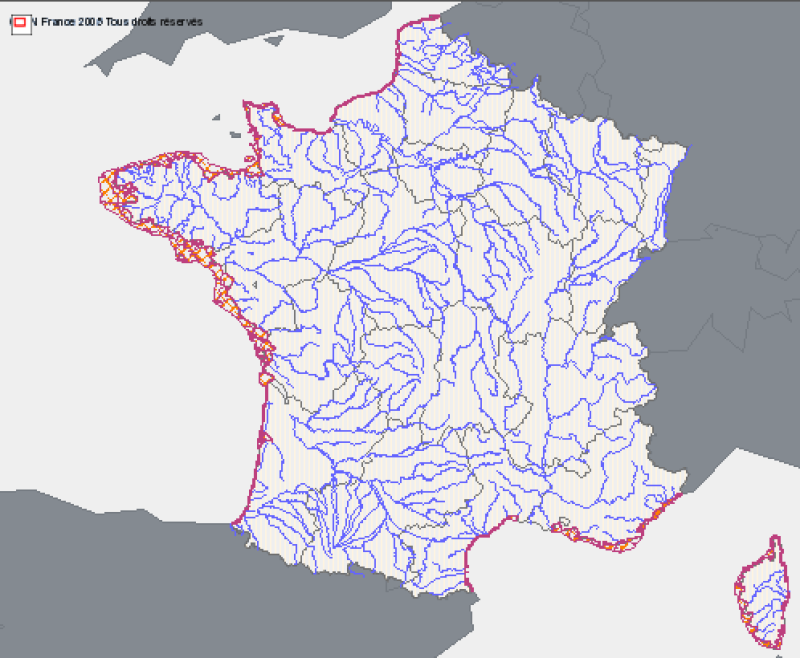
Coastal water bodies of Metropolitan France - Reporting 2010
A coastal water body is a discrete and significant element of surface water located between the baseline from which to measure the breadth of territorial waters to a distance of one nautical mile.
Correspondence reporting of the WFD (Water Framework Directive) : This entity corresponds to the concept of Coastal Water Body (CWBODY) of WISE.
Simple
- Date (Revision)
- 2009-10-30T17:19:00
- Edition
- 2009
- Identifier
- urn:sandre:referentiels:sa_mdo:1.2:MasseDEauCotiere:2009-1:metropole
- Presentation form
- Digital map
- Purpose
- Coastal water bodies have been drafted through the work of IFREMER and water agencies (Agences de l'eau) for the purposes of the waters framework directive. Specifications were developed by the group repositories of the WIS (Water Information System).
- Credit
- Ifremer, Agences de l'eau, DCE
- Status
- Completed
+33555114748
- Maintenance and update frequency
- As needed
- Thèmes Sextant
-
- /Regulation and Management/Marine Administrative Data
- GEMET
-
- environmental policy
- Theme
-
- Water Framework Directive
- WFD
- WATER BODY
- COASTAL WATERS
- COASTAL
- GEMET - INSPIRE themes, version 1.0
-
- Hydrography
- Area management/restriction/regulation zones and reporting units
- Place
-
- FRANCE
- METROPOLE
- Thématiques - SIMM
-
- Actions concrètes
- Cadre Réglementaire - SIMM
-
- Directive Cadre sur l'Eau (DCE)
- Sous-regions marines
-
- /Métropole
- Access constraints
- Intellectual property rights
- Spatial representation type
- Vector
- Denominator
- 50000
- Metadata language
- Français
- Character set
- UTF8
- Topic category
-
- Inland waters
- Begin date
- 2005-01-01T10:25:00
- End date
- 2010-01-01T10:26:00
))
- Reference system identifier
- EPSG / RGF93 (EPSG:4171) / 7.4
- Distribution format
-
-
ESRI Shapefile
(
1998
)
-
MIF / MID
(
MapInfo 10
)
-
ESRI Shapefile
(
1998
)
- OnLine resource
- Consulter la documentation sur le site Sandre ( WWW:LINK )
- OnLine resource
-
MasseDEauCotiere
(
OGC:WMS
)
Service WMS / coastal water bodies
- OnLine resource
-
MasseDEauCotiere
(
OGC:WFS
)
Service WFS (FeatureType: MasseDEauCotiere)
- OnLine resource
- Téléchargement des données - Format ESRI Shapefile ( WWW:LINK )
- OnLine resource
- Téléchargement des données - Format MIF/MID ( WWW:LINK )
- Hierarchy level
- Dataset
- Statement
- Coastal water bodies are defined land / sea by the SHOM coastline at 1:25000
- Description
- 2009 reporting data integration
- Date / Time
- 2009-07-09T11:24:00
- File identifier
- 28185c9c-3e75-4753-86eb-4ae02a2e7581 XML
- Metadata language
- Français
- Character set
- UTF8
- Hierarchy level
- Dataset
- Hierarchy level name
- dataset
- Date stamp
- 2020-06-04T00:32:10
- Metadata standard name
- ISO 19115:2003/19139 - SEXTANT
- Metadata standard version
- 1.0
+33555114748
Overviews

Spatial extent
))
Provided by

 Catalogue PIGMA