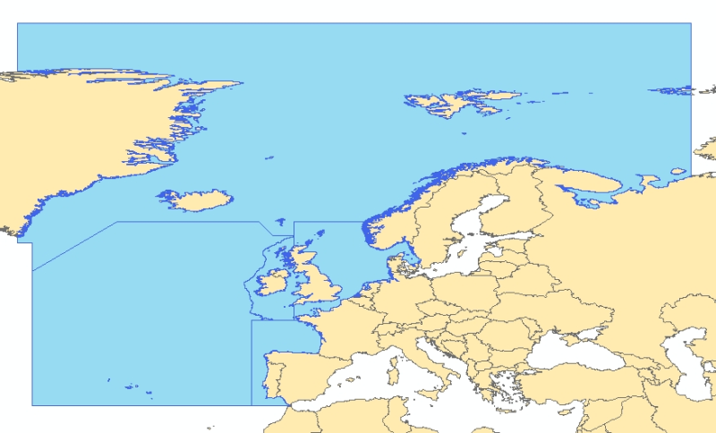
OSPAR Regions boundaries
OSPAR regions boundaries shapefile.
Attributes data definition :
REGION : Number of the OSPAR Region
AREA : Area expressed in square kilometer calculated in North Pole Azimuthal Lambert projection (Equal Area) and reprojected in geographic coordinates system (datum WGS 84).
Simple
- Alternate title
- AAMP_OSPAR_P
- Date (Creation)
- 2009-02-20T00:00:00
- Identifier
- AAMP_OSPAR_P
- Presentation form
- Digital map
- Status
- Completed
Point of contact
Agence des aires marines protégées
-
(
pôle géomatique
)
02 98 33 87 77
16 quai de la douane BP 42932
,
Brest cedex 2
,
29229
,
France
02 98 33 87 67
02 98 33 87 77
- Maintenance and update frequency
- As needed
- Thèmes Sextant
-
- /Réglementation et gestion/Données administratives en mer
- Place
-
- Atlantique Nord
- GEMET - INSPIRE themes, version 1.0
-
- Zones de gestion, de restriction ou de réglementation et unités de déclaration
- Sous-regions marines
-
- /Métropole
- Thématiques - SIMM
-
- Actions concrètes
- Type de jeux de donnée ODATIS
-
- /Données administratives
- Access constraints
- Copyright
- Spatial representation type
- Vector
- Metadata language
- Français
- Character set
- UTF8
- Topic category
-
- Boundaries
N
S
E
W
))
- Reference system identifier
- 4326
- Topology level
- Geometry only
- Geometric object type
- Surface
- Hierarchy level
- Dataset
- Statement
- Non renseignée
- File identifier
- 3bae1290-e60d-11dd-8037-000086f6a603 XML
- Metadata language
- Français
- Character set
- UTF8
- Hierarchy level
- Dataset
- Date stamp
- 2020-06-04T00:23:28
- Metadata standard name
- ISO 19115:2003/19139 - SEXTANT
- Metadata standard version
- 1.0
Point of contact
OSPAR Commission
-
(
)
+ 44 (0) 20 7430 5225
New Court 48 Carey Street
,
London
,
WC2A 2JQ
,
United Kingdom
+44 (0) 20 7430 5200
+ 44 (0) 20 7430 5225
Overviews

Spatial extent
N
S
E
W
))
Provided by

Associated resources
Not available
 Catalogue PIGMA