 Catalogue PIGMA
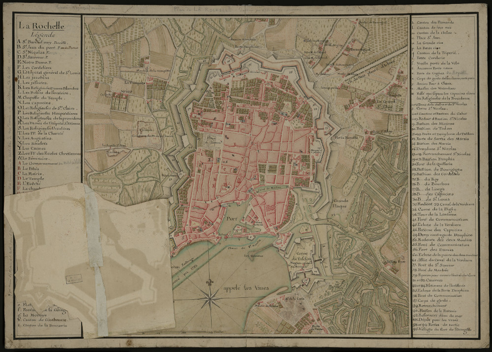
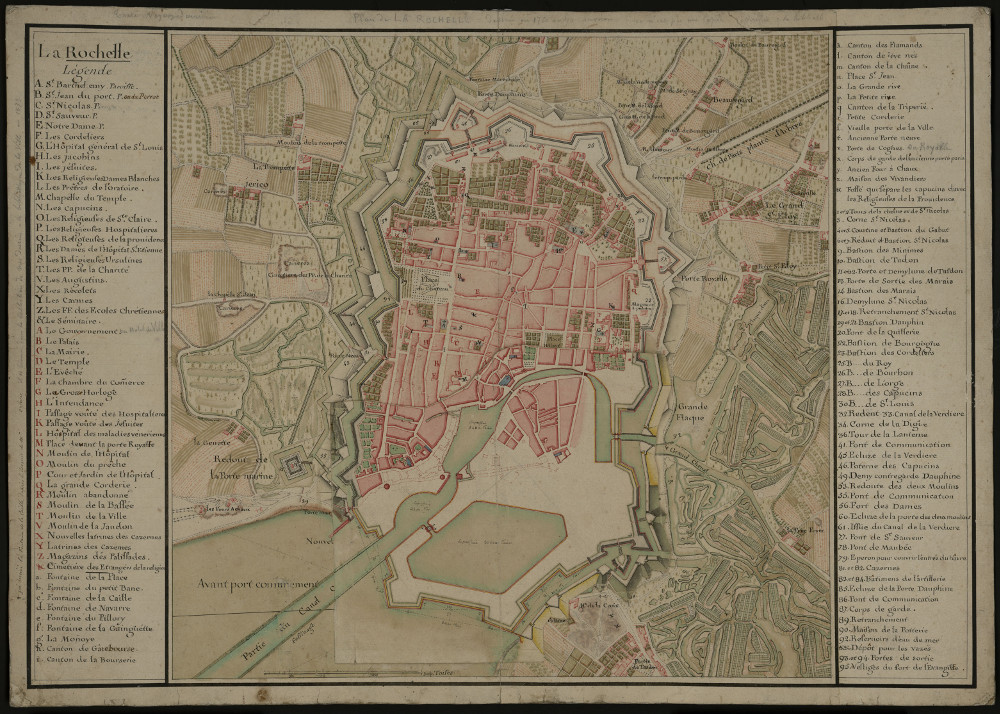
Plan de La Rochelle fin XVIII_3PL163-a-b
Thème :
Date.edition :
Auteur.nom :
Auteur.date :
Interêt : fin XVIII° (projet de bassin) Sans le bassin à flot. Avec extension des fortifications. Fassinage du canal (comme Boulogne sur mer) pour empêcher l’envasement. Grand bassin sur marais. A = projet. B = réalité. Et comblement projeté du chenal st Nicolas.
Editeur :
Echelle :
Taille :
Lieu d'archivage : Michel Crépeau, Patrimoine, Reserve A 3 PL 163-a-b. Exclu du prêt, consultation sur place
Numéro d'archive : Plan Carte (No )
Indices :
Référence : 3 PL 163-a-b
Simple
- Date (Creation)
- 2016-09-05
- Date (Publication)
- 2017-01-30
- Date (Revision)
- 2017-01-30
- Identifier
- FR-180-089-013-03720-LIENSs_dypomar_3_PL_163-a-b_20161229
- Credit
- LIENSs - UMR 7266
- GEMET - INSPIRE themes, version 1.0
-
- Régions maritimes
- Use limitation
- Utilisation libre sous réserve de mentionner la source (a minima le nom du producteur) et la date de sa dernière mise à jour.
- Access constraints
- Intellectual property rights
- Access constraints
- Other restrictions
- Other constraints
- Pas de restriction d’accès publique
- Classification
- Unclassified
- Spatial representation type
- Grid
- Metadata language
- fre
- Character set
- UTF8
- Topic category
-
- Imagery base maps earth cover
- Society
- Environment
))
))
- Begin date
- 1766-01-01
- End date
- 1766-01-01
- Reference system identifier
- EPSG / Lambert 93 / 7.4
- Reference system identifier
- INSPIRE RS registry / grégorien
- Distribution format
-
-
GeoTIFF
(
)
-
GeoTIFF
(
)
- OnLine resource
-
pyramid_1766
(
OGC:WMS
)
pyramid_1766
- OnLine resource
-
pyramid_1765
(
OGC:WMS
)
pyramid_1765
- File identifier
- 91f360ab-884c-42ae-ab5a-5ebadbae9e81 XML
- Metadata language
- fre
- Character set
- UTF8
- Hierarchy level
- Dataset
- Hierarchy level name
- Série de données
- Date stamp
- 2017-09-08T09:39:10
- Metadata standard name
- ISO 19115:2003/19139 - SEXTANT
- Metadata standard version
- 1.0
Overviews
Spatial extent
Provided by
