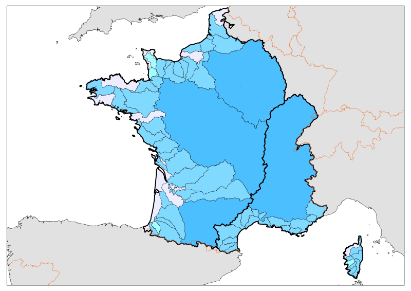
Calculating network of pollutant flows to the sea English Channel-Atlantic-Mediterranean fronts.
Division of French metropolitan territories to define the zones contributing to the pollutant flow carried by rivers to the sea.
Simple
- Alternate title
- FM_Tributaires_joint_tab_wgs84.shp
- Alternate title
- FA_Tributaires_joint_tab_wgs84.shp
- Date (Creation)
- 2005-11-01
- Date (Publication)
- 2005-11-01
- Date (Revision)
- 2010-11-01
- Identifier
- FA_FM_Tributaires_joint_tab_wgs84
- Credit
- MEDDTL/CGDD/SOeS
- Thèmes Sextant
-
- /Physical Environment/Terrestrial Hydrography/Hydrographic Network
- Theme
-
- hydrography
- rates
- fluvial inputs
- polluting flows
- maritime regions
- Place
-
- English Channel
- Atlantic
- Mediterranean
- Sous-regions marines
-
- /Métropole
- Access constraints
- Copyright
- Metadata language
- Français
- Character set
- UTF8
- Topic category
-
- Inland waters
N
S
E
W
))
- Reference system identifier
- EPSG / WGS84 géographiques / 7.4
- Distribution format
-
-
shape ESRI
(
ArcGIS 9.3.1
)
-
shape ESRI
(
ArcGIS 9.3.1
)
- OnLine resource
- site internet Ifremer dédié à la Directive Cadre Stratégie pour le Milieu Marin ( WWW:LINK )
- OnLine resource
-
carthothèque DCSMM
(
WWW:LINK
)
River flows
- Hierarchy level
- Dataset
- Statement
- Divisions based on the division and chaining of hydrographic zones as defined by the BDCarthage.
- File identifier
- a79999d0-f48c-4f6c-b5b3-a3c355a1ab75 XML
- Metadata language
- Français
- Character set
- UTF8
- Hierarchy level
- Dataset
- Hierarchy level name
- Jeu de données
- Date stamp
- 2020-06-04T00:55:08
- Metadata standard name
- ISO 19115:2003/19139 - SEXTANT
- Metadata standard version
- 1.0
Overviews

Spatial extent
N
S
E
W
))
Provided by

Associated resources
Not available
 Catalogue PIGMA