15000
Type of resources
Available actions
Topics
Keywords
Provided by
Years
Formats
Representation types
Update frequencies
status
Scale
-
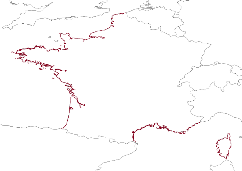
The Histolitt® coastline corresponds to the high tide line with an astronomic tidal coefficient of 120 and in normal weather conditions (no sea breeze and no low pressure systems likely to raise sea level). The Histolitt® coastline models this theoretical input as a series of 2D polylines. In mainland France, it is recommended to use the land-sea limit product which replaces this Histolitt® coastline. There is no land-sea limit in the French overseas areas for the moment.
-

Le trait de côte se définit comme la laisse des plus hautes mers astronomiques de coefficient 120, avec des conditions météorologiques normales. Courant le long des 3 façades maritimes françaises, il est estimé à 5850 km.
-

Le trait de côte se définit comme la laisse des plus hautes mers astronomiques de coefficient 120, avec des conditions météorologiques normales. Courant le long des 3 façades maritimes françaises, il est estimé à 5850 km.
-
Cartes des formations superficielles à différentes échelles, produites par la France dans le cadre du work-package 3 du projet européen EMODNet Geology (phase IV), à l'intérieur de la ZEE métropolitaine française. Echelles disponibles : - 1 : 1 000 000 - 1 : 250 000 - 1 : 100 000 - 1 : 50 000 - 1 : 20 000 - 1 : 15 000 - 1 : 10 000 - 1 : 5 000 Références bibliographiques : - Coltman, N., Gilliland, P. & van Heteren, S. 2007. What can I do with my map? In: MESH Guide to Habitat Mapping, MESH Project, 2007, JNCC, Peterborough. Available online at: (http://www.searchmesh.net/default.aspx?page=1900) - Foster-Smith, R., Connor, D. & Davies, J. 2007. What is habitat mapping? In: MESH Guide to Habitat Mapping, MESH Project, 2007, JNCC, Peterborough. Available online at: (http://www.searchmesh.net/default.aspx?page=1900) - Väänänen, T. (ed), Hyvönen, E., Jakonen, M., Kupila, J., Lerrsi, J., Leskinen, J., Liwata, P., Nevalainen, R., Putkinen, S., Virkki, H. 2007. Maaperän yleiskartan tulkinta- ja kartoitusprosessi. Maaperän yleiskartoitus –hankkeen sisäinen raportti. 17 p.
-
Délimitation du pied de falaise de la Côte Basque sur les photographies aériennes de 1954.
-
Délimitation du pied de falaise de la Côte Basque sur les photographies aériennes de 1968.
-
Délimitation du pied de falaise de la Côte Basque sur les photographies aériennes de 1982.
 Catalogue PIGMA