 Catalogue PIGMA
25000
Type of resources
Available actions
Topics
Keywords
Contact for the resource
Provided by
Years
Formats
Representation types
Update frequencies
status
Scale
Resolution
-

Localisation et description des sentiers de randonnées (GR, PDIPR, itinérance à pied, chemin local,sans classement). Localisation et description des tronçons (accessibilité/nature du sol/état...). Bornes/mats (description/état/historique des interventions...) Mobiliers (description/état/historique des interventions...)
-
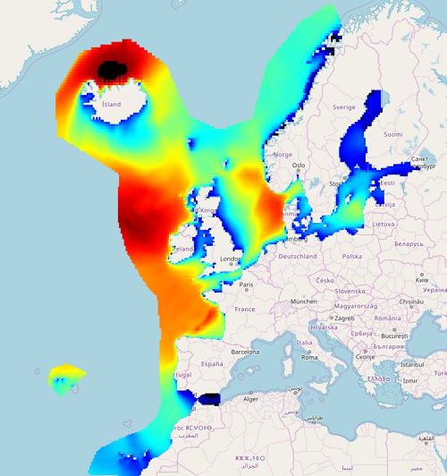
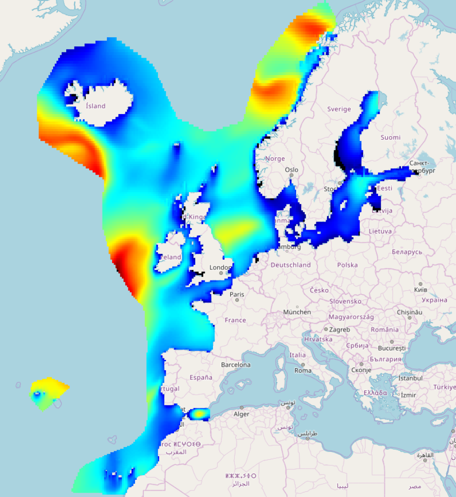
IOWAGA sea-states forecast best estimate generated by the wave model WAVEWATCH-III and forced by ECMWF winds on the North East Atlantic grid from 2017 to now
-
IOWAGA sea-states hindcast database generated by the wave model WAVEWATCH-III and forced by ECMWF winds on the North East Atlantic grid over 1990-2012 period.
-
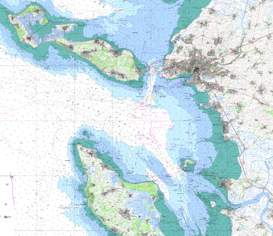
The product SCAN Littoral® is a collection of continuous colour digital map images of the coast, obtained via georeferenced assembling with grid squares of raster data from Shom nautical charts and IGN 1:25,000 land maps. The SCAN Littoral® solution includes a series of digital images with no additions, legends or georeferencing information.
-
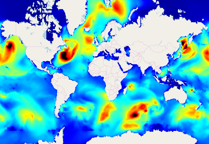
IOWAGA sea-states forecast best estimate generated by the wave model WAVEWATCH-III and forced by ECMWF winds on the Global grid from 2017 to now
-
Ce jeu de données donne la liste des campings du département de la Gironde, potentiellement exposés en cas de risque majeur.
-
IOWAGA sea-states forecast best estimate generated by the wave model WAVEWATCH-III and forced by ECMWF winds on the Mediterranean grid from 2017 to now
-
IOWAGA sea-states hindcast database generated by the wave model WAVEWATCH-III and forced by CFSR winds on the North East Atlantic grid over 1990-2012 period.
-
Marché foncier en Poitou-Charentes
-
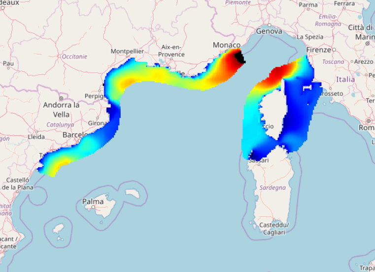
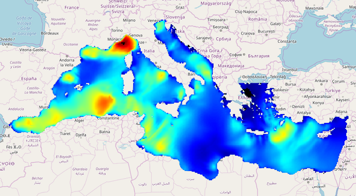
IOWAGA sea-states forecast best estimate generated by the wave model WAVEWATCH-III and forced by ECMWF winds on the North mediterranean grid from 2017 to now