 Catalogue PIGMA
50000
Type of resources
Available actions
Topics
Keywords
Contact for the resource
Provided by
Years
Formats
Representation types
Update frequencies
status
Scale
Resolution
-
-
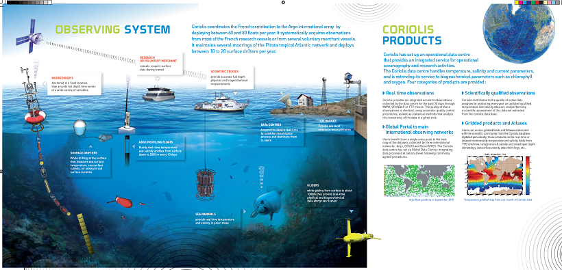
The CORIOLIS data center contributes to the “in situ observations” of operational oceanography, in addition to ocean surface measurements performed using equipment installed on satellites. This contribution is accomplished through the creation of permanent and lasting networks from ships or moored or drifting autonomous systems.
-

-

Validated and aggregated data from current profilers measured continuously by hull-mounted ADCP (Acoustic Doppler Current Profiler) for the year 2003.
-

Validated and aggregated data from current profilers measured continuously by hull-mounted ADCP (Acoustic Doppler Current Profiler) for the year 2011.
-
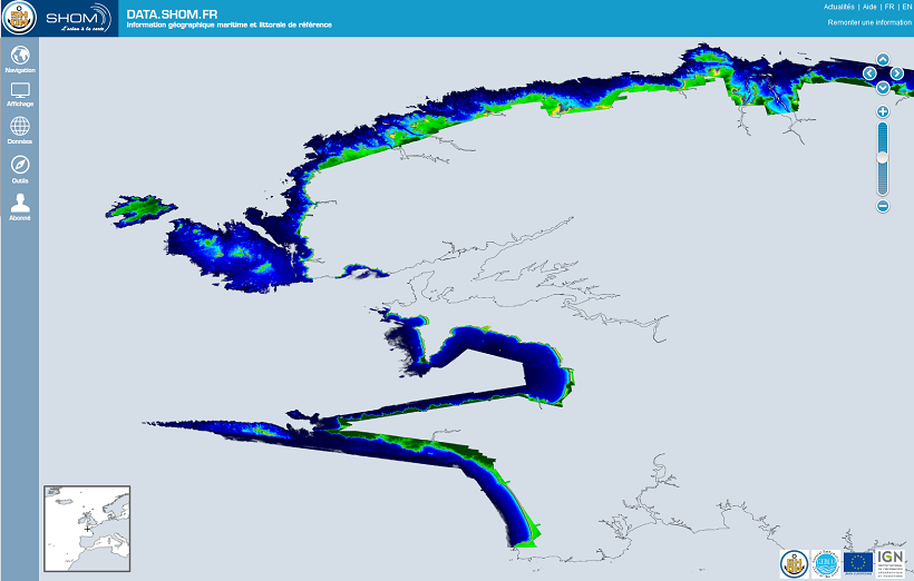
The Litto3D® project, along with the IGN, is responsible for producing detailed topographical and bathymetric information in mainland France so as to meet the needs of coastal and land-based stakeholders.
-

Validated and aggregated data from current profilers measured continuously by hull-mounted ADCP (Acoustic Doppler Current Profiler) for the year 2009.
-
-

Validated and aggregated data from current profilers measured continuously by hull-mounted ADCP (Acoustic Doppler Current Profiler) for the year 2014.
-
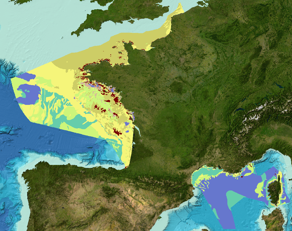
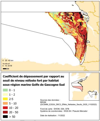
Sediment substrate maps at different scales, of the French metropolitan EEZ produced in the work-package 3 the European project EMODNet Geology (phase IV). Available scales : - 1 : 1 000 000 - 1 : 250 000 - 1 : 100 000 - 1 : 50 000 - 1 : 20 000 - 1 : 15 000 - 1 : 10 000 - 1 : 5 000 Bibliographic references : - Coltman, N., Gilliland, P. & van Heteren, S. 2007. What can I do with my map? In: MESH Guide to Habitat Mapping, MESH Project, 2007, JNCC, Peterborough. Available online at: (http://www.searchmesh.net/default.aspx?page=1900) - Foster-Smith, R., Connor, D. & Davies, J. 2007. What is habitat mapping? In: MESH Guide to Habitat Mapping, MESH Project, 2007, JNCC, Peterborough. Available online at: (http://www.searchmesh.net/default.aspx?page=1900) - Väänänen, T. (ed), Hyvönen, E., Jakonen, M., Kupila, J., Lerrsi, J., Leskinen, J., Liwata, P., Nevalainen, R., Putkinen, S., Virkki, H. 2007. Maaperän yleiskartan tulkinta- ja kartoitusprosessi. Maaperän yleiskartoitus –hankkeen sisäinen raportti. 17 p.