 Catalogue PIGMA
500000
Type of resources
Available actions
Topics
Keywords
Contact for the resource
Provided by
Years
Formats
Representation types
Update frequencies
status
Scale
Resolution
-
-

Physiographic domains map at 1 : 500 000 of the French metropolitan EEZ produced in the work-package 4 (sea-floor geology / geomorphology) of the European project EMODnet Geology. This version of the dataset corresponds to the phase IV of the project.
-
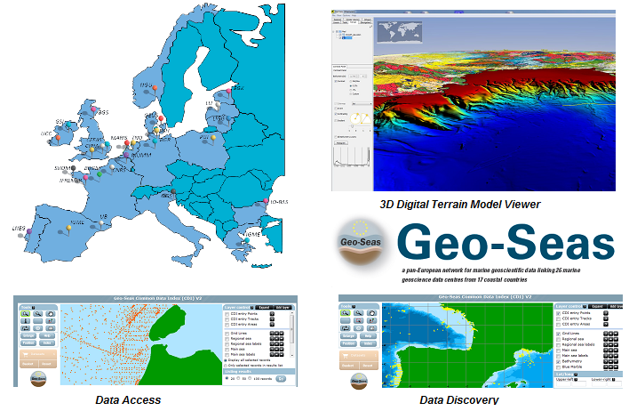
Geo-Seas is Europe-wide infrastructure for managing geological and geophysical marine and ocean data for hydrographic purposes on sites which are of interest to maritime navigation. The current description is limited to making bathymetric data available within the context of the project.
-
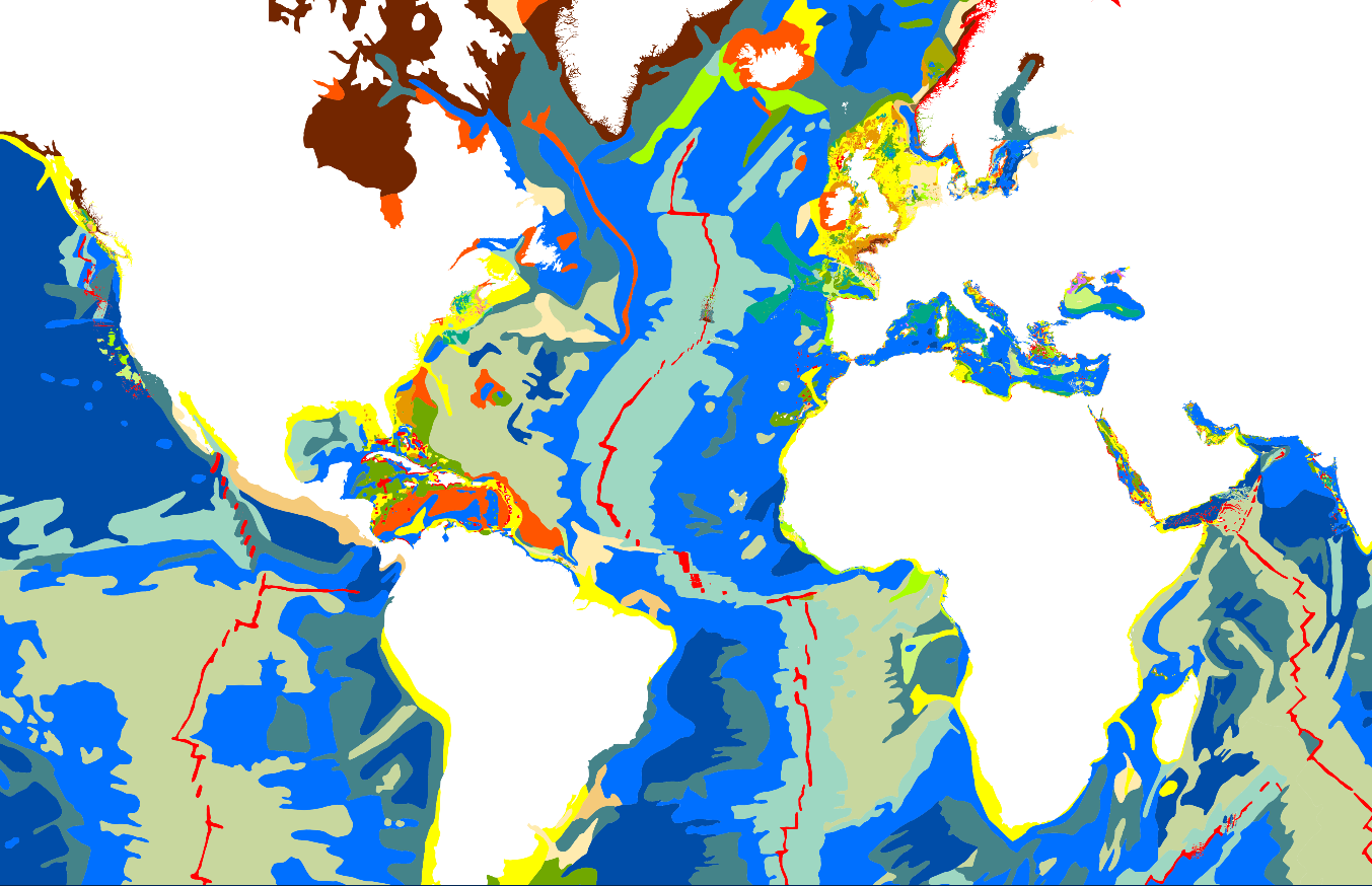
The “World Seabed Sediment Map” product contains geo-referenced digital data, describing the nature of the sediment encountered in different seas and oceans of the world. The objects are all surface areas and the description of an object includes in particular the nature of the sediment including rock-type bottoms.
-
-

The definitive coastal information system, Quadrige stores coastal observation and monitoring network data. In order to manage coastal monitoring data, Ifremer developed the Quadrige² information system. Quadrige is one element of the Water Information System (SIE) http:// www.eaufrance.fr, et à ce titre, contribue aux travaux du Secrétariat d'Administration National des Données Relatives à l'Eau (SANDRE) http://www.sandre.eaufrance.fr. Quadrige Marine Zones is a reference source unique to the Quadrige system. It is used to break down the coast of the French mainland and overseas territories into large areas and to connect each one with observation and monitoring locations.
-
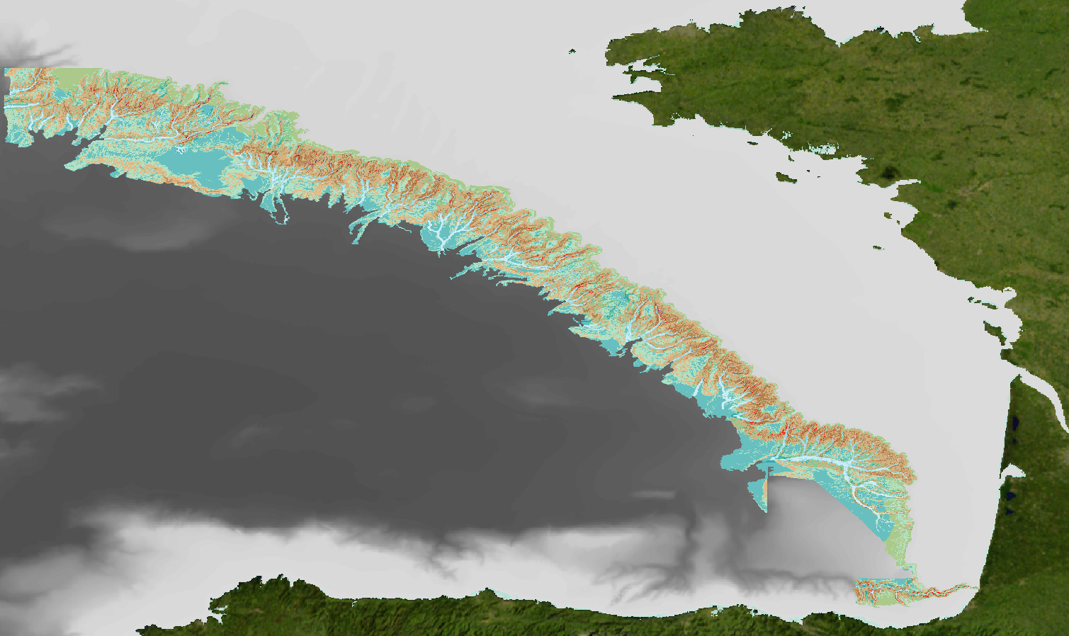
Geomorphological analysis of the continental slope of the Bay of Biscay based on a 100m Data Terrain Model (DTM). This DTM is a synthesis of data acquired during sea surveys ZEE 1, ZEE 2, Sedimanche, Sedifan 1, Sedifan 2, EssNaut 2009, EssReson08, ValidOp, BOBGeo 1, BOBGeo 2, EssInf.
-
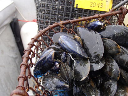
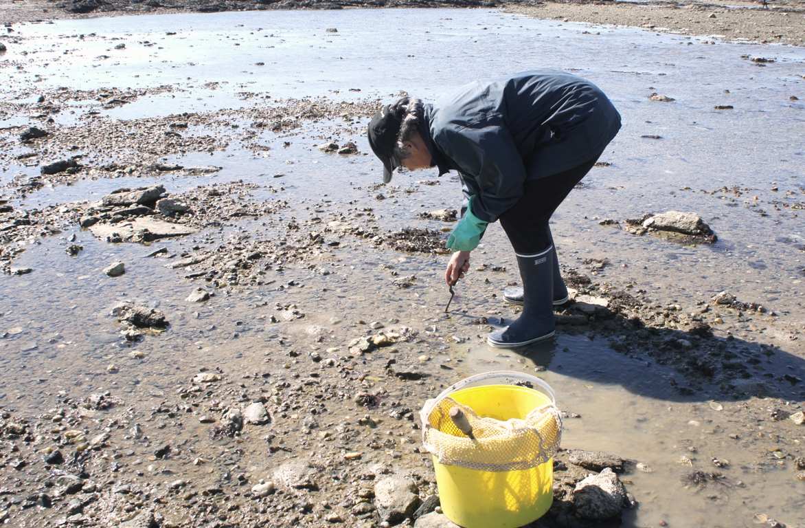
The national observation network for the blue mussel (MYTILOBS), set up in 2012, aims to monitor the growth and mortality of mussels produced for the market. The MYTILOBS is based on the experience of the regional network (REMOULA) which has been monitoring the growth of the blue mussel in the Charentais inlet since 2000. Monitoring mainly takes place the year following the year of capture: it thus integrates the main seasons of the biological life of the mussel, from winter maturation to spring growth, then to summer and fall fattening, the two periods when they are mainly sold. The choice of monitoring sites was decided in consultation between the Regional Environmental Resource Laboratories and the industry. For North Brittany, this is the site of Vivier-sur-Mer in (the sector of) the bay of Mont-Saint-Michel (mussel poles). Each breeding site is monitored every three months. Many parameters are measured including mussel size, weight and mortality. These data are examined taking into account environmental conditions such as temperature, salinity or the abundance and richness of the microalgae on which the shellfish feed. The Mytilobs national network is located in the main mussel-breeding regions of the Atlantic coast: Normandy, North Brittany, South Brittany, Pays de Loire and Poitou-Charentes. The sites of Agon (West Cotentin), Vivier (the bay of Mont Saint-Michel), Pont Mahe (Vilaine bay), Aiguillon (Breton inlet), Yves (Pertuis d’Antioche strait) representing, from north to south, mussel culture using poles. The Filiere site (Pertuis Breton - strait) represents mussels culture using ropes, in full water.
-
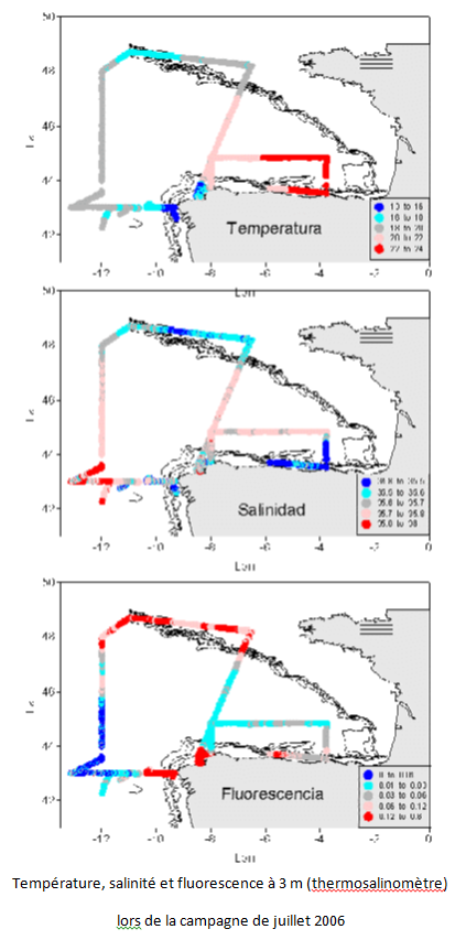
The aim of this project is to implement a sampling network in order to study climate variability in ocean water around the Iberian peninsula and the Bay of Biscay, to determine the flows of heat, freshwater, nutrients and C02 in wastewater, and relationship with NAO. This contributed to international climate change programmes and to the beginning of systematic study of the region. Furthermore, it facilitates the use of a digital model in the region. The main aim of the VACLAN project is to improve observation capacity and the use of the new tools available used to characterize climate change: remote sensing for the study of surface waters, drifting buoys for upper and mid waters, and moored instruments and hydrographic stations for studying the water column. The use of these tools along with digital modelling will make it possible to characterize CO2 flow and the physio-chemical flow in such a large area, where the border current is the Atlantic. Furthermore, once checked and validated, the data in this system will be made available for academic scientific communities and included in digital forecasting models.
-
Upon building a new waste pool for waste from oyster farming, a zostera noltii seagrass meadow was destroyed by sediment deposits. This site is located in the Arcachon basin and has been monitored since 2005 in order to evaluate the impact this of this work and the recolonisation of the site by benthic macrofauna.