 Catalogue PIGMA
Keyword
/Remote sensing
Type of resources
Available actions
Topics
Keywords
Provided by
Representation types
From
1
-
2
/
2
-
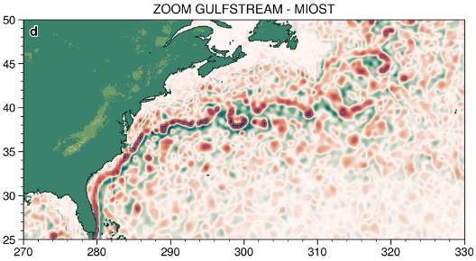
The MIOST (Multiscale Interpolation Ocean Science Topography) experimental altimeter product provides grids at delayed-time, at global scale, 1/10° spatial resolution, the sea surface height (MSLA and MADT) as well as the geostrophic currents, resulting from specific processing. Use for regional studies, ocean variability (mesoscale circulation,...).
-
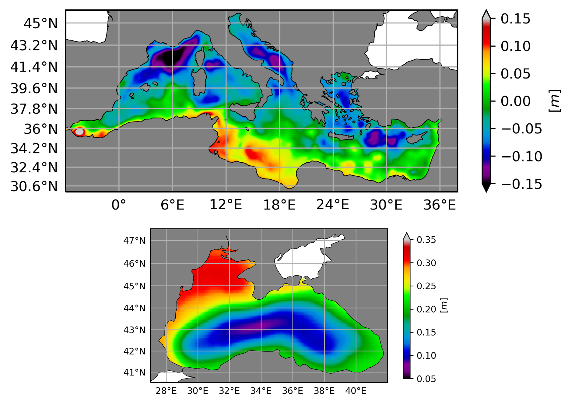
The Mean Dynamic Topography (MDT) is the temporal mean of the Sea Surface Height above the Geoid over a reference period (here 1993-2012). The Hybrid Mean Dynamic Topography contains the MDT-CNES-CLS18 for the global coverage and the MDT CMEMS 2020 for the Black Sea (MDT-CMEMS2020-BLK) and the Mediterranean Sea (MDT-CMEMS2020-MED).