/Tides/Tidal Height
Type of resources
Topics
Keywords
Contact for the resource
Provided by
Years
Formats
Representation types
status
Resolution
-

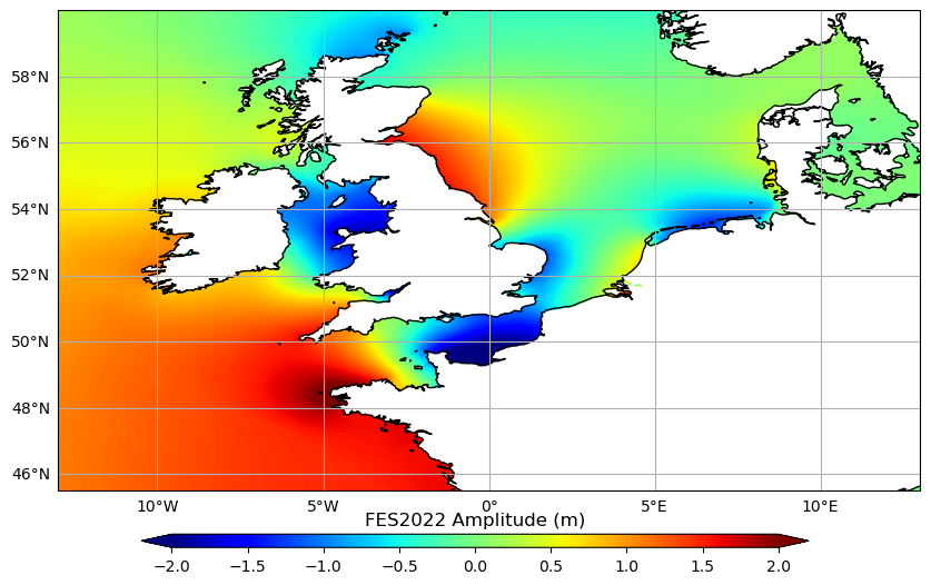
Produit auxiliaire FES2022 marée globale : La base de données des marées FES2022 comprend 2 composantes: les élévations de marée (amplitude et phase) et la marée de charge (amplitude et phase) sur une grille de 1/30°x1/30°. - Elévation de marée: Le modèle de marée océanique FES2022b est distribué; ce modèle a été calculé en utilisant la marée de charge FES2022. Deux versions sont disponibles: + Version non extrapolée: le modèle est défini sur une grille de 1/30° directement interpolée à partir de la grille native d'éléments finis du modèle. + Version extrapolée: la version ci-dessus a été extrapolée sur les côtes afin de couvrir presque entièrement les régions côtières. La procédure est expliquée dans le manuel utilisateur. - Marée de charge: le nouveau modèle de marée de charge FES2022b doit être utilisé pour calculer la marée géocentrique (élastique) comme ceci: marée géocentrique FES2022b (elastique) = marée océanique FES2022b + effet de charge FES2022b. Une description du calcul et des performances du modèle FES2022 est donnée dans le manuel utilisateur (lien ci-dessous). Les fichiers de données sont disponibles sur les services de distribution (FTP/SFTP et le Thredds dans 3 répertoires distincts fes2022b/load_tide , fes2022b/ocean_tide_extrapolated et fes2022b/ocean_tide). Les sous-répertoires contiennent toutes les 34 composantes: M2, S2, K1, O1, P1, Q1, Nu2, Mu2, N2, K2, Eps2, L2, Lambda2, M4, 2N2, J1, M3, M6, M8, Mf, MKS2, Mm, MN4, MS4, MSf, MSqm, Mtm, N4, R2, S1, S4, Sa, Ssa, T2. Pour vous permettre de télécharger des fichiers aussi petits que possibles, les fichiers ont été compressées à l'aide du programme xz en utilisant les algorithmes de compression LZMA2. Pour décompresser les fichiers, vous devez utiliser cette commande ou 7-zip si vous utilisez Windows. L'algorithme de prédiction officiel, LIBFES, est ici: https://github.com/CNES/aviso-fes/tree/2.9.7. Si vous utilisez ce code, merci de citer : "The code used to compute FES2022, was developed in collaboration between Legos, CLS and CNES and is available under GNU General Public License". Nous garantissons les résultats obtenus avec ce code, mais pas ceux obtenus avec d'autres codes de prédiction. References: Carrere et al., OSTST 2022: A new barotropic tide model for global ocean: FES2022, https://doi.org/10.24400/527896/a03-2022.3287 Florent H. Lyard, Loren Carrere, Ergane Fouchet, Mathilde Cancet, David Greenberg, Gérald Dibarboure and Nicolas Picot: “FES2022 a step towards a SWOT-compliant tidal correction”, to be submitted to Ocean Sciences.
-

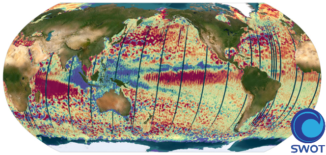
The SWOT L3_LR_SSH product provides ocean topography measurements obtained from the SWOT KaRIn and nadir altimeter instruments, merged into a single variable. The dataset includes measurements from KaRIn swaths on both sides of the image, while the measurements from the nadir altimeter are located in the central columns. In the areas between the nadir track and the two KaRIn swaths, as well as on the outer edges of each swath (restricted to cross-track distances ranging from 10 to 60 km), default values are expected. SWOT L3_LR_SSH is a cross-calibrated product from multiple missions that contains only the ocean topography content necessary for thematic research (e.g., oceanography, geodesy) and related applications. This product is designed to be simple and ready-to-use, and can be combined with other altimetry missions. The SWOT L3_LR_SSH product is a research-orientated extension of the L2_LR_SSH product, distributed by the SWOT project (NASA/JPL and CNES) and managed by the SWOT Science Team project DESMOS. The "Basic" version of SWOT L3_LR_SSH (the "Expert" version is the subject of a separate metadata sheet) includes only the SSH anomalies and mean dynamic topography. References Dibarboure, G., Anadon, C., Briol, F., Cadier, E., Chevrier, R., Delepoulle, A., Faugère, Y., Laloue, A., Morrow, R., Picot, N., Prandi, P., Pujol, M.-I., Raynal, M., Tréboutte, A., and Ubelmann, C.: Blending 2D topography images from the Surface Water and Ocean Topography (SWOT) mission into the altimeter constellation with the Level-3 multi-mission Data Unification and Altimeter Combination System (DUACS), Ocean Sci., 21, 283–323, https://doi.org/10.5194/os-21-283-2025.
-

The SWOT L3_LR_SSH product provides ocean topography measurements obtained from the SWOT KaRIn and nadir altimeter instruments, merged into a single variable. The dataset includes measurements from KaRIn swaths on both sides of the image, while the measurements from the nadir altimeter are located in the central columns. In the areas between the nadir track and the two KaRIn swaths, as well as on the outer edges of each swath (restricted to cross-track distances ranging from 10 to 60 km), default values are expected. SWOT L3_LR_SSH is a cross-calibrated product from multiple missions that contains only the ocean topography content necessary for thematic research (e.g., oceanography, geodesy) and related applications. This product is designed to be simple and ready-to-use, and can be combined with other altimetry missions. The SWOT L3_LR_SSH product is a research-orientated extension of the L2_LR_SSH product, distributed by the SWOT project (NASA/JPL and CNES). SWOT L3_LR_SSH is managed by the SWOT Science Team project DESMOS. The ['Unsmoothed'] version of SWOT L3_LR_SSH (the "Basic" and "Expert" versions are the subject of separate metadata sheets) includes each algorithm, correction, or external model incorporated into the SWOT L3_LR_SSH product as a separate layer. This ['Unsmoothed'] version which includes the MSS, MDT and geostrophic currents (absolute and anomalies) in addition to the SSHA and MDT on the 250 m KaRIn native grid. Like the Expert subproduct, it also integrates a quality flag, corrections and external models as separate layers. References Dibarboure, G., Anadon, C., Briol, F., Cadier, E., Chevrier, R., Delepoulle, A., Faugère, Y., Laloue, A., Morrow, R., Picot, N., Prandi, P., Pujol, M.-I., Raynal, M., Tréboutte, A., and Ubelmann, C.: Blending 2D topography images from the Surface Water and Ocean Topography (SWOT) mission into the altimeter constellation with the Level-3 multi-mission Data Unification and Altimeter Combination System (DUACS), Ocean Sci., 21, 283–323, https://doi.org/10.5194/os-21-283-2025.
-

The SWOT L3_LR_SSH product provides ocean topography measurements obtained from the SWOT KaRIn and nadir altimeter instruments, merged into a single variable. The dataset includes measurements from KaRIn swaths on both sides of the image, while the measurements from the nadir altimeter are located in the central columns. In the areas between the nadir track and the two KaRIn swaths, as well as on the outer edges of each swath (restricted to cross-track distances ranging from 10 to 60 km), default values are expected. SWOT L3_LR_SSH is a cross-calibrated product from multiple missions that contains only the ocean topography content necessary for thematic research (e.g., oceanography, geodesy) and related applications. This product is designed to be simple and ready-to-use, and can be combined with other altimetry missions. The SWOT L3_LR_SSH product is a research-orientated extension of the L2_LR_SSH product, distributed by the SWOT project (NASA/JPL and CNES). SWOT L3_LR_SSH is managed by the SWOT Science Team project DESMOS. The "Expert" version of SWOT L3_LR_SSH (the "Basic" version is the subject of a separate metadata sheet) includes each algorithm, correction, or external model incorporated into the SWOT L3_LR_SSH product as a separate layer. In addition to the SSH anomalies, this "Expert" version also includes mean dynamic topography (as in the "Basic" version), backscatter coefficient (sigma0), mean sea surface and geostrophic currents (absolute and anomalies). References Dibarboure, G., Anadon, C., Briol, F., Cadier, E., Chevrier, R., Delepoulle, A., Faugère, Y., Laloue, A., Morrow, R., Picot, N., Prandi, P., Pujol, M.-I., Raynal, M., Tréboutte, A., and Ubelmann, C.: Blending 2D topography images from the Surface Water and Ocean Topography (SWOT) mission into the altimeter constellation with the Level-3 multi-mission Data Unification and Altimeter Combination System (DUACS), Ocean Sci., 21, 283–323, https://doi.org/10.5194/os-21-283-2025.
-

 Catalogue PIGMA