Atlantic - CH10 - Bathymetry
Type of resources
Available actions
Topics
Keywords
Contact for the resource
Provided by
Years
Formats
Representation types
Update frequencies
status
Resolution
-
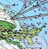
Identified areas across the north Atlantic which have been flagged as priority locations for quality bathymetry data, in the context of expanded shipping traffic and port expansions. The reference to determine the priority survey areas in combination with shiping routes and port locations are the bathymetric data sources used for product 2( GEBCO, EMODnet bathymetry, USGS and CHS) and the depth uncertainty derived of Product 2. The adequacy assessment of the input characteristics of Product 3 is limited to the shiping routes and port locations.
-
This product is a map of the uncertainty of available digital bathymetry measurements for the North Atlantic Ocean. This is done for a spatial resolution feasible for this large area (25km x 25km). It is designed to assess the quality of the bathymetry readings with a view to supporting assessments of future need. The product is formulated through a number of characteristics of the data including age of measurement and slope.
-
This data product selects sample areas of digital bathymetry, chosen for their relevance to marine activities and data sources alternative to GEBCO. The approach for building the digital map of water depth is to use GEBCO as a baseline and look at a set of sample areas where GEBCO could be improved upon. Sample areas have also been selected to be representative of each continent bordering the Atlantic and expected future requirements. Data sources include GEBCO, EMODNET, USGS and CHS.
-
Identified areas across the north Atlantic which have been flagged as priority locations for quality bathymetry data, in the context of expanded shipping traffic and port expansions. The reference to determine the priority survey areas in combination with shiping routes and port locations are the bathymetric data sources used for product 2( GEBCO, EMODnet bathymetry, USGS and CHS) and the depth uncertainty derived of Product 2. The adequacy assessment of the input characteristics of Product 3 is limited to the shiping routes and port locations.
-

-

-

-

 Catalogue PIGMA