 Catalogue PIGMA
Fisheries and aquaculture
Type of resources
Available actions
Topics
Keywords
Contact for the resource
Provided by
Years
Formats
Representation types
Update frequencies
status
Resolution
-
Survival was recorded at the endpoint for all batches of each group (2n-control, 2n-wild, 2n-commercial, 2nR, 3nR and 3n-commercial). Similarly, initial and final yield were recorded, corresponding to the total weight of the live oysters at deployment and at the endpoint. Finally, shell length and total weight for individually recorded at reception and at the endpoint.
-
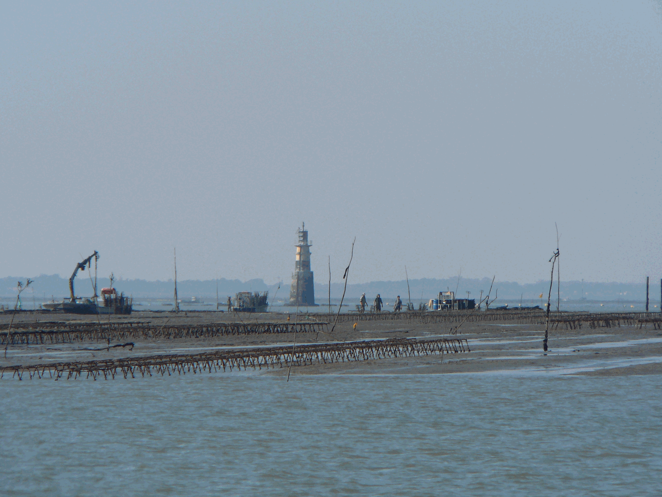
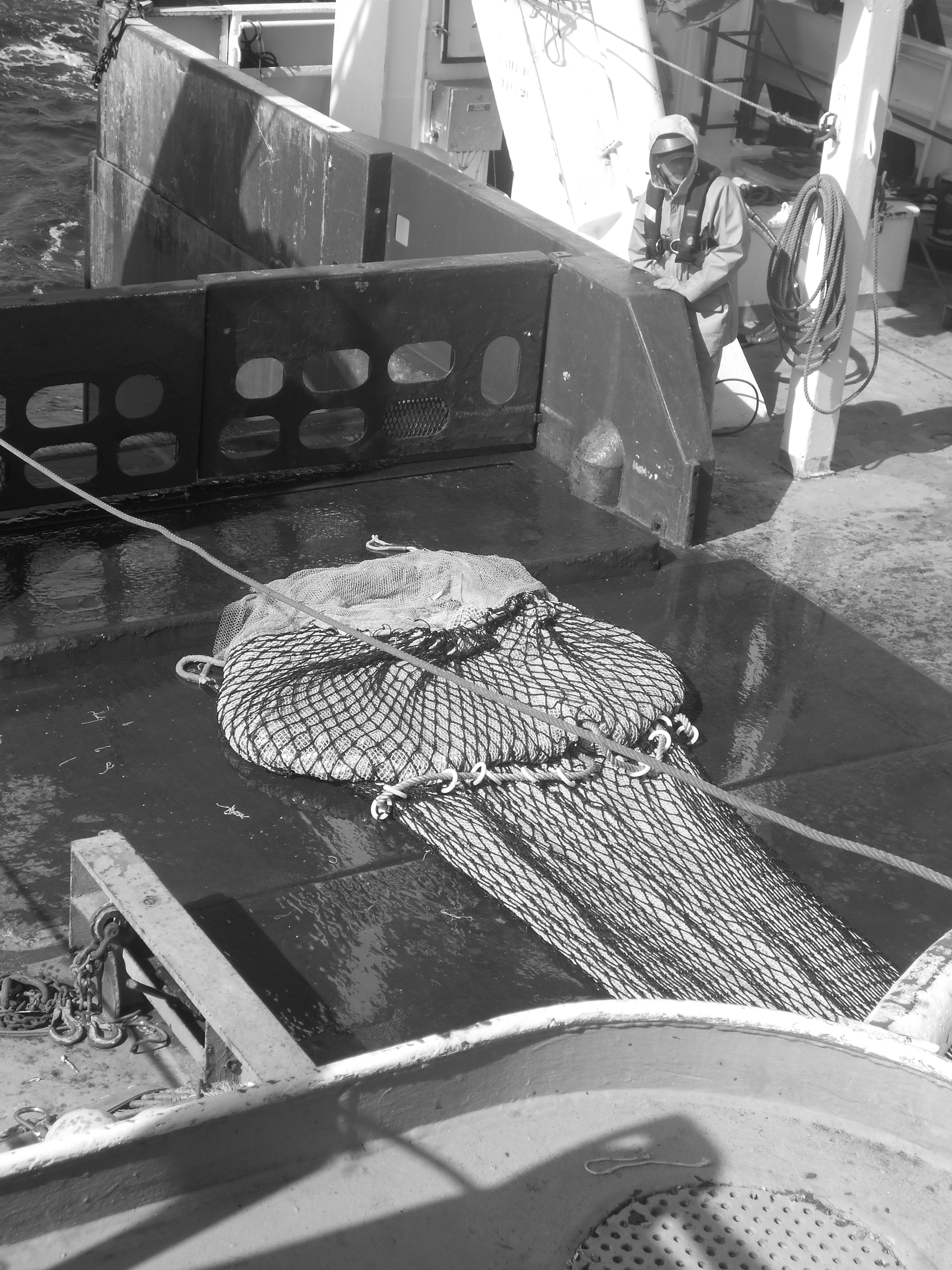
Data were collected from the regional program LOUPE (Observation of the habitat and associated communities in the context of the fisheries of the Capbreton Canyon). It consisted in the observations of two métiers practiced around the canyon. The observations were carried out between July 2011 and April 2013 on coastal boats. Observations and interviews were made on board commercial vessels. The longlines used in the hake fishery are semi-pelagic and are deployed on the edge of the Capbreton Canyon. It is an emblematic and major métier benefiting from a particular regulation as they take advantage of a prohibition of net and trawl fishing on their fishing grounds. Between 8 and 14 costal boats practice this métier during the year and the fleet characteristics are homogeneous. Boats lay between 1,200 and 1,800 hooks per day, baited with frozen pilchard (Sardina pilchardus). Two or three men are on board these vessels. Fishing is mostly practiced in spring and summer but a small number of vessels work all year. Generally, trips last between ten and twelve hours; longline is set before sunrise and retrieved three or four hours later. Hake is the main targeted species; other targets are pollack (Pollachius pollachius), red sea bream (Pagellus bogaraveo) and conger (Conger conger). Netting is a major métier in terms of vessels involved and the number of trips. Crew composition varies and depends on boat length (from one to four men on average). This métier is practiced by 30 to 35 boats all year round, but fleet characteristics are less homogeneous than in the case of longliners . The strategy of these netters operating in the coastal area is based on the use of several types of nets (gillnets and trammel nets) targeting several species, often sold directly to consumers on the docks. Gillnets, consisting of a single mesh, target hake, sea bass and sea bream species (Diplodus spp, Sparus aurata, Litognathus mormyrus), while the trammel nets (three meshes) are used to capture benthic fish, such as common sole, monkfish (Lophius spp), turbot and brill (Scophthalmus rhombus). Generally, trips last less than twelve hours for coastal netters (less than 15 m), which predominate in the sector, and a few days for large netters. On average, the coastal vessels set 6000 to 8000 m. nets daily.
-
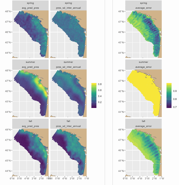
The Delmoges project aims to generate new ecological and fisheries knowledge to reduce dolphin bycatch in the Bay of Biscay (GoG). This dataset presents maps produced by a hierarchical model of the seasonal and interannual distribution of dolphins' main prey, small pelagic fish. The model integrates 3 types of data: presence-absence and biomass of fish from scientific campaigns and presence of fish from fishing data. For the first time, the model has provided a quantitative description of the seasonal spatial dynamics of sardines and associated fisheries. The main sardine distribution areas were coastal, from the mouth of the Gironde to south-west Brittany. On average, sardines were distributed over a wider area in small aggregations in spring. They seemed to concentrate in their main distribution areas in summer, and to disperse offshore in autumn, but to a lesser extent than in spring. Fishing was concentrated in the sardine's main coastal distribution areas, and was more intense in summer, then autumn, and less intense in spring.
-
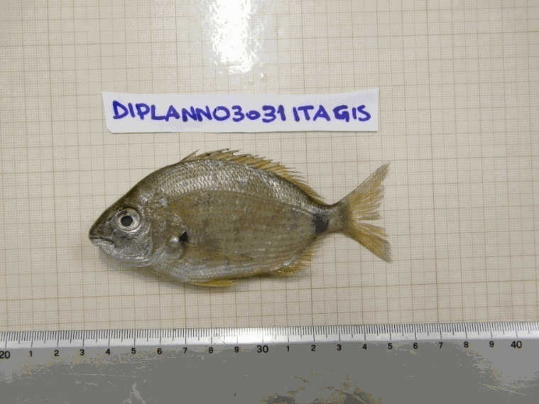
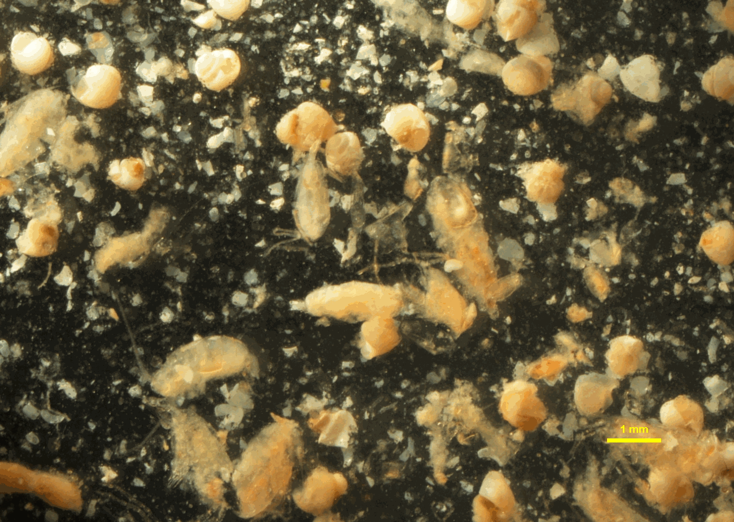
The data come from organisms and pictures collected during the MEDITS annual bottom trawl surveys conducted between 2011 and 2013 (Bertrand et al. 2002). MEDITS surveys cover the continental shelf (10 m to 200 m depth) and the upper part of the continental slope (200 m to 800 m) on the Mediterranean. A total of 1511 individuals from 85 fish species were collected from seven Mediterranean areas (South Adriatic Sea, Sardinia, Gulf of Lions, around Cyprus, Mallorca, Tyrrhenian Sea, and North West Ionian Sea). A set of 14 morphological traits related to the habitat and the diet of the species were measured in the field and on pictures using the ImageJ software (version 1.47, http://imagej.nih.gov/ij/) (see Granger et al. 2015 and Brind'Amour et al. submitted for details) (Figure 1). Replicats of measures vary between 1 (e.g. Scorpaena loppei) to 53 (e.g. Serranus hepatus) according to fish species. Twelve of the chosen traits consist in continuous biological characteristics measured on each individual (measured in cm). The two remaining traits are categorical and determined at the species level.
-
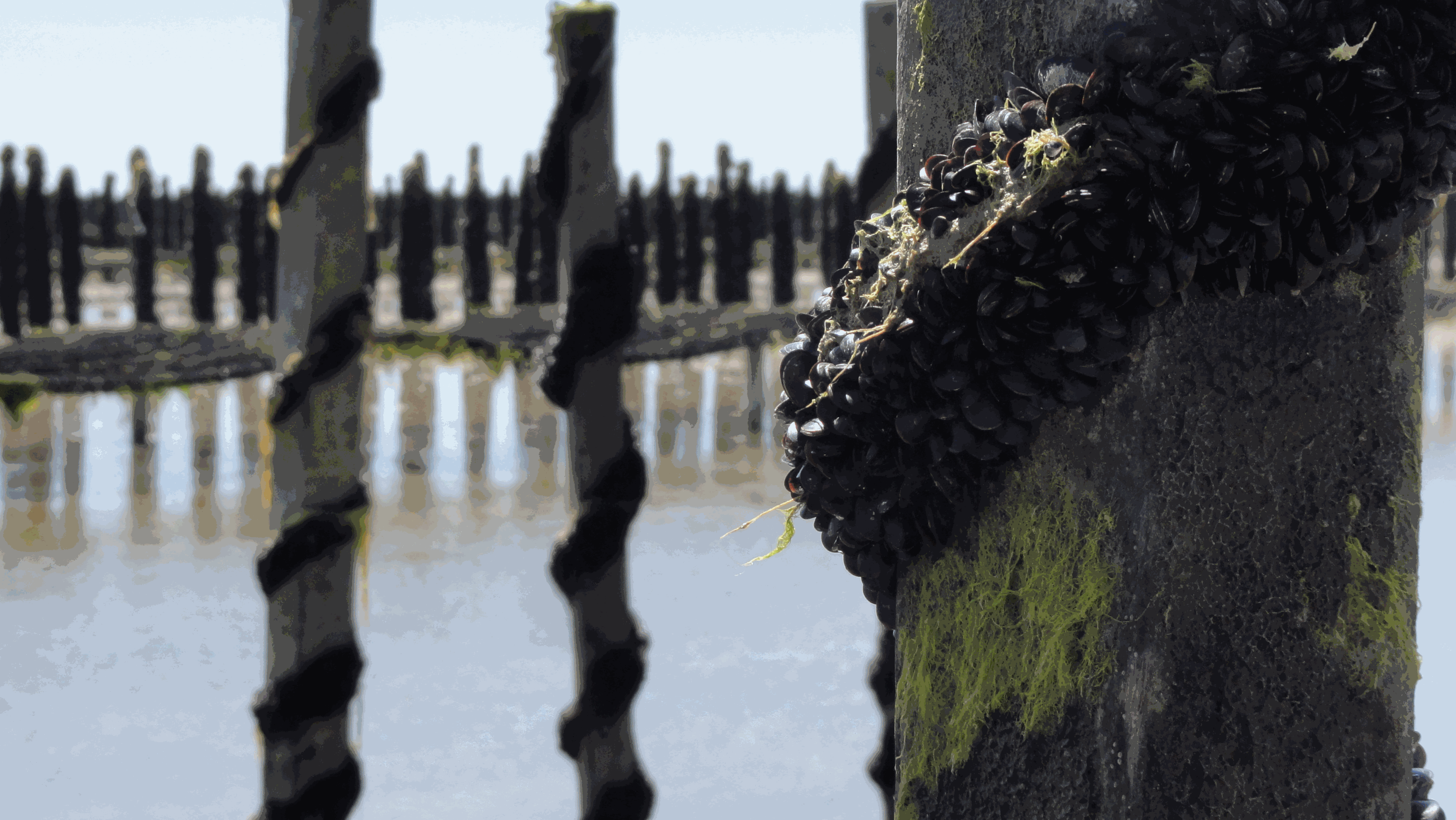
The Mytilobs network, carried out by IFREMER (French Research Institute for Exploitation of the Sea), is a national network dedicated to building long-term physiological variations time series of blue mussels (Mytilus edulis), across a large spatial scale. This observation network, initially designed to survey production yields, also provides valuable data to track environmental variations of coastal ecosystems. Mussels exhibit high phenotypic plasticity in response to environmental variations. Collection of data describing phenotypic variations, over an extended period, reveals small-scale climate and habitat variations. With its broad deployment across time and space, the data produced under Mytilobs will be useful for the establishment of a baseline condition when studying the effect of a perturbation affecting an ecosystem’s functioning. Finally, the monitoring of mussel biometric traits and mortality was coupled with high-frequency measurements of salinity, temperature, and sea level, complementing this multi-layer observational framework.
-
Long-term time series of coliform bacteria concentration (fecal coliform or Escherichia coli) in shellfish in four submarine areas (North Sea/Channel, Britany, Atlantic, Mediterranean).
-
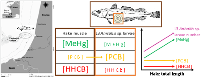
This dataset gathers isotopic ratios (carbon and nitrogen) and concentrations of both priority (mercury species and polychlorinated biphenyls congeners) and emerging (musks and sunscreens) micropollutants measured in a host-parasite couple (hake Merluccius merluccius muscle and in its parasite Anisakis sp) from the south of Bay of Biscay in 2018. In addition, the hake infection degree measured as the number of Anisakis sp. larvae was added for each hake collected.
-
This dataset comprises stomach contents from 2004 to 2022 for the five dominant small pelagic fish species, anchovy (Engraulis encrasicolus), sardine (Sardina pilchardus), mackerel (Scomber scombrus), sprat (Sprattus, sprattus) and horse mackerel (Trachurus trachurus) on the french shelf of the Bay of Bisacy in spring. The dataset represents a unique long-term monitoring of stomach contents characterized with a low taxonomic resolution and semi-quantitative abundance quotation. The data were acquired on the PELGAS survey series. This integrated survey is run in each year in May since 2000, to monitor the Bay of Biscay pelagic ecosystem at springtime and assess the biomass of its small pelagic fish species. Survey protocols are detailed in Doray et al. 2018. During the survey, pelagic trawl hauls are undertaken to identify echotraces to species and to measure individual fish traits. All hauls are performed during day time. The fish stomachs were sampled from the haul catch. For a given species, twenty individuals were selected at random from the catch, their stomachs dissected and preserved. This was repeated at three hauls in each of the ten spatial strata defined to cover the entire Biscay shelf. Stomach sampling by species depended on the trawl haul catch and all species were not systematically sampled jointly at the same trawl haul. Also, stomach sampling intensity varied between species and years. The stomachs were preserved in formaline until 2018 and in ethanol since. The taxonomic analysis of stomach contents was performed in the laboratory under a binocular magnifyer by the company LAPHY. A simplified taxonomic resolution was used, which considered five icthtyoplankton groups, two copepod groups, euphausids or mysids, amphipods, two decapod groups, other crustacea, other zooplankton, phytoplankton and pulp. Taxon abundance was defined by a quotation : 0 (absence), 1 (presence : <10 individuals), 2 (abundant : between 10 and 100), 3 (very abundant : > 100). The dataset comprises trawl haul information, information on the quality of the stomach contents and abundance quotes for the list of plankton taxons.
-
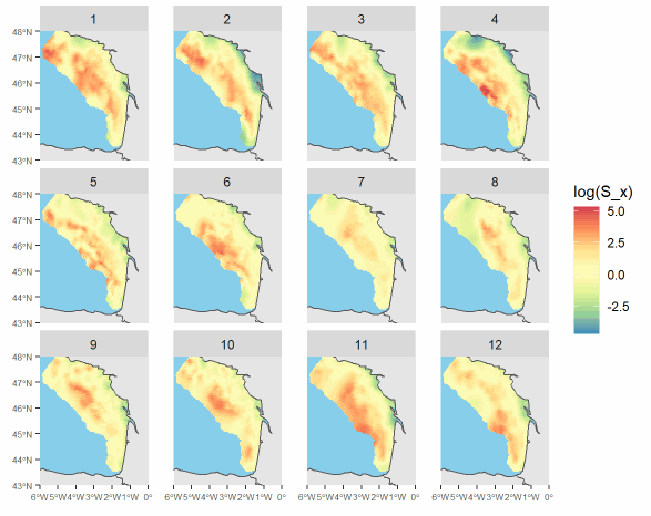
These data are outputs of a spatio-temporal model inferring fish distribution. The maps are based on high-resolution catch data (VMS-logbook). They have a montly time resolution and a 0.05° spatial resolution. Four demersal species of the Bay of Biscay are available in the dataset: common sole (Solea solea), megrim (Lepidorhombus whiffiagonis), anglerfish (Lophius spp) and thornback ray (Raja clavata). Maps are provided for year 2008 to 2018 ; they were produced in the context of the MACCO project (https://www.macco.fr/en/accueil-english/), an Ifremer project that aims at proposing alternative management strategies for the mixed demersal fisheries of the Bay of Biscay.
-
The Pélagiques Gascogne (PELGAS, Doray et al., 2000) integrated survey aims at assessing the biomass of small pelagic fish and monitoring and studying the dynamics and diversity of the Bay of Biscay pelagic ecosystem in springtime. PELGAS has been conducted within the EU Common Fisheries Policy Data Collection Framework and Ifremer’s Fisheries Information System. Details on survey protocols and data processing methodologies can be found in Doray et al., (2014, 2018). This dataset comprises the abundance (no. of individuals), biomass (metric tons), mean length (cm), mean weight (g) of marine organisms collected by midwater trawling to identify fish echoes detected during PELGAS surveys (2000-2018). All parameters have been raised to the trawl haul level. Trawl haul metadata and species reference list are also provided.