 Catalogue PIGMA
Geoscientific information
Type of resources
Available actions
Topics
Keywords
Contact for the resource
Provided by
Years
Formats
Representation types
Update frequencies
status
Scale
Resolution
-
-
-

The "Magnetic Stations" product contains measurements from magnetic reference stations deployed by the French Hydrographic and Oceanographic Service (SHOM) near marine magnetic survey areas. Measurement files are available by station and by year. These magnetic reference measurements correct marine measurements for diurnal and high-frequency variations in the Earth's magnetic field.
-
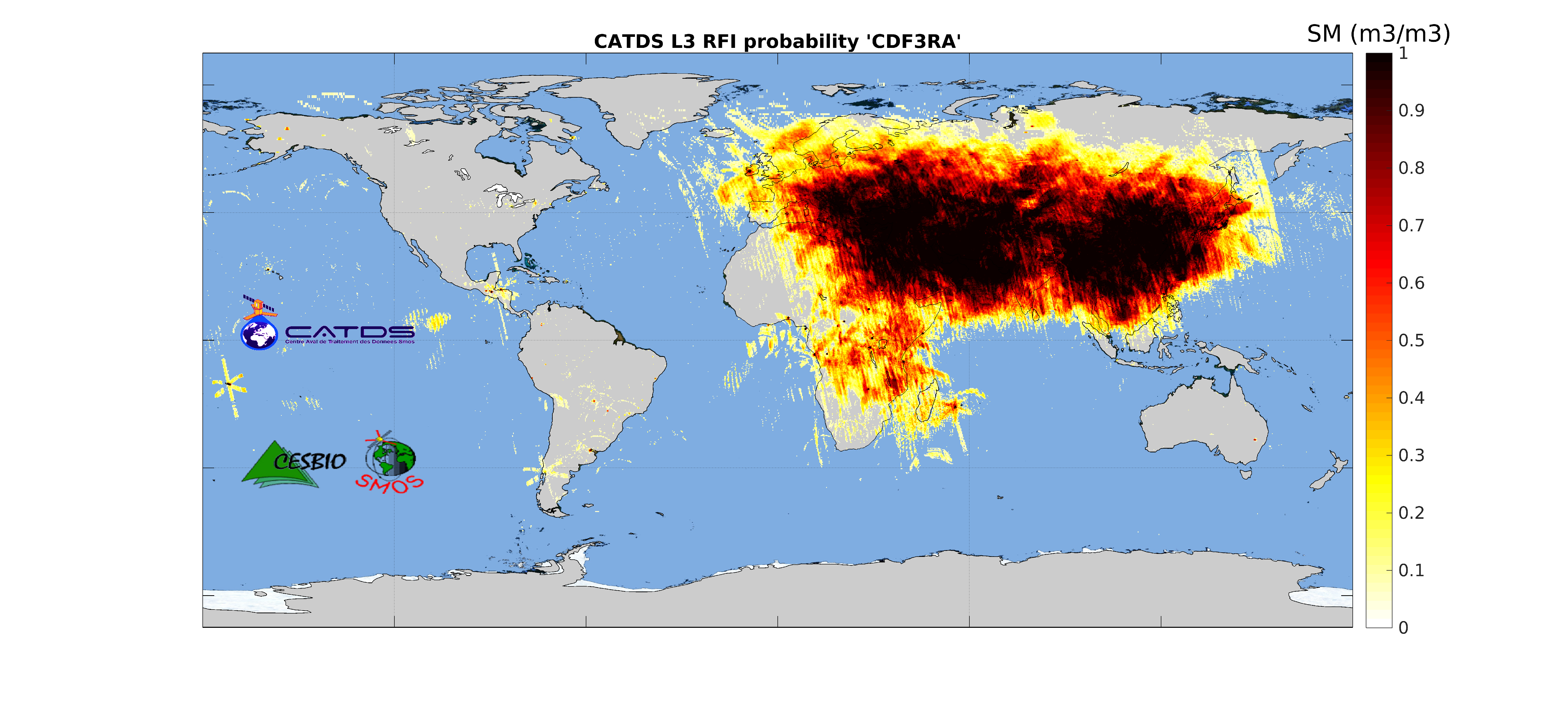
This product is radio frequency interference (RFI) probability for each angle bin computed daily and based on a monthly moving window average. Ascending and descending orbits are processed separately, and only in full polarization. ** This product is no longer available, see below **
-
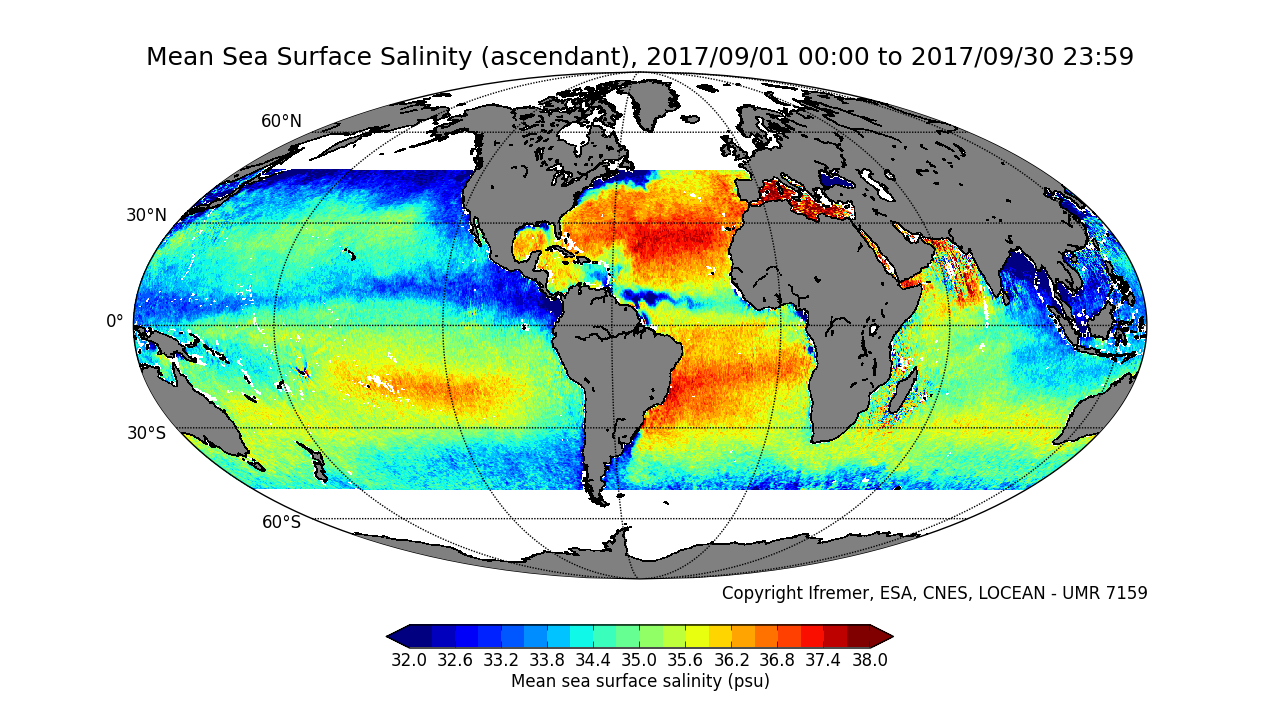
This product contains average 10 days & monthly salinity field based on L2P products, ascending and descending orbits being processed separately. ** This product is no longer available, see below **
-
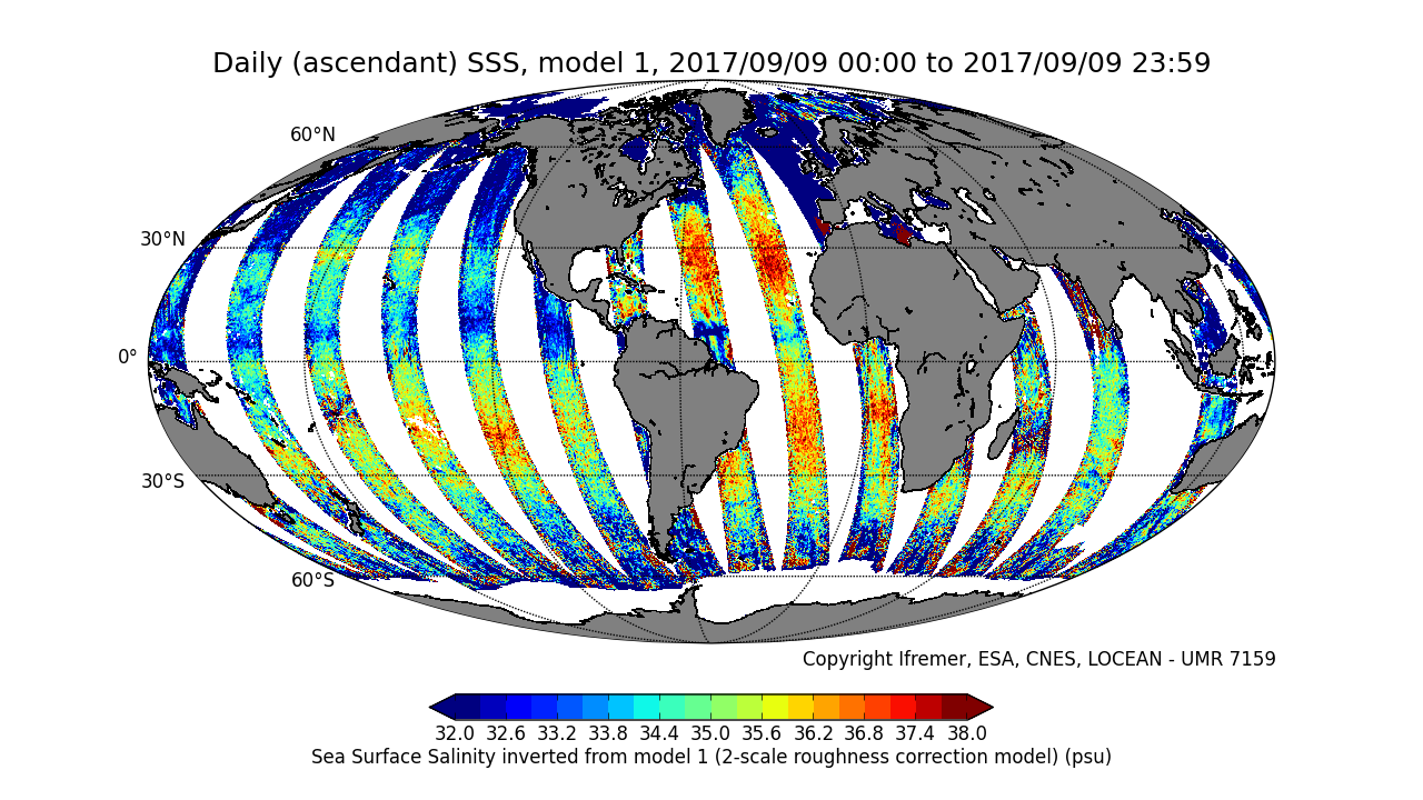
This product is an intermediate product, that provides, in daily files, SSS with qualification flags (associated confidence classes) which allow selecting valid data before averaging. Ascending and descending orbits are processed separately ** This product is no longer available, see below **
-
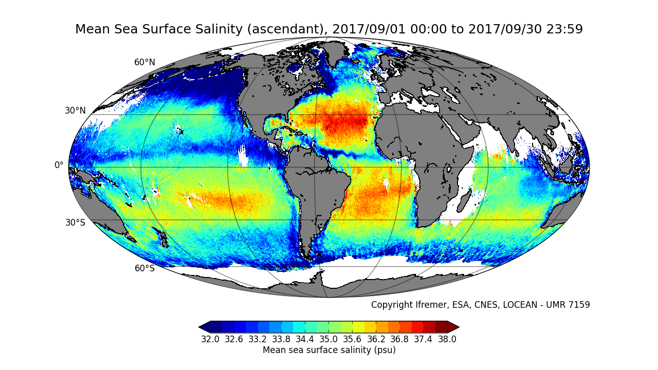
This product contains average 10 days & monthly salinity field corrected from land-sea contamination and latitudinal bias, based on L2Q products, ascending and descending orbits being processed separately. ** This product is no longer available, see below **
-
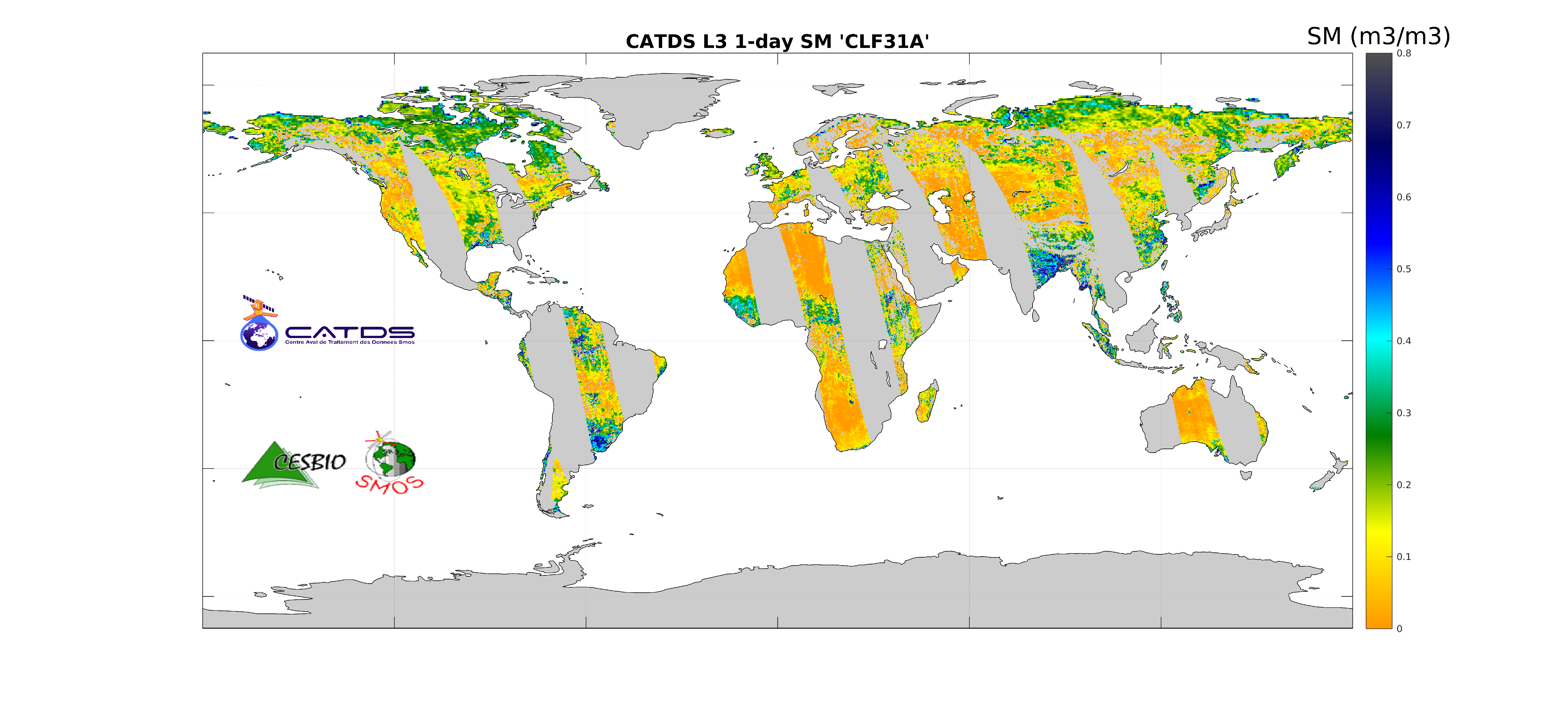
This product is the daily product of soil moisture. The retrievals are based on a multi-orbit retrieval algorithm. Ascending and descending orbits are processed separately.
-
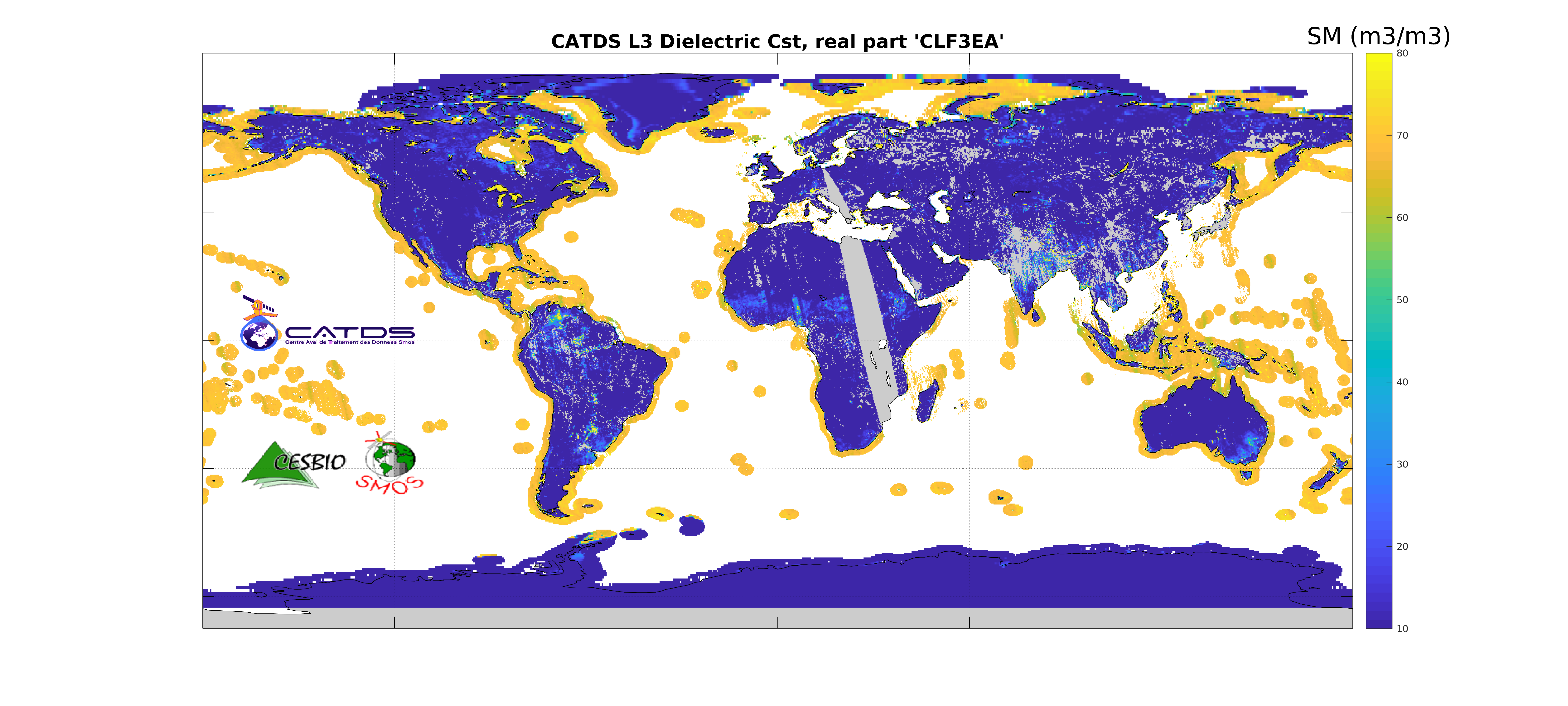
This product is an aggregation of daily maps of dielectric constant and its associated parameters over a 3 day moving window. The whole Earth's surface is covered in this 3-day product. Ascending and descending orbits are processed separately.
-
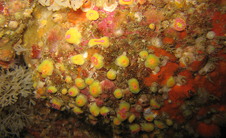
The main objective of this atlas is to summarise the knowledge acquired on biofouling, and more generally on communities of living organisms on hard substrates, available today in mainland France and the French overseas territories, in order to anticipate the issues that this phenomenon will pose in an ORE context. The atlas is based on the most exhaustive bibliographical analysis possible, including A-level scientific articles, reports (training courses, monitoring, studies), and works presenting the results of studies conducted in French waters