 Catalogue PIGMA
HVD
Type of resources
Available actions
Topics
Keywords
Contact for the resource
Provided by
Years
Formats
Representation types
Update frequencies
status
Scale
Resolution
-

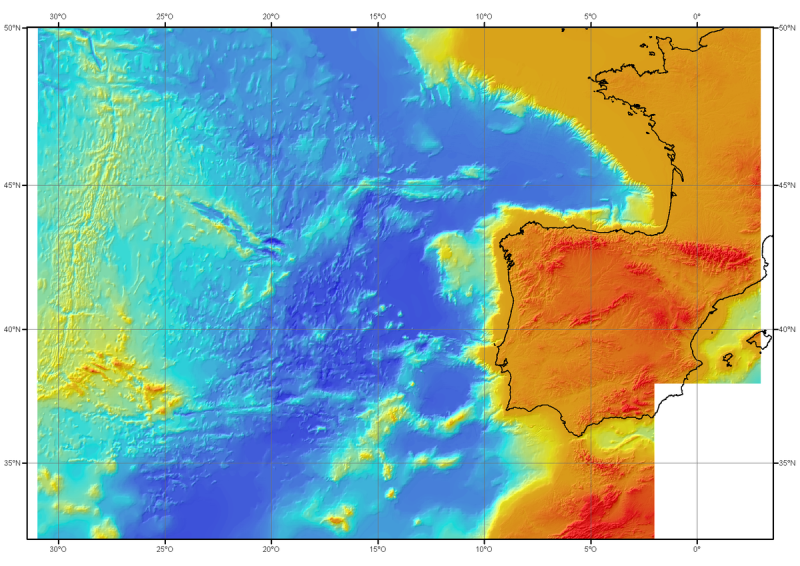
The "EMODnet Digital Bathymetry (DTM)- 2022" is a multilayer bathymetric product for Europe’s sea and oversea basins covering: • the Greater North Sea, including the Kattegat and stretches of water such as Fair Isle, Cromarty, Forth, Forties,Dover, Wight, and Portland • the English Channel and Celtic Seas • Western Mediterranean, the Ionian Sea and the Central Mediterranean Sea • Iberian Coast and Bay of Biscay (Atlantic Ocean) • Adriatic Sea (Mediterranean) • Aegean - Levantine Sea (Mediterranean). • Madeira and Azores (Macaronesia) • Baltic Sea • Black Sea • Norwegian and Icelandic Seas • Canary Islands (Macaronesia) • Arctic region and Barentz Sea and the Caribbean Sea. The DTM is based upon 21937 bathymetric survey data sets and Composite DTMs that have been gathered from 64 data providers from 28 countries riparian to European seas and beyond. Also Satellite Derived Bathymetry data products have been included fro Landsat 8 and Sentinel satellite images. Areas not covered by observations are completed by integrating GEBCO 2022 and IBCAO V4. The source reference layer in the portal viewing service gives metadata of the data sets used with their data providers; the metadata also acknowledges the data originators. The incorporated survey data sets itself can be discovered and requested for access through the Common Data Index (CDI) data discovery and access service that in December 2022 contained > 41.000survey data sets from European data providers for global waters. The Composite DTMs can be discovered through the Sextant Catalogue service. Both discovery services make use of SeaDataNet standards and services and have been integrated in the EMODnet portal (https://emodnet.ec.europa.eu/en/bathymetry#bathymetry-services ). In addition, the EMODnet Map Viewer (https://emodnet.ec.europa.eu/geoviewer/ ) gives users wide functionality for viewing and downloading the EMODnet digital bathymetry such as: • water depth (refering to the Lowest Astronomical Tide Datum - LAT) in gridded form on a DTM grid of 1/16 * 1/16 arc minute of longitude and latitude (ca 115 * 115 meters). • option to view depth parameters of individual DTM cells and references to source data • option to download DTM in 58 tiles in different formats: ESRI ASCII, XYZ, EMODnet CSV, NetCDF (CF), GeoTiff and SD • option to visualize the DTM in 3D in the browser without plug-in • layer with a number of high resolution DTMs for coastal regions • layer with wrecks from the UKHO Wrecks database. The EMODnet DTM is also available by means of OGC web services (WMS, WFS, WCS, WMTS), which are specified at the EMODnet Bathymetry portal. The original datasets themselves are not distributed but described in the metadata services, giving clear information about the background survey data used for the DTM, their access restrictions, originators and distributors and facilitating requests by users to originator.
-
The "EMODnet Digital Bathymetry (DTM)- 2024" is a multilayer bathymetric product for Europe’s sea and oversea basins covering: • the Greater North Sea, including the Kattegat and stretches of water such as Fair Isle, Cromarty, Forth, Forties,Dover, Wight, and Portland • the English Channel and Celtic Seas • Western Mediterranean, the Ionian Sea and the Central Mediterranean Sea • Iberian Coast and Bay of Biscay (Atlantic Ocean) • Adriatic Sea (Mediterranean) • Aegean - Levantine Sea (Mediterranean). • Madeira and Azores (Macaronesia) • Baltic Sea • Black Sea • Norwegian and Icelandic Seas • Canary Islands (Macaronesia) • Arctic region and Barentz Sea and the Caribbean Sea. The DTM is based upon 22063 bathymetric survey data sets and Composite DTMs that have been gathered from 66 data providers from 28 countries riparian to European seas and beyond. Also Satellite Derived Bathymetry data products have been included from Landsat 8 and Sentinel satellite images. Areas not covered by observations are completed by integrating GEBCO 2024 and IBCAO V4. The source reference layer in the portal viewing service gives metadata of the data sets used with their data providers; the metadata also acknowledges the data originators. The incorporated survey data sets itself can be discovered and requested for access through the Common Data Index (CDI) data discovery and access service that icontains > 41.000 survey data sets from European data providers for global waters. The Composite DTMs can be discovered through the Sextant Catalogue service. Both discovery services make use of SeaDataNet standards and services and have been integrated in the EMODnet portal (https://emodnet.ec.europa.eu/en/bathymetry#bathymetry-services ). In addition, the EMODnet Map Viewer (https://emodnet.ec.europa.eu/geoviewer/ ) gives users wide functionality for viewing and downloading the EMODnet digital bathymetry such as: • water depth (refering to the Lowest Astronomical Tide Datum - LAT) in gridded form on a DTM grid of 1/16 * 1/16 arc minute of longitude and latitude (ca 115 * 115 meters). • option to view depth parameters of individual DTM cells and references to source data • option to download DTM in 59 tiles in different formats: ESRI ASCII, XYZ, EMODnet CSV, NetCDF, GeoTiff, RGB and SD • option to visualize the DTM in 3D in the browser without plug-in • layer with a number of high resolution DTMs for coastal regions • layer with wrecks from the UKHO Wrecks database. The EMODnet DTM is also available by means of OGC web services (WMS, WFS, WCS, WMTS), which are specified at the EMODnet Bathymetry portal. The original datasets themselves are not distributed but described in the metadata services, giving clear information about the background survey data used for the DTM, their access restrictions, originators and distributors and facilitating requests by users to originator.
-
Pour ce produit consulter les données plus récentes du projet EMODnet Bathymetry : https://emodnet.ec.europa.eu/en/bathymetry. Modèle bathymétrique régional (MNT) de l'Atlantique Nord-Est, générée à partir de données conventionnelles de bathymétrie multifaisceaux, antérieures à l'année 2000. Le pas de la grille est de 1000 mètres. Référence bibliographique : Sibuet J.C. & al., (2004) - Carte bathymétrique de l'Atlantique nord-est et du golfe de Gascogne : implications cinématiques. Bull. Soc. géol. Fr.T. 175, n°5, pp. 429-442
-
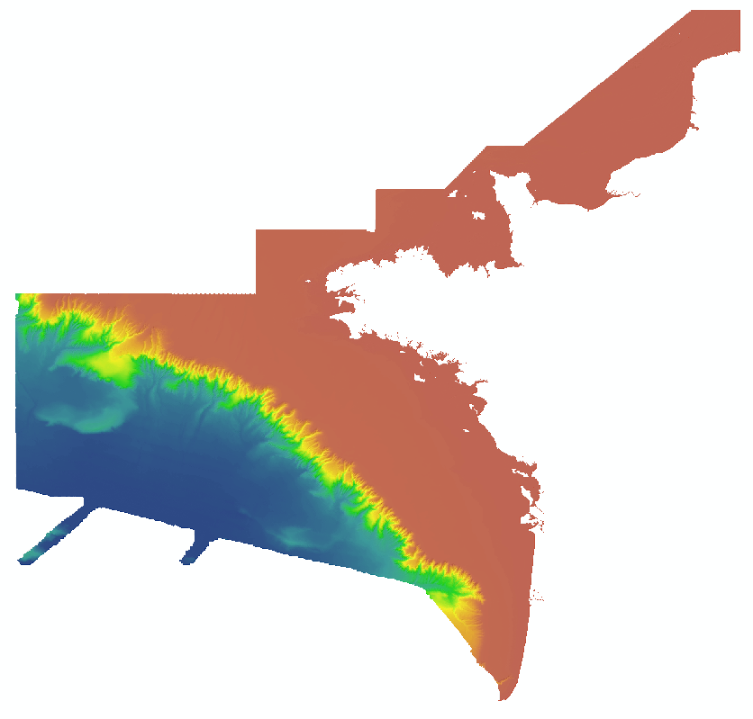
Pour ce produit consulter les données plus récentes du projet EMODnet Bathymetry : https://emodnet.ec.europa.eu/en/bathymetry. Bathy-morphologie régionale de la façade Manche Atlantique, version 2016, résolution 100 m (WGS84, Mercator latitude 46°N) Le modèle bathymétrique couvre la zone ZEE Manche-atlantique depuis la côte vers les grands fonds. Il résulte principalement de la combinaison de trois modèles bathymétriques : - MODELE BATHY 1: synthèse "ZEE" de données multifaisceau des campagnes ZEEGASC, ZEEGASC2, Sedimanche1, Sedifan, réalisée au pas de 125 mètres (version 2000) et re-maillée ici au pas de 100 mètres. - MODELE BATHY 2 : synthèse Ifremer-Shom au pas de 100 mètres de données bathymétriques sur le plateau continental (version 2010, édition Iftremer-Shom 2014). Les données utilisées proviennent de l'Ifremer, du SHOM et de différents Ports Autonomes. A cette synthèse des corrections complémentaires d'artéfacts ont été appliquées ainsi que l'intégration locale de données additionnelles (Minquiers, Mont-saint-Michel). - MODELE BATHY 3 : complément pour les zones non couvertes par les 2 autres MNT avec le modèle Emodnet bathymetry version 2015. Produit interne Ifremer
-
Pour ces produits consulter les données plus récentes du projet EMODnet Bathymetry : https://emodnet.ec.europa.eu/en/bathymetry. Ces modèles bathymétriques sont le résultat de la compilation de données et modèles numériques antérieurs à 2008 dans la zone du Golfe de Gascogne. Ces jeux de données sont disponibles à 500 m et 1 000 m de résolution. Les isobathes sont aussi disponibles pour les deux modèle numérique de terrain (MNT) équidistantes de 50 m pour le MNT 500 m, et équidistantes de 100 m pour le MNT 1 000 m. Accès tout public sous conditions.
-
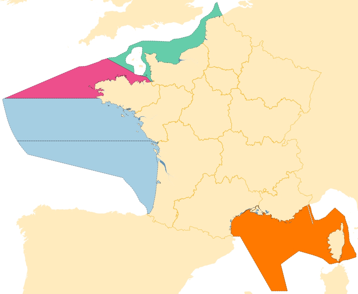
Unités de rapportage utilisées pour les parties françaises des sous-régions marines européennes : découpage géographique utilisé pour les plans d'actions pour le milieu marin (PAMM), en application de la directive cadre stratégie milieu marin (DCSMM), intégrés aux documents stratégiques de façade (DSF).
-
Le produit Surval "Inventaire des lieux actifs" présente l’inventaire des lieux programmés actuellement pour un suivi. Ils donnent donc accès à la programmation des réseaux (un lieu dont la période d’activité dans Quadrige inclue la date du jour est considéré actif pour le programme). Pour accéder aux données d'observation, il faut passer par les lieux du produit Surval 'Données par paramètre". Le réseau national (REMI) comprend un dispositif de surveillance régulière et un dispositif d'alerte : - Le dispositif de surveillance régulière vérifie que le niveau de contamination microbiologique de chaque zone de production reste conforme au classement défini dans les arrêtés préfectoraux et dépistent les épisodes inhabituels de contamination. - Le dispositif d'alerte est déclenché par les résultats de la surveillance qui dépassent ou risquent de dépasser les normes définissant les classes de qualité, ou en cas de risque de contamination (rejet polluant, orage), voire d'épidémie constatée ou présumée d'origine coquillière.
-
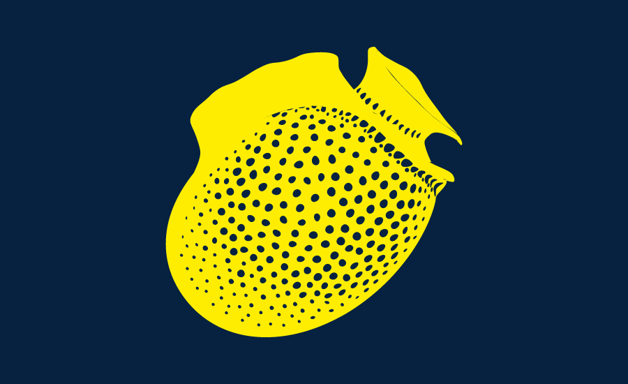
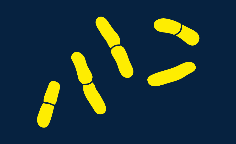
Le produit Surval "Inventaire des lieux actifs" présente l’inventaire des lieux programmés actuellement pour un suivi. Ils donnent donc accès à la programmation des réseaux (un lieu dont la période d’activité dans Quadrige inclue la date du jour est considéré actif pour le programme). Pour accéder aux données d'observation, il faut passer par les lieux du produit Surval 'Données par paramètre". Le REPHY est un réseau national couvrant le littoral métropolitain et sur les DOMs Martinique, Guadeloupe, Réunion et Mayotte. Il a pour objectifs : - d'observer l'ensemble des espèces phytoplanctoniques des eaux côtières, et recenser les événements tels que les eaux colorées, les efflorescences exceptionnelles et les proliférations d'espèces toxiques ou nuisibles pour la faune marine, - de surveiller plus particulièrement les espèces produisant des toxines dangereuses pour les consommateurs de coquillages. Ces objectifs sont complémentaires, puisque la surveillance régulière de l'ensemble des espèces phytoplanctoniques permet la détection des espèces toxiques et nuisibles connues, mais également d'espèces potentiellement toxiques. C'est la présence de ces espèces toxiques dans l'eau qui déclenche la surveillance des toxines dans les coquillages. Le REPHY a pour mission de surveiller les coquillages dans leur milieu naturel (parcs, gisements). Pour les coquillage sortis du milieu marin (c'est à dire dans les établissements d'expédition conchylicoles, sur les marchés, avant l'exportation), des plans nationaux de surveillance et de contrôle sont organisés par la Direction Générale de l'Alimentation du ministère de l'Agriculture. Les analyses sont effectuées par les laboratoires départementaux vétérinaires agréés, qui sont encadrés par le Laboratoire National de Référence, de l'Agence Française de Sécurité Sanitaire des Aliments
-
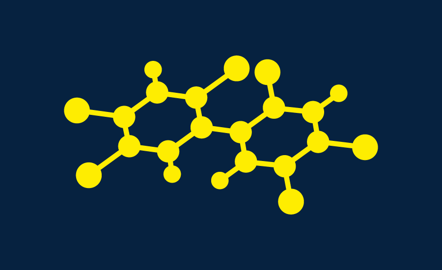
Le produit Surval "Inventaire des lieux actifs ROCCH" présente l’inventaire des lieux programmés actuellement pour un suivi. Ils donnent donc accès à la programmation des réseaux (un lieu dont la période d’activité dans Quadrige inclue la date du jour est considéré actif pour le programme*). Pour accéder aux données d'observation, il faut passer par les lieux du produit Surval 'Données par paramètre". Depuis 2008, le Réseau d'Observation de la Contamination CHimique du littoral (ROCCH) a pris la suite du RNO (Réseau National d'Observation de la qualité du milieu marin) qui existait depuis 1974. LE ROCCH a pour objectif de répondre aux obligations nationales, communautaires et internationales de surveillance chimique. Il est donc plus un réseau de contrôle qu'un réseau patrimonial tel que l'était le RNO. La colonne vertébrale du ROCCH est l'application de la Directive Cadre européenne sur l'Eau (DCE) et la réponse aux obligations des Conventions OSPAR et de Barcelone. La décentralisation étant inscrite dans la DCE, le ROCCH est passé d'un maître d'ouvrage unique (le Ministère chargé de l'environnement) à de multiples donneurs d'ordres (agences de l'eau, DIREN, etc.). Les analyses chimiques ne sont plus confiées à l'IFREMER mais attribuées sur appels d'offres des maîtres d'ouvrage. Le ROCCH intègre également le suivi chimique des zones de production conchylicoles pour le compte de la Direction Générale de l'Alimentation (DGAL) du Ministère de l'agriculture et de la pêche. Cette surveillance porte sur les trois métaux réglementés, mercure, plomb, cadmium dans les espèces exploitées. La surveillance des contaminants chimiques est effectuée dans les trois matrices marines, eau, biote et sédiment. A ce suivi il faut ajouter celui de l'imposex, effet biologique du tributylétain (TBT), obligation de la Convention OSPAR. Le ROCCH inclut également le projet méditerranéen RINBIO qui consiste en un suivi des contaminants dans des moules implantées (cagging). (*) Un lieu dont la période d’activité dans Quadrige inclut la date du jour est considéré actif pour le programme. Cette sélection se base sur les stratégies Quadrige et non sur les résultats. Il existe des cas particuliers : - Si le programme possède un moratoire qui inclut la date du jour, alors le lieu est exclu. - Si le programme est ROCCHMV, alors le lieu est sélectionné s'il possède au moins un résultat sur la dernière période de 3 ans. - Si le programme est ROCCHSED, alors le lieu est sélectionné s'il possède au moins un résultat sur la dernière période de 10 ans.
-

Le produit Surval "Données par paramètre" met à disposition les données d'observation et de surveillance bancarisées dans Quadrige, validées et qui ne sont pas sous moratoire. Ce système d'information contient des résultats sur la plupart des paramètres physiques, chimiques et biologiques de description de l'environnement. Les premières données datent par exemple de 1974 pour les paramètres de la qualité générale des eaux et les contaminants, 1987 pour le phytoplancton et les phycotoxines, 1989 pour la microbiologie, du début des années 2000 pour le benthos. Les données sous moratoire ou les données qualifiées "Faux" sont exclus de la diffusion Surval. Une donnée validée dans Quadrige aujourd’hui sera disponible dans Surval demain. Par contre, les fichiers associés à la donnée ne sont pas disponibles dans Surval. L'accès aux données d'observation se fait par lieu. Un lieu de surveillance est un lieu géographique où des observations, des mesures et/ou des prélèvements sont effectués. Il est localisé de façon unique par son emprise cartographique (surface, ligne ou point). Un lieu de mesure peut être utilisé par plusieurs programmes d'observation et de surveillance. Conformément aux exigences de l’ « Open data », toutes les données validées sans moratoire sont diffusées à J+1 et sans traitement. Ainsi tous les paramètres et tous les programmes Quadrige sont diffusés, et regroupés sous forme de thème : - Benthos dont récifs coralliens - Contaminants chimiques et Écotoxicologie - Déchets marins - Microbiologie - Phytoplancton, hydrologie et phycotoxines - Suivi du cycle de vie du bivalve - Zooplancton - Autres Un thème regroupe un ou plusieurs programmes d'acquisition. Un programme correspond à une mise en œuvre d'un protocole, sur une période et un ensemble de lieux. Chaque programme est placé sous la responsabilité d'un animateur. Pour accompagner le résultat, de nombreuses données sont diffusées (téléchargeables en tant que données d’observation), comme : - la description complète du « Paramètre-Support-Fraction-Méthode-Unité »; - la description complète des « Passages », « Prélèvements » et « Échantillons »; - le niveau de qualification du résultat; - une proposition de citation, afin d’identifier tous les organismes contribuant à cette observation. Ces données sont décrites plus précisément sur la page suivante https://surval.ifremer.fr/Astuces/Telechargement-contenu-du-fichier-csv L'emprise géographique est nationale : la métropole et les départements et régions d'outre-mer. L'accès au téléchargement direct du jeu de données complet (~ 220 Mo) s'effectue par ce lien : https://sextant.ifremer.fr/documentation/surveillance_littorale/surval/data/surval.zip ou https://www.data.gouv.fr/fr/datasets/donnees-par-parametre/ L'accès par le site Quadrige-Surval (https://surval.ifremer.fr/Les-produits/Donnees-par-parametre) permet de configurer des extractions et des graphes de visualisation sur demande (email demandé pour le téléchargement). Pour en savoir plus : le vocabulaire employé sur ce site et dans les fichiers extraits est explicité dans des documents comme le manuel Quadrige web ; les thématiques sont plus détaillées dans les consignes thématiques au utilisateurs. https://quadrige.ifremer.fr/support/Mon-support-Quadrige/Je-consulte-les-manuels Le DOI faisant référence à ce jeu de données chez le producteur est https://doi.org/10.12770/cf5048f6-5bbf-4e44-ba74-e6f429af51ea