Lowest Astronomical Tide
Type of resources
Available actions
Topics
Keywords
Contact for the resource
Provided by
Years
Formats
Representation types
Scale
Resolution
-
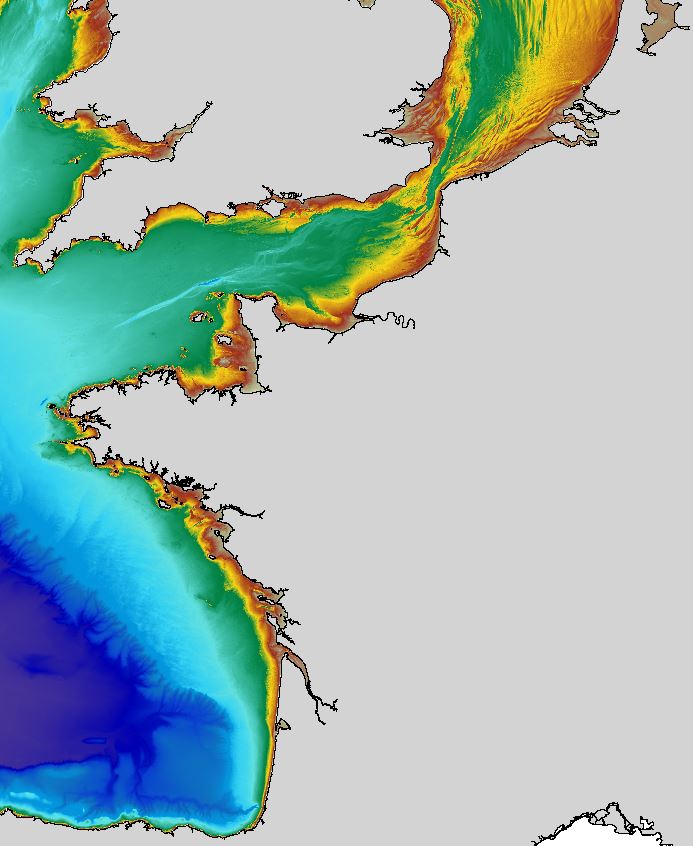
The regional bathymetric Atlantic – Channel – North-Sea DTM has a resolution of 0.001° (~111m). Its geographic coverage includes the Bay of Biscay, the English Channel and a part of the North Sea. The DTM extends from the coast to the continental slope (about of 4800m deep). This DTM is produced in the framework of the HOMONIM project which aims at improving operational forecast capabilities for the national coastal flood warning system. This DTM is offered openly on the Shom diffusion website (http://diffusion.shom.fr/produits/bathymetrie/mnt-facade-atl-homonim.html). http://dx.doi.org/10.17183/MNT_ATL100m_HOMONIM_WGS84
-
The data have been acquired with a Seabat 8160 (50 kHz) multibeam echosounder mounted on board of the CoNISMa research vessel "Universitatis" (chief scientist Paolo E. Orrù; party chief Paolo E. Orrù). The main objective of this cruise was to study the instability processes along continental margins of South Sardinia (Sardinia channel).
-
The Digital Terrain Model of the Bay of Biscaye and of the Channel is the result of the processing of a compilation of single and multibeam echosounder data, of DTMs and of chart countours produced before 2008 for hydrodynamic modeling.
-
This composite Digital Terrain Model (cDTM) is a high resolution bathymetry dataset that covers SHAKE,TOPOMED-GASSIS and MELCOR cruises. Multibeam data acquired in 2011, 2012 and 2015 on board the R/V Sarmiento de Gamboa and R/V García del Cid with and Atlas Hydrosweep DS-3 and Elac Seabeam 1050D echo-sounders.
-
The data have been acquired with a Seabat 8101 (240 kHz) multibeam echosounder mounted on board of a little boat (chief scientist F.L. Chiocci; party chief A. Bosman). The main objective of the cruise was the recognition of the submarine hazard features placed offshore the Cirò Marina-Punta Alice (Ionic Calabrian Coast).
-
This composite Digital Terrain Model (cDTM) is a high resolution bathymetry dataset that covers bathymetry surveys CHIANTI-I and CHIANTI-4. Bathymetric data collected in 2015 on board the R/V Sarmiento de Gamboa using an Atlas Hydrosweep DS-3 multi-beam echosounder.
-
The DTM is a compilation of multibeam echosounder surveys acquired in 2013. The resolution is 1/64 arc-minutes (~30m). Surveys are located on the Capbreton Submarine Canyon (France) with depths from -4.7m to -344.9m. Depths are referenced to the Lowest Astronomical Tide and the coordinates are expressed into the WGS84 reference frame. The surveys which compose the DTM are S201306500-09 and S201306500-11. Data and metadata associated to these surveys are available on the website http://diffusion.shom.fr/pro/lots-bathy.html. The DTM is not to be used for navigation.
-
The data have been acquired with a Seabat 8160 (50 kHz) multibeam echosounder mounted on board of the CoNISMa research vessel "Universitatis" (chief scientist Paolo E. Orrù; party chief Paolo E. Orrù). The main objective of this cruise was to study the instability processes along continental margins of South Sardinia (Sardinia channel).
-
High resolution composite DTM based on single beam, multi beam and Lidar covering the Weser and Weser approach. All data acquired in the years 2010-2017.
-
MESC-2005 CSR / To define in detail the morphology of the continenatal shelf margin and slope in order to identify instability areas potentially prone to gravitational collapse.