Nouméa
Type of resources
Available actions
Topics
Keywords
Contact for the resource
Provided by
Years
Formats
Representation types
Update frequencies
status
Scale
Resolution
-
The GEBCO_2022 Grid is a global continuous terrain model for ocean and land with a spatial resolution of 15 arc seconds. In regions outside of the Arctic Ocean area, the grid uses as a base Version 2.4 of the SRTM15_plus data set (Tozer, B. et al, 2019). This data set is a fusion of land topography with measured and estimated seafloor topography. Included on top of this base grid are gridded bathymetric data sets developed by the four Regional Centers of The Nippon Foundation-GEBCO Seabed 2030 Project. The GEBCO_2022 Grid represents all data within the 2022 compilation. The compilation of the GEBCO_2022 Grid was carried out at the Seabed 2030 Global Center, hosted at the National Oceanography Centre, UK, with the aim of producing a seamless global terrain model. Outside of Polar regions, the Regional Centers provide their data sets as sparse grids i.e. only grid cells that contain data are populated. These data sets were included on to the base using a remove-restore blending procedure. This is a two-stage process of computing the difference between the new data and the base grid and then gridding the difference and adding the difference back to the existing base grid. The aim is to achieve a smooth transition between the new and base data sets with the minimum of perturbation of the existing base data set. The data sets supplied in the form of complete grids (primarily areas north of 60N and south of 50S) were included using feather blending techniques from GlobalMapper software. The GEBCO_2022 Grid has been developed through the Nippon Foundation-GEBCO Seabed 2030 Project. This is a collaborative project between the Nippon Foundation of Japan and the General Bathymetric Chart of the Oceans (GEBCO). It aims to bring together all available bathymetric data to produce the definitive map of the world ocean floor by 2030 and make it available to all. Funded by the Nippon Foundation, the four Seabed 2030 Regional Centers include the Southern Ocean - hosted at the Alfred Wegener Institute, Germany; South and West Pacific Ocean - hosted at the National Institute of Water and Atmospheric Research, New Zealand; Atlantic and Indian Oceans - hosted at the Lamont-Doherty Earth Observatory, Columbia University, USA; Arctic and North Pacific Oceans - hosted at Stockholm University, Sweden and the Center for Coastal and Ocean Mapping at the University of New Hampshire, USA.
-
The GEBCO grid is global data set of elevation values, in metres, on a 15 arc-second interval grid. It is accompanied by a Type Identifier (TID) Grid that gives information on the types of source data that the GEBCO_2024 Grid is based on. An additional 4.34 million square kilometres of bathymetric data has been added to the global grid since the last release in 2023, with 26.1% of the seabed now mapped. This is the Sixth GEBCO grid developed through the Nippon Foundation-GEBCO Seabed 2030 Project.This is a collaborative project between the Nippon Foundation of Japan and GEBCO. The aim of the project is to map the global sea floor by 2030. GEBCO's grids can be downloaded as a global file in netCDF format or for user-defined areas, through our download app, in netCDF, data GeoTiff and ESRI ASCII raster formats. The data set can also be downloaded in the form of imagery. This release of the GEBCO grid includes data from version 5.0 of the International Bathymetric Chart of the Arctic Ocean (IBCAO) . GEBCO's aim is to provide the most authoritative publicly-available bathymetry of the world's oceans. It operates under the joint auspices of the International Hydrographic Organization (IHO) and the Intergovernmental Oceanographic Commission (IOC) (of UNESCO).
-
Emprise géographique correspondant aux conventions internationales pour la protection des mers (conventions dites des mers régionales) auxquelles la France est partie.
-

L'espace maritime français, d’une surface totale d’environ 10,2 millions de km² représente le deuxième espace maritime mondial derrière celui des États-Unis d'Amérique. Les Outre-mer correspondent à près de 96 % à ces espaces. L'espace maritime français concerne les eaux sous souveraineté française (eaux intérieures, mer territoriale) ainsi que les eaux sous juridiction française (zone économique exclusive). Ce produit a pour principal intérêt de fermer l'espace maritime français sur la base des délimitations maritimes françaises officielles (Shom, 2023) et de différentes limites terre-mer. Il est fourni à titre indicatif, seules les délimitations maritimes françaises telles que diffusées sur le portail national des limites maritimes - https://limitesmaritimes.gouv.fr/ - étant juridiquement opposables. Des associations ont été faites par ailleurs au niveau des attributs afin d'associer les espaces maritimes à différents libellés ou codes officiels en vigueur (IHO, ISO, INSEE, NUTS, FAO).
-
Produits issus de la mission satellite CFOSAT avec plusieurs paramètres de vagues de l'instrument français SWIM (hauteur, direction, longueur d'onde, spectre, ...) et produit vent du diffusiomètre chinois SCAT (vitesse, direction). Quelques variables météorologiques échantillonnées à la localisation des acquisitions SWIM sont aussi distribuées dans des fichiers dédiés.
-

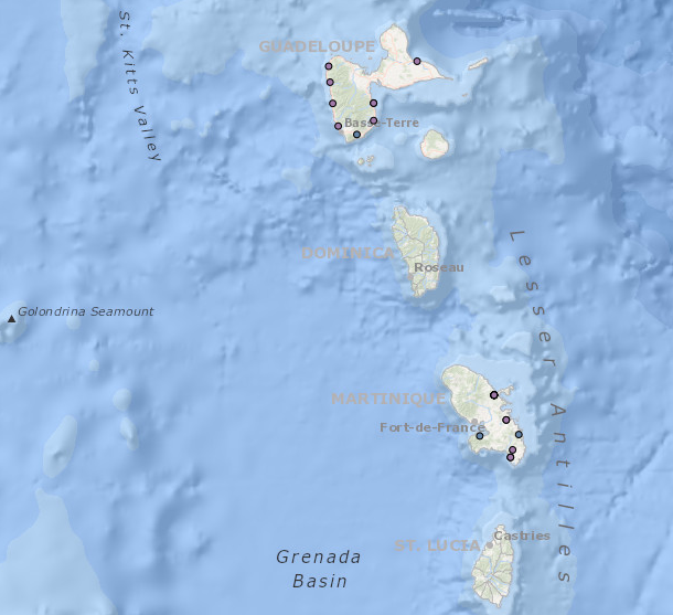
Données d’occurrence des échouages de mammifères marins collectées par les correspondants du Réseau National Echouages (date, position, espèce) en Outre-Mer en 2014-2020. cdNom: code de l'espèce observée selon taxref nomCite: nom latin de l'espèce observée selon taxref date_obs: jj/mm/aaaa, date de l'observation de l'animal échoué y: y en degrés décimaux de la commune de l'échouage x: x en degrés décimaux de la commune de l'échouage codeCommune: code de la commune de l'échouage selon l'INSEE nomCommune: nom de la commune selon l'INSEE identiteObservateur: nom du correspondant ayant effectué l'observation organismeObservateur: organisme du correspondant ayant effectué l'observation organismeGestionnaireDonnees: organisme assurant la gestion de la base de données
 Catalogue PIGMA