 Catalogue PIGMA
Temperature
Type of resources
Available actions
Topics
Keywords
Contact for the resource
Provided by
Years
Formats
Representation types
Update frequencies
status
Scale
-
.jpg)
The Sir Alister Hardy Foundation for Ocean Science (SAHFOS) is an international charity that operates the Continuous Plankton Recorder (CPR) Survey. The dataset covers the North Atlantic and the North Sea on since 1958.
-
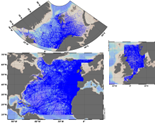
The SeaDataNet aggregated datasets over the Atlantic Ocean are regional ODV historical collections of all temperature and salinity measurements contained within SeaDataNet database and covering 3 European sea basins: North Arctic Ocean, North Sea, North Atlantic Ocean. Two versions have been published during SeaDataNet 2 and they represent a snapshot of the SeaDataNet database content at two different times: • V1.1 January 2014 • V2 March 2015 Each of them is the result of the Quality Check Strategy (QCS) implemented during SeaDataNet 2 that contributed to highly improve the quality of temperature and salinity data. The QCS is made by four main phases: 1. data harvesting from the central CDI 2. file and parameter aggregation 3. quality check analysis at regional level 4. analysis and correction of data anomalies. The aggregated datasets have been prepared and quality checked using ODV software.
-
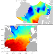
SeaDataNet gridded climatologies are based on the SeaDataNet Temperature and Salinity historical data collection v1.1. For the Atlantic Ocean there are covering 2 European sea basins: North Arctic Ocean, and North Atlantic Ocean The preparation of the products has also improved the quality, the consistency and the overall coherence of the data made available by SeaDataNet. They have been computed using DIVA software.
-

GLODAP is an internally consistent data product for interior ocean “carbon relevant” variables, but in practice this means “everything that is measured from water samples” taken on hydrographic cruises that takes measurements of biogeochemistry, including inorganic carbon measurements. GLODAP was first published in 2004, and a new massively increased version, GLODAPv2, was published in 2016. A new version – GLODAPv2.2018 – will be published in early 2019. GLODAP have three main products: 1) A collection of individual cruise file in a consistent format and 1st level QC, 2) A product that has been bias corrected through 2nd level QC procedures, and 3) an interpolated product on a regular grid.
-
Data from FerryBoxes on ships of opportunity going on permanent routes are stored inside this database (ferrydata.hzg.de). Parameters are temperature, salinity, chlorophyll-a fluorescence, oxygen and different others. The data model is transect oriented. A data portal to access and visualise the data is also provided.
-
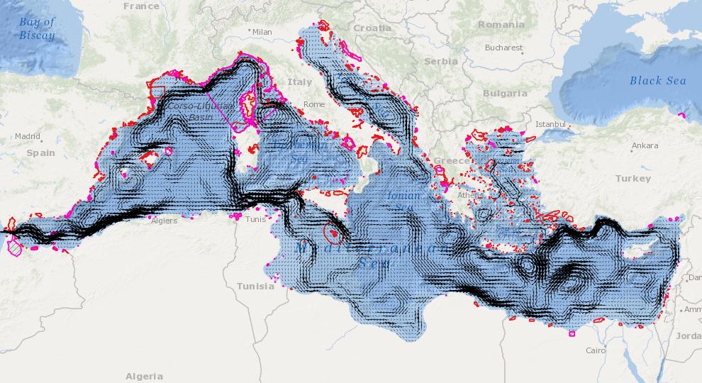
In order to assess the connectivity oceanographic data will be used. A shape map will be created combining data on MPAs adequacy and distribution of MPAs and temperature, currents seasonal GIS layers (The temperature and currents are INGV climatological products made available to CH2.
-

'''Short description:''' For the Global Ocean- Gridded objective analysis fields of temperature and salinity using profiles from the reprocessed in-situ global product CORA (INSITU_GLO_TS_REP_OBSERVATIONS_013_001_b) using the ISAS software. Objective analysis is based on a statistical estimation method that allows presenting a synthesis and a validation of the dataset, providing a validation source for operational models, observing seasonal cycle and inter-annual variability. Acces through CMEMS Catalogue after registration: http://marine.copernicus.eu/ '''Detailed description:''' The operational analysis system set up by the in-situ TAC Global component operated by Coriolis data centre. It produces temperature and salinity gridded fields. The system is based on a statistical estimation method (objective analysis). This system allows presenting a synthesis and a validation of the dataset, providing a validation source for operational models, observing seasonal cycle and inter-annual variability.
-
The Global Sea Level Observing System (GLOSS) was established by the Intergovernmental Oceanographic Commission (IOC) of UNESCO in 1985 to establish a well-designed, high-quality in situ sea level observing network to support a broad research and operational user base. Various tide gauge networks have contributed to GLOSS, each with a different focus and each changing over time as research priorities evolve. The main component is the GLOSS Core Network (GCN), a global set of ~300 tide gauges that serves as the backbone of the global in situ sea level network. GCN gauges were allocated to each island or group of islands at intervals not closer than 500 km, and along continental coasts at intervals generally not less than 1000 km. Preference was given to islands in order to maximise exposure to the open ocean. Established in 1933, the Permanent Service for Mean Sea Level (PSMSL) is responsible for the collection, publication, analysis and interpretation of sea level data from the global network of tide gauges, including the GLOSS Core Network.
-
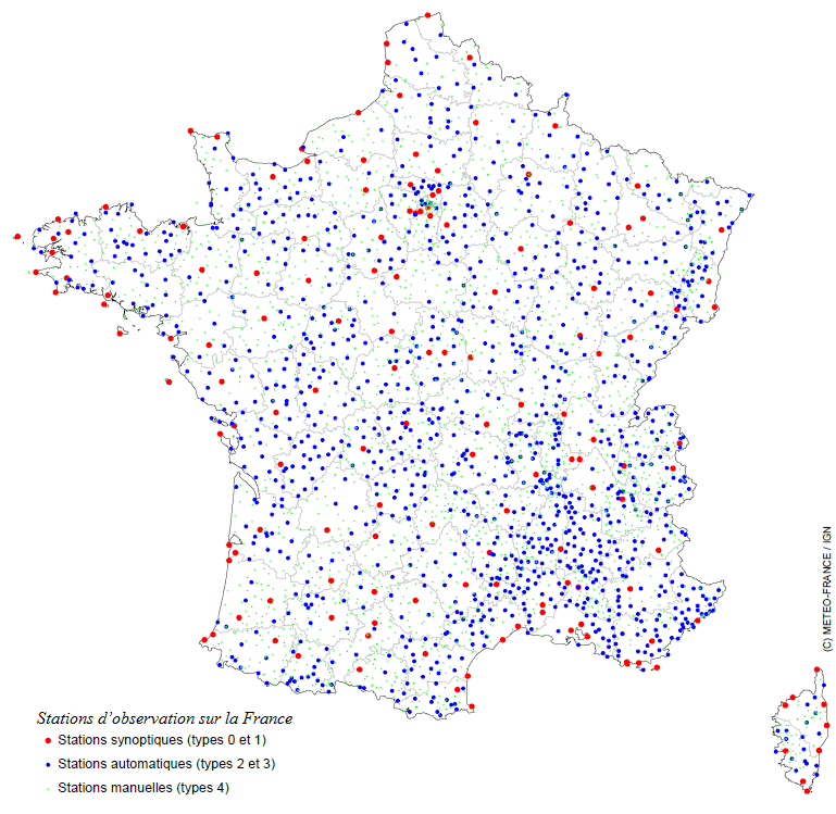
Throughout France, Météo-France has a network of 554 observation stations, the Radome network, which provides the establishment with temperature, humidity, rainfall, wind and diffusion measurements. Maintaining operational conditions is our priority.
-
The Drifting Buoys GDAC -Global Data Assembly Centre- is the repository of surface drifters data. Both NRT -Near Real Time- and DM -Delayed Mode- data are available on the GDAC. Drifters report generally trajectories, sea-surface temperatures, atmospheric pressures at sea-level, as well as sea-surface salinity or sub-surface temperature in the ocean top layer.