 Catalogue PIGMA
Western Mediterranean
Type of resources
Available actions
Topics
Keywords
Contact for the resource
Provided by
Years
Representation types
Update frequencies
status
Scale
-

-
-

-
-
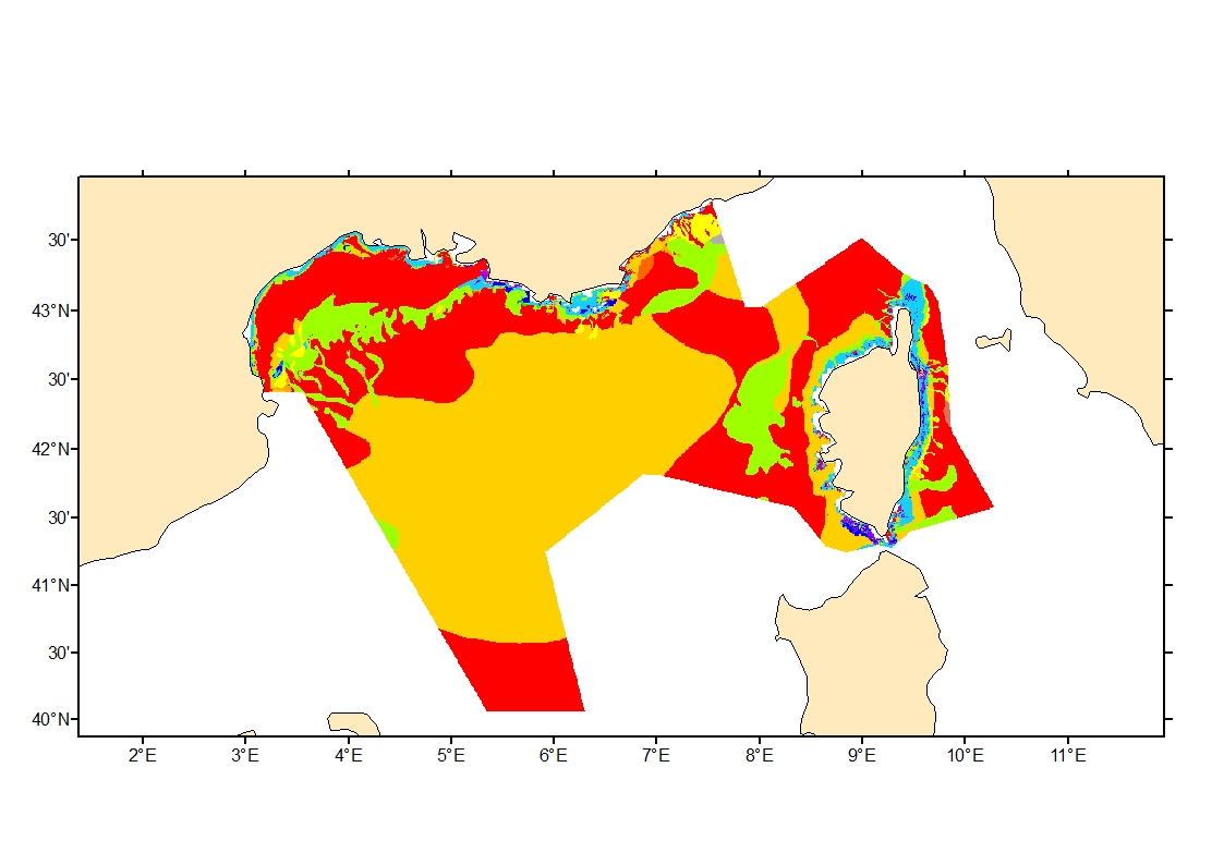
Sediment average grain size in French Mediterranean waters was generated from sediment categories. This rough granulometry estimate may be used for habitat models at meso- and large scale.
-
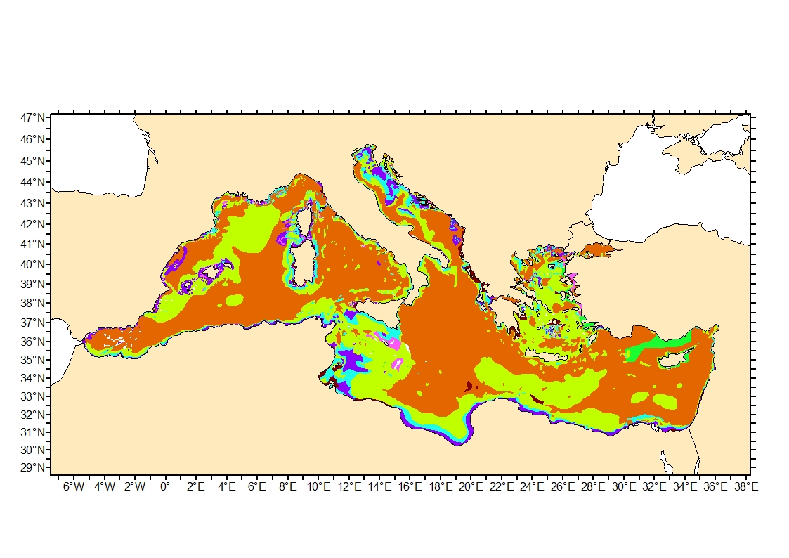
Sediment average grain size in the Mediterranean was generated from sediment categories. This rough granulometry estimate may be used for habitat models at meso- and large scale.
-
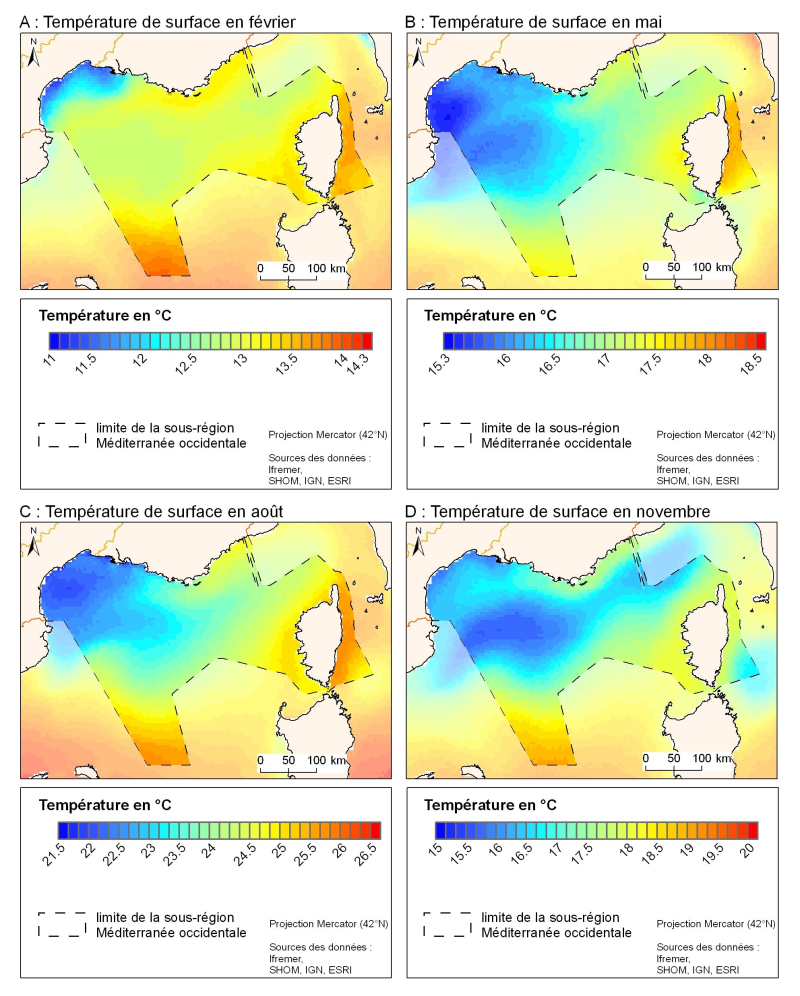
The spatial resolution from satellite climatology provides a more detailed description of spatio-temporal variations of surface temperature in the northern part of the western basin. Climatology exists for the surface temperature based on satellite infrared measurements which provides a spatial resolution on the order of kilometres.
-
-
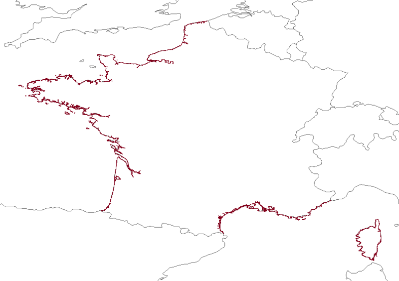
Coastline monitoring : Aquitaine coast (sandy coast since 1996, rocky coast since 2000), Corsican coast (since 2000 or 2002 depending on the site), the Pays de Monts coast (since 2010), the PACA region cliffs (work in progress). This project includes a number of coastal monitoring measures implemented on a local scale by the BRGM (the French Geological Survey) within the framework of the Aquitaine Coastal Observatory, the Corsican Coastal Observation Network and the Pays de Mons Coastal Observatory.
-
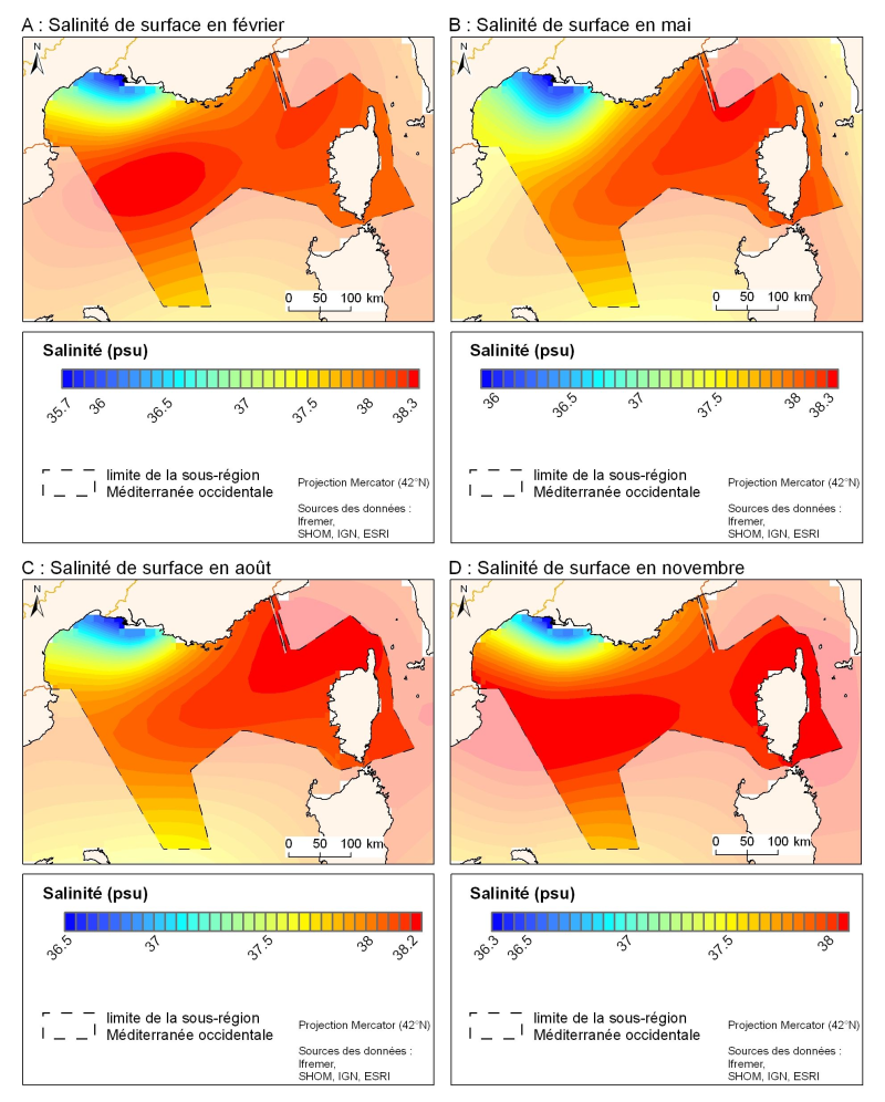
Assembled from historical data. The MEDAR / MEDATLAS climatology provides salinity fields for the Mediterranean with a horizontal resolution of about 20 km, but with better zoom resolution for area like the Gulf of Lion and the Ligurian Sea.