drainage
Type of resources
Available actions
Topics
Keywords
Contact for the resource
Provided by
Years
Formats
Representation types
Update frequencies
Scale
-

EU-Hydro is a dataset for all EEA38 countries and the United Kingdom providing photo-interpreted river network, consistent of surface interpretation of water bodies (lakes and wide rivers), and a drainage model (also called Drainage Network), derived from EU-DEM, with catchments and drainage lines and nodes. The EU-Hydro dataset is distributed in separate files (river network and drainage network) for each of the 35 major basins of the EEA38 + UK area, in GDB and GPKG formats. The production of EU-Hydro and the derived layers was coordinated by the European Environment Agency in the frame of the EU Copernicus programme. You can read more about the product here: https://land.copernicus.eu/en/products/eu-hydro/eu-hydro-river-network-database.
-
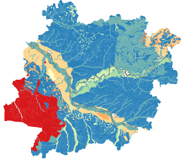
Propriétés pédologiques dominantes au sein des UCS (unités cartographiques de sols) du Référentiel Régional Pédologique du Lot-et-Garonne (RRP47). Pour chaque propriété pédologique est associé leur pourcentage de représentativité au sein de l'UCS. Liste des paramètres (modalité dominante) représentés : matériau parental, pierrosité de surface, classe texturale de surface, épaisseur des sols, circulation de l'eau dans le sol (drainage naturel).
 Catalogue PIGMA
