 Catalogue PIGMA
biota
Type of resources
Available actions
Topics
Keywords
Contact for the resource
Provided by
Years
Formats
Representation types
Update frequencies
status
Scale
Resolution
-

Species distribution models (Maxent) predicting the distribution of two Vulnerable Marine Ecosystems (VME): the reef-forming Scleractinian coral Desmophyllum pertusum and the aggregations forming Hexactinellid sponge Pheronema carpenteri. Both of these species are VME indicator taxa and form habitat that enhance deep-sea diversity (Ross and Howell, 2013). Maps of the likely distribution of the habitat formed by these two species will enable efficient Marine Spatial planning to facilitate their conservation. This work was performed at the University of Plymouth in 2021. A GIS layer is provided for each species.
-
-
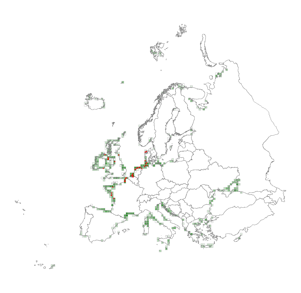
This metadata corresponds to the EUNIS Littoral biogenic habitat types (salt marshes), distribution based on vegetation plot data dataset. Littoral biogenic habitats (commonly known as salt marshes) are formed by animals such as worms and mussels or plants. The verified saltmarsh habitat samples used are derived from the Braun-Blanquet database (http://www.sci.muni.cz/botany/vegsci/braun_blanquet.php?lang=en) which is a centralised database of vegetation plots and comprises copies of national and regional databases using a unified taxonomic reference database. The geographic extent of the distribution data are all European countries except Armenia and Azerbaijan. The dataset is provided both in Geodatabase and Geopackage formats.
-
The observation of catches at sea, whether landed or discarded by professional fishing vessels, provides a better understanding of the interactions between fishing activity, resources and marine ecosystems. This system, called ObsMer, is applied in metropolitan France, excluding Corsica.
-
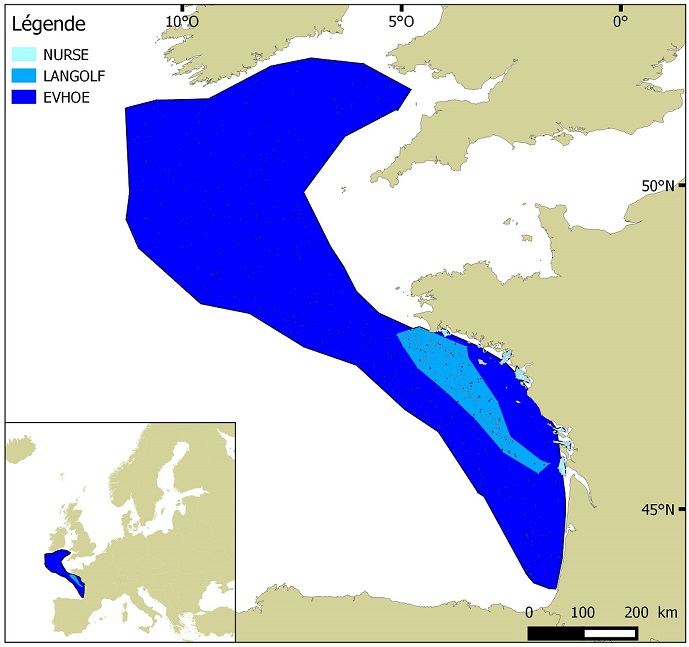
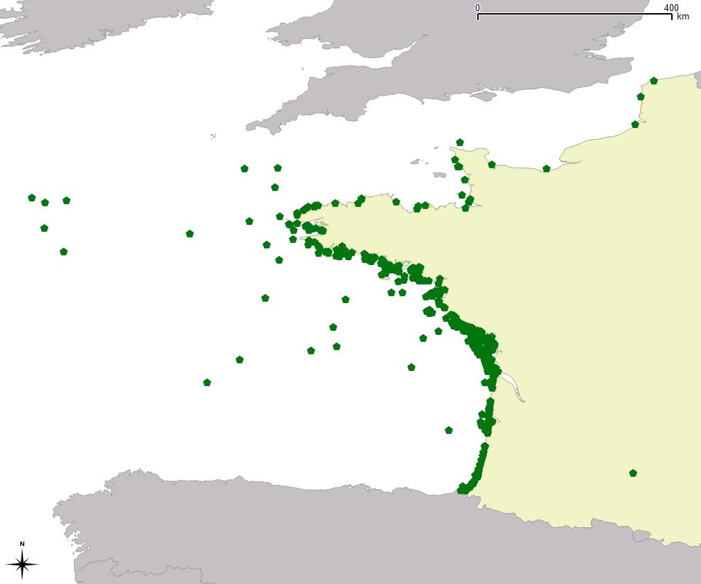
Distribution of benthic invertebrate species in Atlantic based on cumulative and interpolated relative abundance density data from fisheries surveys EVHOE (2008-2013), LANGOLF (2011-2013), NURSE (2000-2013), ORHAGO (2011-2015)
-
-
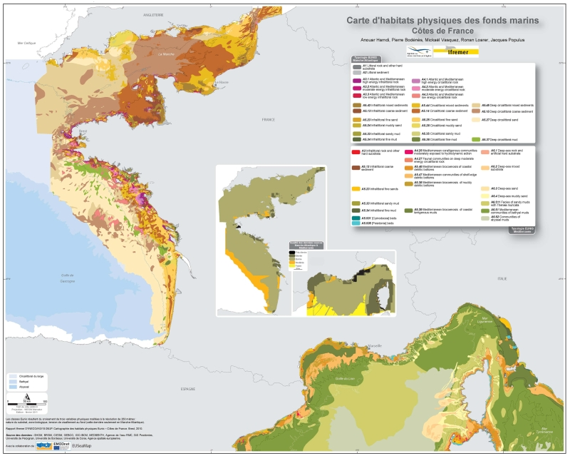
Eunis-classified physical habitats physiques resulting from the combination of three physical variables meshed at a resolution of 250 metres: nature of the substrates, biological area, shearing tension on the sea floor. Coasts of mainland France. Ifremer report "Hamdi Anouar, Vasquez Mickael, Populus Jacques (2010). Cartographie des habitats physiques Eunis - Côtes de France. Ifremer/AAMP agreement n° 09/12177764/FY. http://archimer.ifremer.fr/ doc/00026/13751/ "
-
The "Fishing trips" data in the declarative flow correspond to the catch and fishing effort data declared by the professionals in the logbooks for vessels whose overall length is greater than or equal to 10 metres, and the fishing sheets for vessels whose overall length is less than 10 metres.
-
The "Sales" data in the declarative flow contain mainly auction sales data and some non-exhaustive data on non-auction sales.
-
The observation of sales consists of periodically measuring the size of individuals of the main species at auctions and landing points, taking into account the commercial names used at the point of sale. This system, called ObsVentes, is applied in metropolitan France and in the French overseas territories : Guyane, Guadeloupe, Martinique, Réunion and Mayotte.