Global Merged Multi-Mission Hourly Gridded Wind Level 4 Dataset (2010-2020) for ESA MAXSS Project
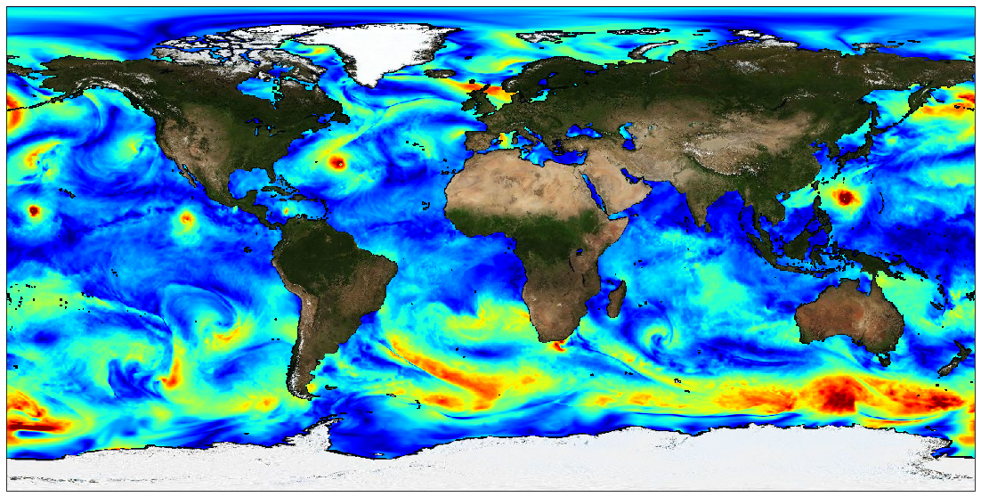
The Level 4 merged microwave wind product is a complete set of hourly global 10-m wind maps on a 0.25x0.25 degree latitude-longitude grid, spanning 1 Jan 2010 through the end of 2020. The product combines background neutral equivalent wind fields from ERA5, daily surface current fields from CMEMS, and stress equivalent winds obtained from several microwave passive and active sensors to produce hourly surface current relative stress equivalent wind analyses.
The satellite winds include those from recently launched L-band passive sensors capable of measuring extreme winds in tropical cyclones, with little or no degradation from precipitation. All satellite winds used in the analyses have been recalibrated using a large set of collocated satellite-SFMR wind data in storm-centric coordinates.
To maximize the use of the satellite microwave data, winds within a 24-hour window centered on the analysis time have been incorporated into each analysis. To accomodate the large time window, satellite wind speeds are transformed into deviations from ERA5 background wind speeds interpolated to the measurement times, and then an optical flow-based morphing technique is applied to these wind speed increments to propagate them from measurement to analysis time. These morphed wind speed increments are then added to the background wind speed at the analysis time to yield a set of total wind speeds fields for each sensor at the analysis time.
These individual sensor wind speed fields are then combined with the background 10-m wind direction to yield vorticity and divergence fields for the individual sensor winds. From these, merged vorticity and divergence fields are computed as a weighted average of the individual vorticity and divergence fields. The final vector wind field is then obtained directly from these merged vorticity and divergence fields.
Note that one consequence of producing the analyses in terms of vorticity and divergence is that there are no discontinuities in the wind speed fields at the (morphed) swath edges.
There are two important points to be noted: the background ERA5 wind speed fields have been rescaled to be globally consistent with the recalibrated AMSR2 wind speeds. This rescaling involves a large increase in the ERA5 background winds beyond about 17 m/s. For example, an ERA5 10 m wind speed of 30 m/s is transformed into a wind speed of 41 m/s, and a wind speed of 34 m/s is transformed into a wind speed of about 48 m/s. Besides the current version of the product is calibrated for use within tropical cyclones and is not appropriate for use elsewhere.
This dataset was produced in the frame of ESA MAXSS project. The primary objective of the ESA Marine Atmosphere eXtreme Satellite Synergy (MAXSS) project is to provide guidance and innovative methodologies to maximize the synergetic use of available Earth Observation data (satellite, in situ) to improve understanding about the multi-scale dynamical characteristics of extreme air-sea interaction.
Simple
- Date (Creation)
- 2022-11-09
- Date (Publication)
- 2023-03-30
- Identifier
- MAXSS-L4-GLOB_025_1H_MULTI-v1.0 / 1.0
- Status
- completed Completed
- GEMET - INSPIRE themes, version 1.0
-
- Oceanographic geographical features
- Cersat - Parameter
-
- Ocean Winds
- Cersat - Latency
-
- Historical
- Cersat - GCMD parameter
-
- /Ocean Winds
- Centre de données ODATIS
-
- CDS-CERSAT
- Type de jeux de donnée ODATIS
-
- /Observational data/satellite
- Use limitation
- None
- Access constraints
- unrestricted
- Use constraints
- Other restrictions
- Other constraints
- CC-BY (Creative Commons - Attribution)
- Other constraints
- Ifremer / CERSAT. 2023. Global Merged Multi-Mission Hourly Gridded Wind Level 4 Dataset (2010-2020) (v1.0) for ESA Marine Atmosphere eXtreme Satellite Synergy project (MAXSS). Ver. 1.0. Ifremer, Plouzane, France. Dataset accessed [YYYY-MM-DD].
- Spatial representation type
- grid Grid
- Distance
- 0.25 degree
- Topic category
-
- Oceans
))
- Geographic identifier
- Global
- Begin date
- 2010-01-01
- End date
- 2020-12-31
- Reference system identifier
- http://www.opengis.net/def/crs/EPSG/0/4326
- Distribution format
-
-
NetCDF
(
4
)
-
NetCDF
(
4
)
- OnLine resource
- Ifremer HTTPS server ( WWW:LINK )
- OnLine resource
-
Ifremer FTP server
(
WWW:FTP
)
FTP
- OnLine resource
-
Local path on Datarmor
(
NETWORK:LINK
)
Local path
- OnLine resource
- Digital Object Identifier (DOI) ( DOI )
- Hierarchy level
- Dataset
- Attribute description
- composite
- Processing level code
- L4 /
- File identifier
- 35002607-3546-412b-8c5d-9c182a16ffea XML
- Metadata language
- English
- Character set
- UTF8
- Hierarchy level
- Dataset
- Date stamp
- 2024-10-15T14:56:02.871724Z
- Metadata standard name
- ISO 19115-3:2018 - Remote Sensing
Overviews

Spatial extent
))
Provided by

 Catalogue PIGMA