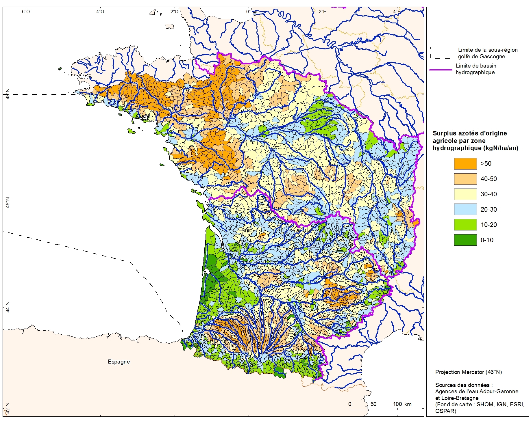
Excess nitrogen from agricultural drainage by hydrographic zone of the Adour-Garonne basin
Excess nitrogen from agricultural drainage by hydrographic zone in the Adour-Garonne basin. This data was collected as part of the "initial state" phase of DCSSM with the Adour-Garonne Water Agency.
Referent expert AAMP : Aurélie Blanck.
Partial description of the fields: "kgN_ha_an" : nitrogen surplus (kgN / ha / year)
Simple
- Date (Publication)
- 2011-06-01
- Identifier
- PHY_ATL_DCSMM_Rejet_nutriment_N_agri_zone_hydro_AEAG_pol_L2
- Credit
- Adour-Garonne Water Agency
- Thèmes Sextant
-
- /Physical Environment/Terrestrial Hydrography/Hydrographic Network
- Theme
-
- rejet ; nutriment ; azote ; DCSMM ; agriculture
- GEMET - INSPIRE themes, version 1.0
-
- Hydrographie
- Sous-regions marines
-
- Bay of Biscay
- Use limitation
- The Adour-Garonne Water Agency should be consulted for any application to use the data.
- Access constraints
- Copyright
- Use constraints
- Copyright
- Classification
- Restricted
- Spatial representation type
- Vector
- Metadata language
- Français
- Character set
- UTF8
- Topic category
-
- Environment
- Farming
- Planning cadastre
N
S
E
W
))
- Reference system identifier
- EPSG / Lambert II Carto / Etendu / 7.4
- Distribution format
-
-
ESRI Shapefile
(
1.0
)
-
ESRI Shapefile
(
1.0
)
- Hierarchy level
- Dataset
- Statement
- Data produced by the Adour-Garonne Water Agency.
- File identifier
- 4710530a-ee8e-4381-acd1-3816de583b4e XML
- Metadata language
- Français
- Character set
- UTF8
- Hierarchy level
- Dataset
- Hierarchy level name
- Jeu de données
- Date stamp
- 2020-06-04T00:25:35
- Metadata standard name
- ISO 19115:2003/19139 - SEXTANT
- Metadata standard version
- 1.0
Overviews

Spatial extent
N
S
E
W
))
Provided by

Associated resources
Not available
 Catalogue PIGMA