 Catalogue PIGMA
1000000
Type of resources
Available actions
Topics
Keywords
Contact for the resource
Provided by
Years
Formats
Representation types
Update frequencies
status
Scale
Resolution
-
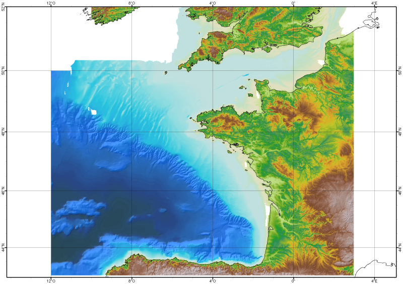
The Digital Terrain Model of the Bay of Biscaye and of the Channel is the result of the processing of a compilation of single and multibeam echosounder data, of DTMs and of chart countours produced before 2008 for hydrodynamic modeling..
-
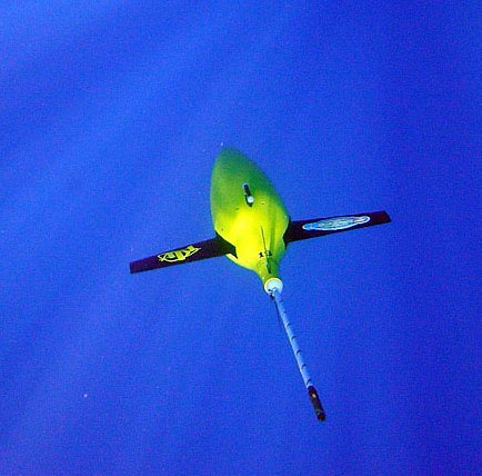
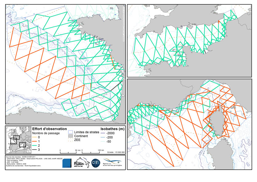
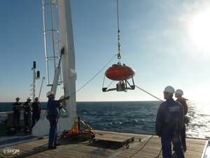
The Everyone's Gliding Observatories (EGO) initiative is a gathering of several teams of oceanographers, interested in developing the use of gliders for ocean observations. EGO started in Europe with members from France, Germany, Italy, Norway, Spain, and the United Kingdom. The partners of EGO have been funded by both European and national agencies to operate gliders for various purposes and at different sites. Coordinated actions are being set up for these sites in order to demonstrate the capabilities of a fleet of gliders for sampling the ocean, with a given scientific and/or operational objective. Gliders were developed since the 90’s to carry out in-situ observations of the upper 1km of the ocean, filling the gaps left by the existing observing systems. Gliders look like small autonomous robotic underwater vehicles which that uses an engine to change their buoyancy. While gliding from surface to about 1000 meters, gliders provide real-time physical and biogeochemical data along their transit. They observe temperature, salinity, pressure, biogeochemical data or acoustic data.
-
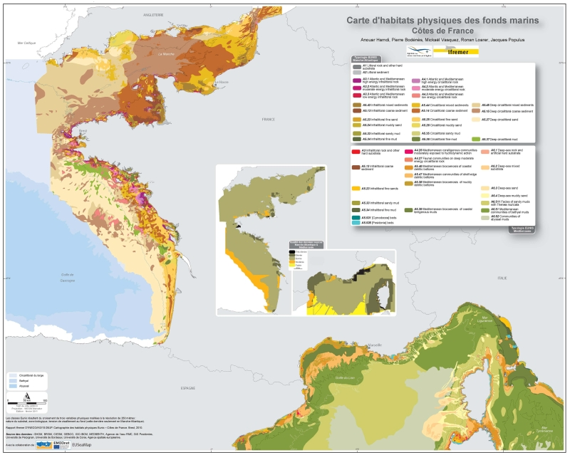
Eunis-classified physical habitats physiques resulting from the combination of three physical variables meshed at a resolution of 250 metres: nature of the substrates, biological area, shearing tension on the sea floor. Coasts of mainland France. Ifremer report "Hamdi Anouar, Vasquez Mickael, Populus Jacques (2010). Cartographie des habitats physiques Eunis - Côtes de France. Ifremer/AAMP agreement n° 09/12177764/FY. http://archimer.ifremer.fr/ doc/00026/13751/ "
-
The Drifting Buoys GDAC -Global Data Assembly Centre- is the repository of surface drifters data. Both NRT -Near Real Time- and DM -Delayed Mode- data are available on the GDAC. Drifters report generally trajectories, sea-surface temperatures, atmospheric pressures at sea-level, as well as sea-surface salinity or sub-surface temperature in the ocean top layer.
-
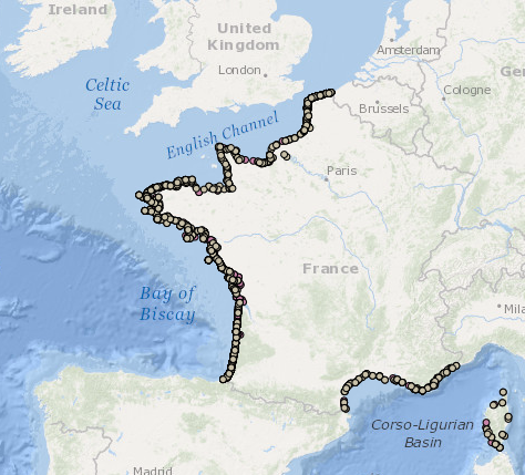
Occurrence data of strandings of marine mammals collected by the correspondents of the National Stranding Network (date, position, species) in metropolitan France in 2014-2020.
-
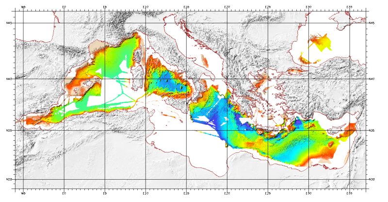
For this product, see the most recent data from the EMODnet Bathymetry project: https://emodnet.ec.europa.eu/en/bathymetry. Bathymetric model (Digital Terrain Model) of the Mediterranean. MediMap group. Bathymetry data acquired by multibeam sounders during campaigns Almofront.leg1 and Almofront.leg2, Almofront, Bretane, Seamewe2, Heralis, Medee, Anaxiprobe, Almofront2 - leg1 and leg2, Prismed2, Marmara, Fanil, Tvic5 et 6, Progres, Maradja, Blac, Nautinil, Medor-Simed1 / 2 / 3 / 4 / 5, Maradja2, Sardinia, Prisme, Assemblage and Thertou. Integration of partner organizations DTM. This DTM is available at two cell sizes : 500 meters and 1000 meters. Partners MediMap : - SHOM (service Hydrographique et Océanographique de la Marine) ; - CNRS/INSU (Centre National de la recherche Scientifique / Institut National des Sciences de l'Univers) ; - Géosciences Azur / Observatoire Océanologique de Villefranche sur Mer ; - ENS Paris (Ecole Nationale Supérieure de Paris) ; - UBO/IUEM (Université de Bretagne Occidentale / Institut Universitaire Européen de la Mer) - UP (Université de Perpignan / Laboratoire d'Etudes des Géo-environnements Marins) ; - UB/GRC-GM (Universitat de Barcelona / Geociències Marines) ; - IEO (Instituto Espanol de Oceanografia) ; - IHM (Instituto Hidrografico de la Marina) ; - Instituto Andaluz de Ciencias de la Tierra / Unitat de Tecnologia Marina, CMIMA / Universidad de Granada ; - ISMAR (Istituto di Scienze Marine) ; - Istituto Nazionale di Oceanografia e di Geofisica Sperimentale OGS/RIMA ; - Università di Trieste / Università della Calabria - Scienze della Terra ; - HCMR (Hellenic Centre for Marine Research) ; - NWO (Nederlandse organisatie voor Wetenschappelijk Onderzoek / Vrije Universiteit Amsterdam ; - Israel's national Bathymetric Survey.
-
-

Eunis-classified physical habitats physiques resulting from the combination of three physical variables meshed at a resolution of 250 metres: nature of the substrates, biological area, shearing tension on the sea floor. Coasts of mainland France. Ifremer report "Hamdi Anouar, Vasquez Mickael, Populus Jacques (2010). Cartographie des habitats physiques Eunis - Côtes de France. Ifremer/AAMP agreement n° 09/12177764/FY. http://archimer.ifremer.fr/ doc/00026/13751/ "
-
-
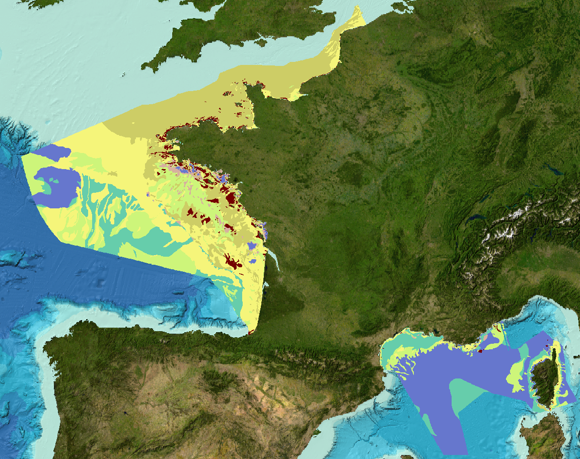
Sediment substrate maps at different scales, of the French metropolitan EEZ produced in the work-package 3 the European project EMODNet Geology (phase IV). Available scales : - 1 : 1 000 000 - 1 : 250 000 - 1 : 100 000 - 1 : 50 000 - 1 : 20 000 - 1 : 15 000 - 1 : 10 000 - 1 : 5 000 Bibliographic references : - Coltman, N., Gilliland, P. & van Heteren, S. 2007. What can I do with my map? In: MESH Guide to Habitat Mapping, MESH Project, 2007, JNCC, Peterborough. Available online at: (http://www.searchmesh.net/default.aspx?page=1900) - Foster-Smith, R., Connor, D. & Davies, J. 2007. What is habitat mapping? In: MESH Guide to Habitat Mapping, MESH Project, 2007, JNCC, Peterborough. Available online at: (http://www.searchmesh.net/default.aspx?page=1900) - Väänänen, T. (ed), Hyvönen, E., Jakonen, M., Kupila, J., Lerrsi, J., Leskinen, J., Liwata, P., Nevalainen, R., Putkinen, S., Virkki, H. 2007. Maaperän yleiskartan tulkinta- ja kartoitusprosessi. Maaperän yleiskartoitus –hankkeen sisäinen raportti. 17 p.