 Catalogue PIGMA
5000
Type of resources
Available actions
Topics
Keywords
Contact for the resource
Provided by
Years
Formats
Representation types
Update frequencies
status
Scale
Resolution
-
Géolocalisation ponctuelle des maisons familiales et rurales (coordonnées WGS84). Information de précision des données : dans la mesure du possible, la donnée est au bâtiment près ou à la rue; il existe cependant des cas où le centre de la commune est le point de référence (cf. champ "Précision"). MAJ : 2016
-
PPRIF
-
Pôles de la CAPB correspondant aux anciens EPCI
-
Le Dossier Départemental des Risques Majeurs (DDRM) est un ouvrage de sensibilisation aux risques majeurs, illustré par des cartes d'aléas schématiques. Il a pour but de recenser, de décrire, et de porter à la connaissance du public l'ensemble des risques majeurs recensés dans le département et les communes concernées, ainsi que les mesures de sauvegarde prévues pour en limiter les effets.
-
PCI vecteur
-
The French national network (REMI) includes a regular monitoring system and a warning system: - The regular monitoring system checks that the level of microbiological contamination in each production area remains within the limits set by the classification defined in the prefectural decree and tests unusual occurrences of contamination. - The warning system is triggered when results of the monotoring programme exceed or are at risk of exceeding the norms defining the quality classes and thresholds, or in case of contamination risk (pollution spillage, storms, etc.), or even in the case of a suspected or confirmed epidemic in shellfish.
-
Périmètre de la CAPB
-
-
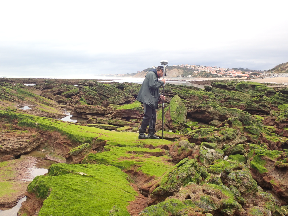
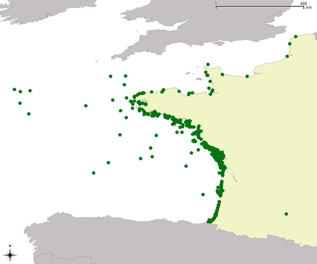
The present dataset is based on a nine site study of fine seabed topography in intertidal zones. Four coral sites (Maupiti A, B and C and Niau islands) and five rocky sites (Ars en Ré, Socoa, Parlementia A and B and Banneg island) have been explored. The data has been gathered using on-foot GNSS RTK for all sites (Trimble R8/R8S and Leica sytems) except Banneg island, where aerial Lidar data from Litto3D program has been used. The horizontal resolution varies between 3.8 and 12cm allowing to describe a wide range of spatial scales (generally over 3 spectral decades). The data has been processed to explore the statistical and spectral metrics which can be used to characterize the architectural complexity of seabeds. Owners: - Topographic survey on Ars-en-Ré : profile X, Z in meter along a transec was operated on 10-15 Jan 2021 with On-foot Trimble R8/R8S GNSS RTK by Shom, Gladys and Univ. de Montpellier - Topographic survey on Maupiti Hoe: profile X, Z in meter along a transec was operated on 5-10 July 2018 with on-foot Trimble R8/R8S GNSS RTK by GLADYS and Université de Montpellier - Topographic survey on Niau : profile X, Z in meter along a transec operated on 10 Nov. 2021 with On-foot Trimble R8/R8S GNSS RTK - by CEREGE and MIO (OSU Pytheas) - Topographic survey on Parlementia A, and B : profile X, Z in meter along a transec was operated on 22 Fev 2023 with on-foot Leica GNSS RTK by SIAME, UPPA - Topographic survey on Socoa : profile X, Z in meter along a transec was operated on 21 Fev 2023 with on-foot Leica GNSS RTK by SIAME, UPPA and Shom - Topographic survey in high resolution of Banneg island (X, Y, Z) is made by aerial lidar litto3D on spring 2012/2013 by Shom and IGN
-
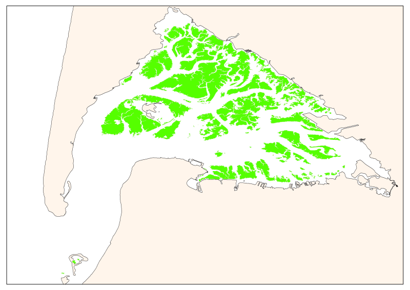
Map of the maximum extent of the seagrass Zostera noltti of Arcachon acquired in 2007-2008, under the supervisory control of the WFD (EU Water Framework Directive). Funded by the AEAG (Agence de l'Eau Adour Garonne) and Ifremer.