 Catalogue PIGMA
500000
Type of resources
Available actions
Topics
Keywords
Contact for the resource
Provided by
Years
Formats
Representation types
Update frequencies
status
Scale
Resolution
-

Sea bed sediment maps for the 4 marine sub-regions prepared as part of the initial evaluation of the MSFD (Marine Strategy Framework Directive).
-
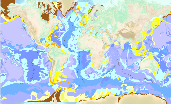
The “World Seabed Sediment Map” product contains geo-referenced digital data, describing the nature of the sediment encountered in different seas and oceans of the world. The objects are all surface areas and the description of an object includes in particular the nature of the sediment including rock-type bottoms.
-
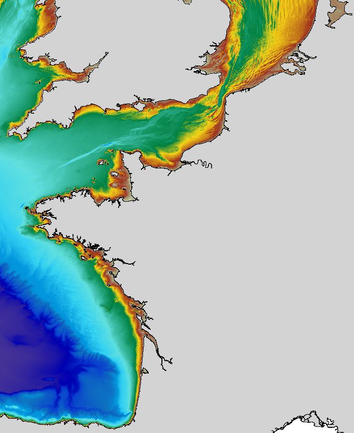
The regional bathymetric Atlantic – Channel – North-Sea DTM has a resolution of 0.001° (~111m). Its geographic coverage includes the Bay of Biscay, the English Channel and a part of the North Sea. The DTM extends from the coast to the continental slope (about of 4800m deep). This DTM is produced in the framework of the HOMONIM project which aims at improving operational forecast capabilities for the national coastal flood warning system. This DTM is offered openly on the Shom diffusion website (http://diffusion.shom.fr/produits/bathymetrie/mnt-facade-atl-homonim.html). http://dx.doi.org/10.17183/MNT_ATL100m_HOMONIM_WGS84
-

Les périmètres des quartiers prioritaires de la politique de la ville sont fixés par le décret n° 2014-1750 du 30 décembre 2014 pour la métropole et par le décret n° 2014-1751 du 30 décembre 2014 pour les départements et collectivités d’outre-mer, rectifiés par le décret n°2015-1138 du 14 septembre 2015.
-

Carte de géomorphologie à 1 : 500 000 produite par la France dans le cadre du work-package 4 (géologie du fond marin / géomorphologie) du projet européen EMODnet Geology, à l'intérieur de la ZEE métropolitaine française. Cette version du jeu de données correspond à la phase IV du projet.
-

Carte des domaines physiographiques à 1 : 500 000 produite par la France dans le cadre du work-package 4 (géologie du fond marin / géomorphologie) du projet européen EMODnet Geology, à l'intérieur de la ZEE métropolitaine française. Cette version du jeu de données correspond à la phase IV du projet.
-
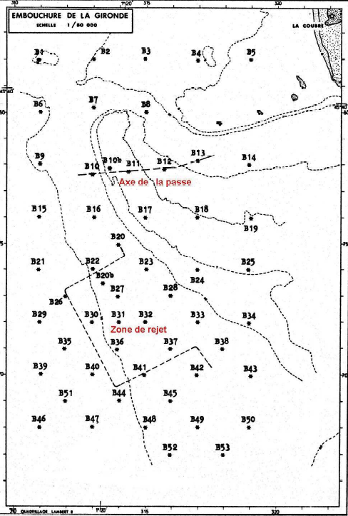
Cette étude présente les résultats d’une étude biosédimentaire réalisée au large de l’embouchure de la Gironde. Elle comprend le site de travaux de dragage (stations 10, 10 bis, 11, 12 et 13) commencés en juin 1978 pour la rectification de la passe d’entrée en Gironde ainsi que le périmètre prévu pour les rejets de matériaux issus de ce creusement (cf carte). Un suivi a été réalisé sur 5 stations (5 fois) en 1979.
-
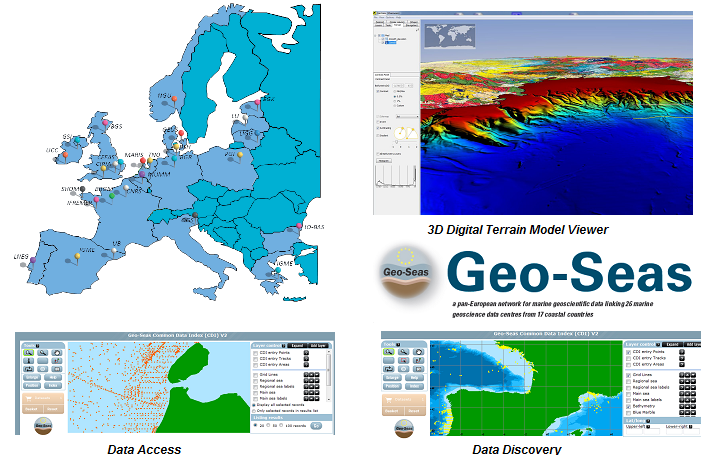
Geo-Seas est une infrastructure paneuropéenne pour la gestion des données marines et océaniques géologiques et géophysiquestuées pour les besoins de l'hydrographie, dans les sites intéressants pour la navigation maritime. Cette fiche se limite à la mise à disposition de données bathymétriques dans le cadre du projet.
-
Cartographie des communes possédant un site Internet permettant aux citoyens d'accéder à des démarches de type eAdministration.
-

Observations marines et sous-marins de l'état des paysages sous marins et des pressions