Netcdf
Type of resources
Available actions
Topics
Provided by
Years
Formats
Representation types
-
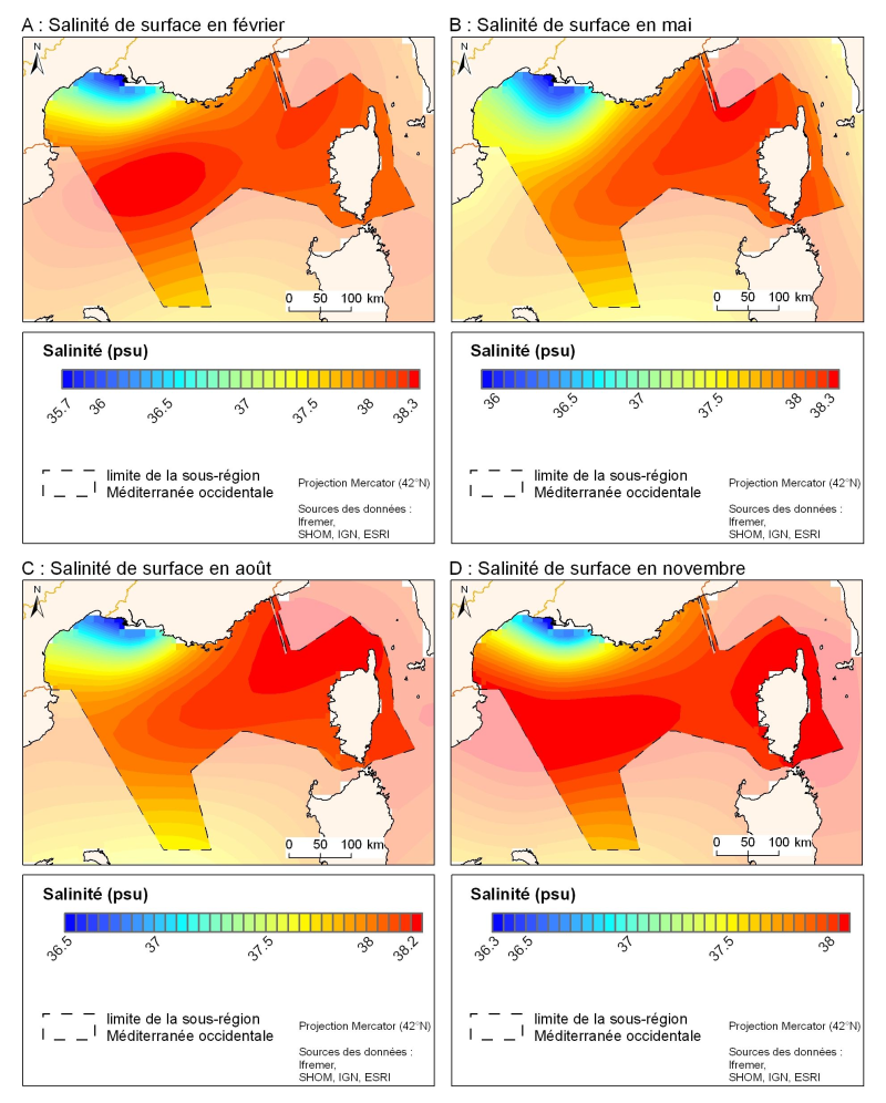
Assembled from historical data. The MEDAR / MEDATLAS climatology provides salinity fields for the Mediterranean with a horizontal resolution of about 20 km, but with better zoom resolution for area like the Gulf of Lion and the Ligurian Sea.
-
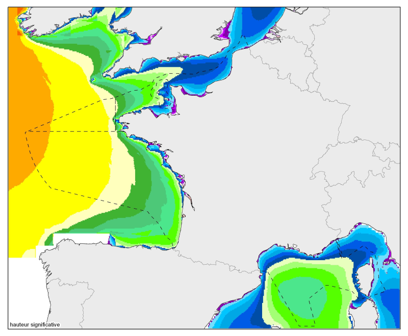
Median of the 90th and 99th percentiles of significant height and significant agitation. From the North Sea to the Mediterranean Sea, at a resolution of 2 minutes.
-
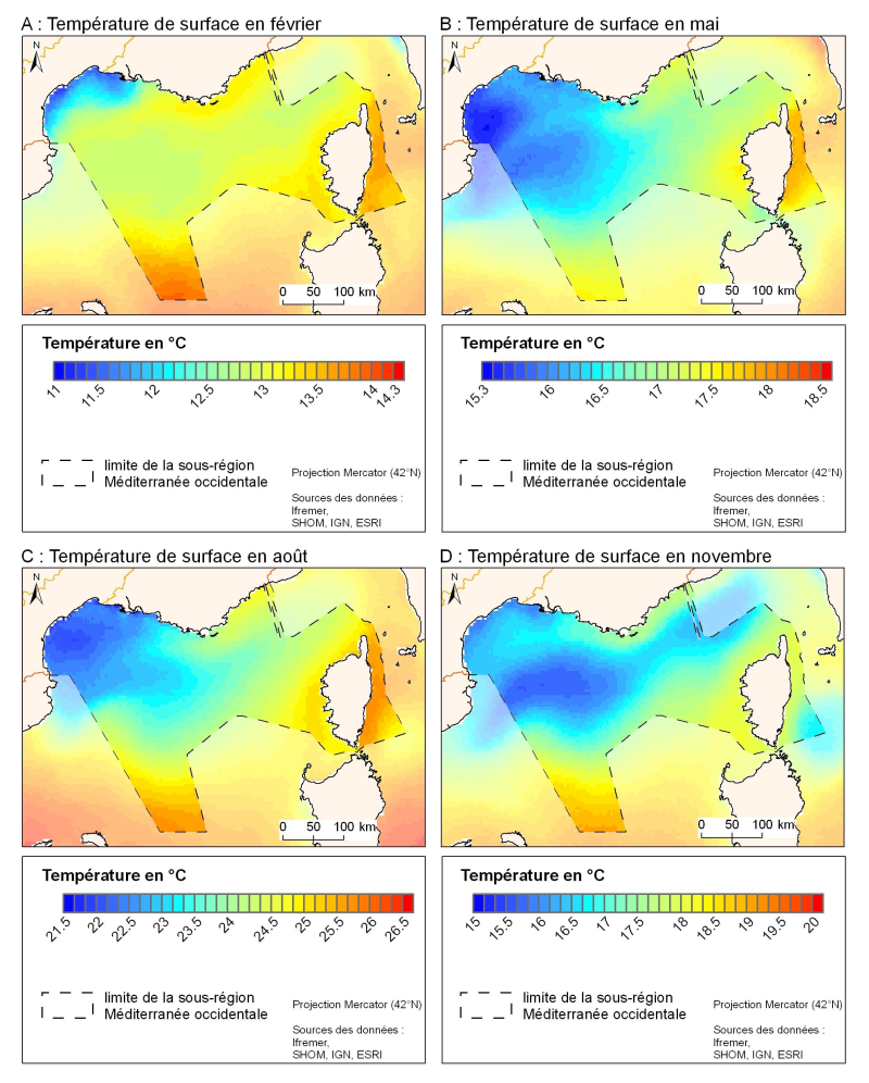
The spatial resolution from satellite climatology provides a more detailed description of spatio-temporal variations of surface temperature in the northern part of the western basin. Climatology exists for the surface temperature based on satellite infrared measurements which provides a spatial resolution on the order of kilometres.
-
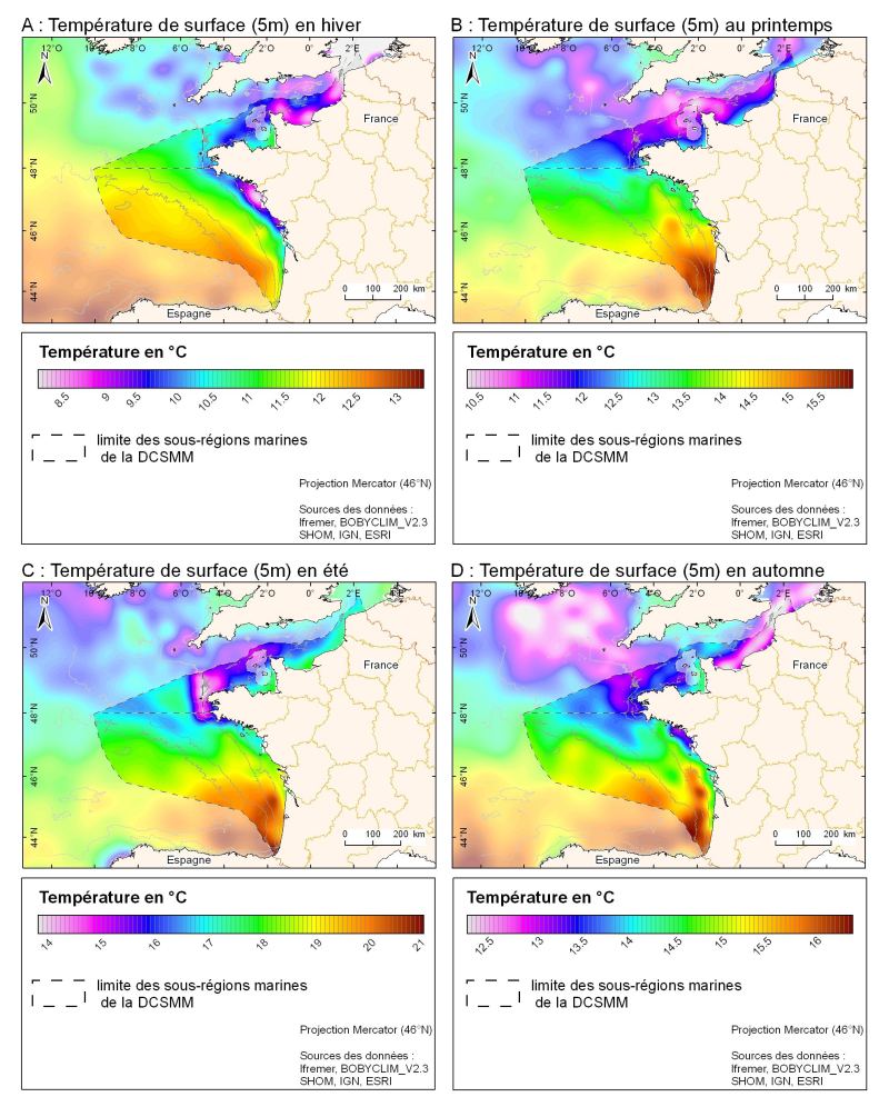
3D seasonal temperature range (in ° C) obtained by objective analysis (interpolation) of the raw data in situ, at a depth of 5m. Within the Bay of Biscay Challenge and the programme of the Operational Coastal Oceanographic Centre Prévimer, the services of SISMER DYNECO-PHYSED of IFREMER have built a joint hydrological database of the Bay of Biscay, from CTD measurements, Bouteilles, XBT / MBT and Profileurs from multiple global data centres to achieve a climatological atlas of the region for temperature and salinity.
-
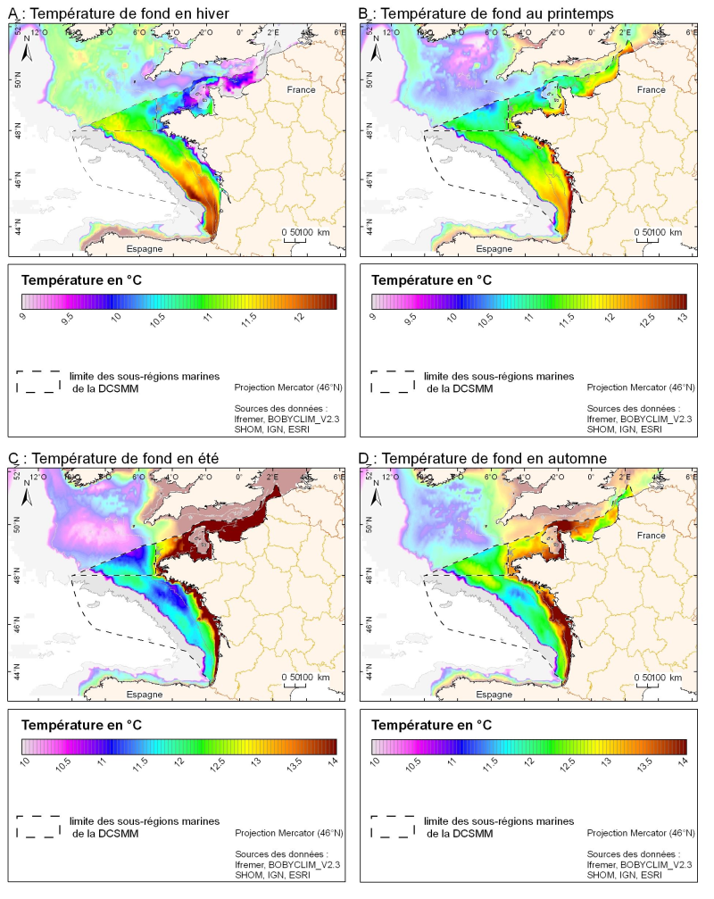
3D seasonal temperature range (in ° C) obtained by objective analysis (interpolation) of the raw data in situ, near the seafloor. Within the Bay of Biscay Challenge and the programme of the Operational Coastal Oceanographic Centre Prévimer, the services of SISMER DYNECO-PHYSED of IFREMER have built a joint hydrological database of the Bay of Biscay, from CTD measurements, Bouteilles, XBT / MBT and Profileurs from multiple global data centres to achieve a climatological atlas of the region for temperature and salinity.
-
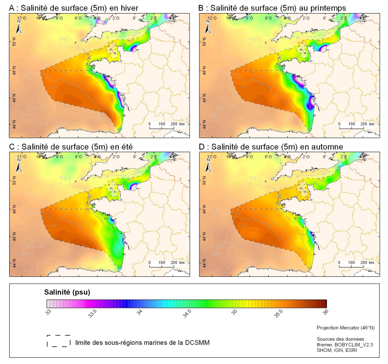
3D seasonal salinity field (in Psu) obtained by objective analysis (interpolation) of the raw data in situ at 5m depth. Within the Bay of Biscay Challenge and the programme of the Operational Coastal Oceanographic Centre Prévimer, the services of SISMER DYNECO-PHYSED of IFREMER have built a joint hydrological database of the Bay of Biscay, from CTD measurements, Bouteilles, XBT / MBT and Profileurs from multiple global data centres to achieve a climatological atlas of the region for temperature and salinity.
 Catalogue PIGMA