/Human Activities/Scientific Activities
Type of resources
Available actions
Topics
Keywords
Contact for the resource
Provided by
Representation types
Update frequencies
status
Scale
-
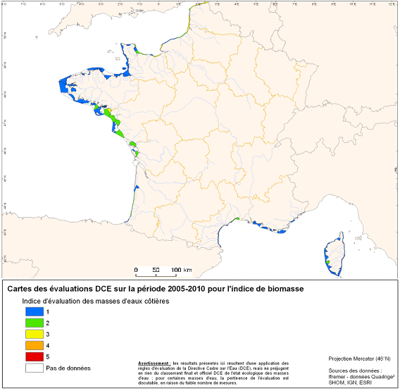
Under the EU Water Framework Directive (2000/60/EC), among the biological parameters involved in the assessment of coastal water bodies, the quality element "phytoplankton" is defined. This indicator Phytoplankton is made up of several indexes including a biomass index and an abundance index. Oxygen balance appearing among the elements of physicochemical quality selected for the classification of the ecological state of coastal water bodies. The quality element "benthic invertebrates" is also part of the biological parameters involved in the assessment of these water bodies.
-

A final aggregated vulnerability index was obtained by combining all the partial indices belonging to each of the five vectors with V4 scores multiplied by −1 since Vector 4 indicators are of “resilience” rather than of “vulnerability”. Figures 6a and 6b show respectively map and cartogram of the geographical distribution obtained for this vector. As can be seen, except for most of Ireland, the Atlantic European coast ap- pears in redish colours corresponding to higher values of vulnerability.
-
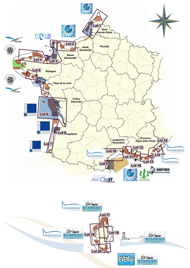
The inventory of national marine habitats in mainland France was undertaken at the request of the Ministry for Sustainable Development. Its primary objective is to meet local requirements with regards to designation of sites of ecological importance which are joining the European Natura 2000 Network as part of the “Habitat, fauna, flora” directive (DHFF) from 1992.
-
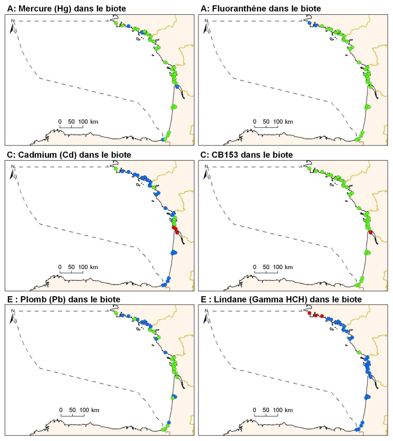
Levels of metal concentration (lead, cadmium, mercury), organochlorine (PCB153 and HCHg Lindane), PAHs (Fluoranthene) in mussels and oysters on the coast of the sub-regions Bay of Biscay and Iberian Coast.
-
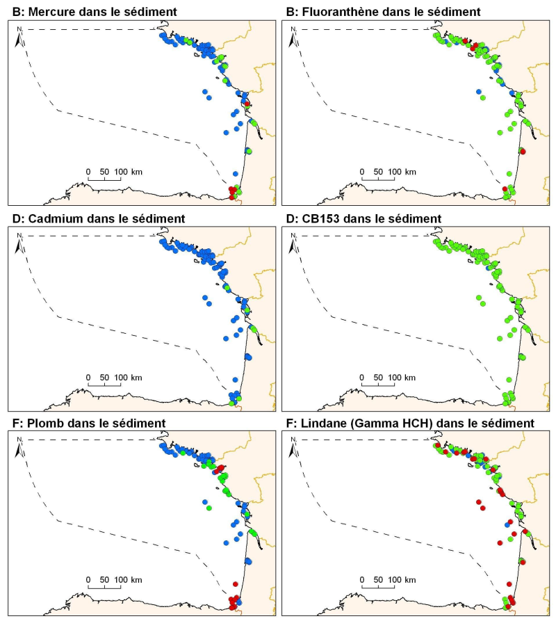
Levels of metal concentration (lead, cadmium, mercury), organochlorine (PCB153 and HCHg Lindane), PAHs (Fluoranthene) in surficial sediments (1 cm) of the sub-region Bay of Biscay and Iberian Coast.
-
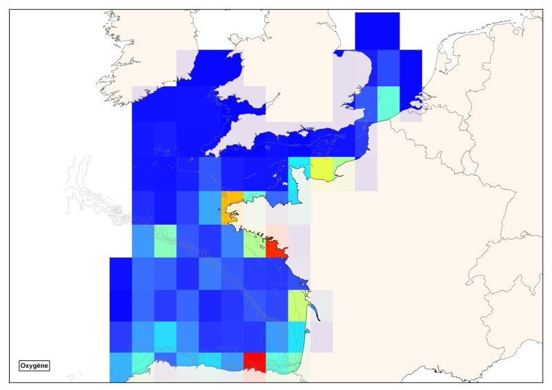
Spatial distribution of all oxygen data in degrees integrated vertically and horizontally for all sub-regions of the English Channel, the North Sea, the Celtic Seas and the Bay of Biscay.
 Catalogue PIGMA