 Catalogue PIGMA
Dissolved oxygen
Type of resources
Available actions
Topics
Keywords
Contact for the resource
Provided by
Years
Formats
Representation types
Update frequencies
status
Scale
-

This dataset contains the biological outputs of a global ocean simulation coupling dynamics and biogeochemistry at ¼° over the year 2019. The simulation has been performed using the coupled circulation/ecosystem model NEMO/PISCES (https://www.nemo-ocean.eu/), which is here enhanced to perform an ensemble simulation with explicit simulation of modeling uncertainties in the physics and in the biogeochemistry. This dataset is one of the 40 members of the ensemble simulation. This study was part of the Horizon Europe project SEAMLESS (https://seamlessproject.org/Home.html), with the general objective of improving the analysis and forecast of ecosystem indicators. See Popov et al. (https://os.copernicus.org/articles/20/155/2024/) for more details on the study.
-
This product contains observations and gridded files from two up-to-date carbon and biogeochemistry community data products: Surface Ocean Carbon ATlas SOCATv2023 and GLobal Ocean Data Analysis Project GLODAPv2.2023. The SOCATv2023-OBS dataset contains >25 million observations of fugacity of CO2 of the surface global ocean from 1957 to early 2023. The quality control procedures are described in Bakker et al. (2016). These observations form the basis of the gridded products included in SOCATv2023-GRIDDED: monthly, yearly and decadal averages of fCO2 over a 1x1 degree grid over the global ocean, and a 0.25x0.25 degree, monthly average for the coastal ocean. GLODAPv2.2023-OBS contains >1 million observations from individual seawater samples of temperature, salinity, oxygen, nutrients, dissolved inorganic carbon, total alkalinity and pH from 1972 to 2021. These data were subjected to an extensive quality control and bias correction described in Olsen et al. (2020). GLODAPv2-GRIDDED contains global climatologies for temperature, salinity, oxygen, nitrate, phosphate, silicate, dissolved inorganic carbon, total alkalinity and pH over a 1x1 degree horizontal grid and 33 standard depths using the observations from the previous major iteration of GLODAP, GLODAPv2. SOCAT and GLODAP are based on community, largely volunteer efforts, and the data providers will appreciate that those who use the data cite the corresponding articles (see References below) in order to support future sustainability of the data products.
-
This In Situ delayed mode product integrates the best available version of in situ oxygen, chlorophyll / fluorescence and nutrients data. The latest version of Copernicus delayed-mode BGC (bio-geo-chemical) product is also distributed from Copernicus Marine catalogue.
-
From 2015 to 2018 five field experiments (9 legs) have been performed in the Western Mediterranean Basin during winter or early spring. Thanks to the intensive use of a towed vehicle undulating in the upper oceanic layer between 0 and 400 meter depth (i.e. a Seasoar), a large amount of very high resolution hydrographic transects have been performed, to measure the mesoscale dynamics (slope current and its instabilities, anticyclonic eddies, sub-mesoscale coherent vortices, frontal dynamics convection events, strait outflows) and sub-mesoscale processes like stirring, mixed layer or symmetric instabilities. When available, the data were completed with velocities recorded by Vessel Mounted Acoustic Doppler Current Profiler (VMADCP) and by surface salinity and temperature recorded by ThermosalinoGraph (TSG). Some CTD casts have also been performed giving the background hydrography of the deep layers. In 2017, a Moving Vessel Profiler (MVP) has been deployed to manage even higher horizontal resolution. This data set is an unprecedented opportunity to investigate the very fine scale processes as the Mediterranean Sea is known for its intense and contrasted dynamics. It should be useful for modellers (who reduce the grid size below a few hundred meters) and expect to properly catch finer scale dynamics. Likewise, theoretical work could also be illustrated by in situ evidence embedded in this data set.
-
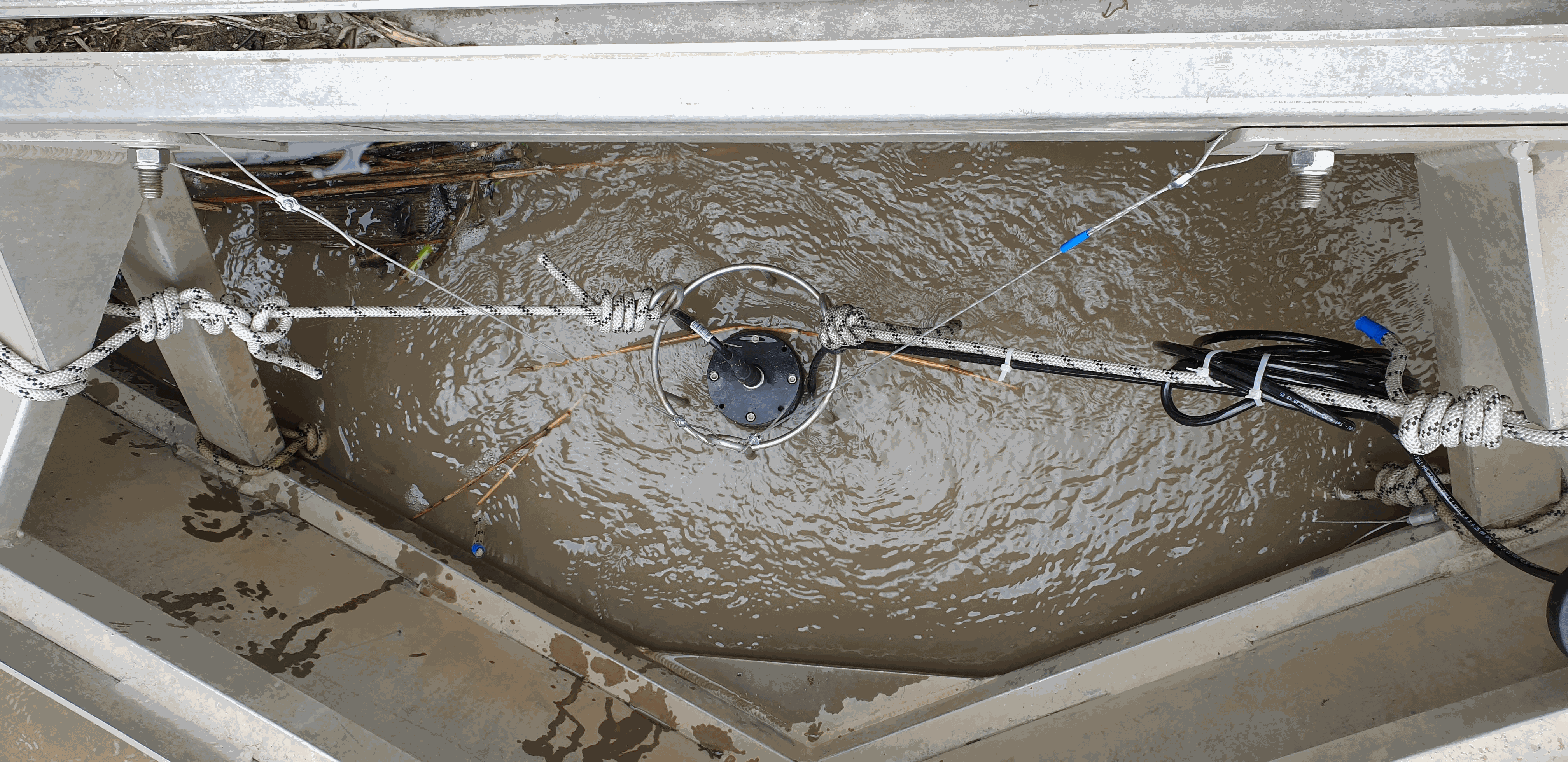
Key physico-chemical parameters (salinity, temperature, turbidity and dissolved oxygen) were measured in surface water during longitudinal transects in the Loire and Gironde estuaries in summers 2017 and 2018. This objective of this work was to determine the distribution of the dissolved oxygen and to detect potential severe desoxygenation. The transects were scheduled in order to begin the measurements at high tide from a site located upstream of an area where severe deoxygenation have been already been reported. Then, the transect was realised by sailing at low speed downstream with a multiparameter probe SAMBAT, maintained at 0.5 m below the surface, that collected a measurement every 2 minutes.
-
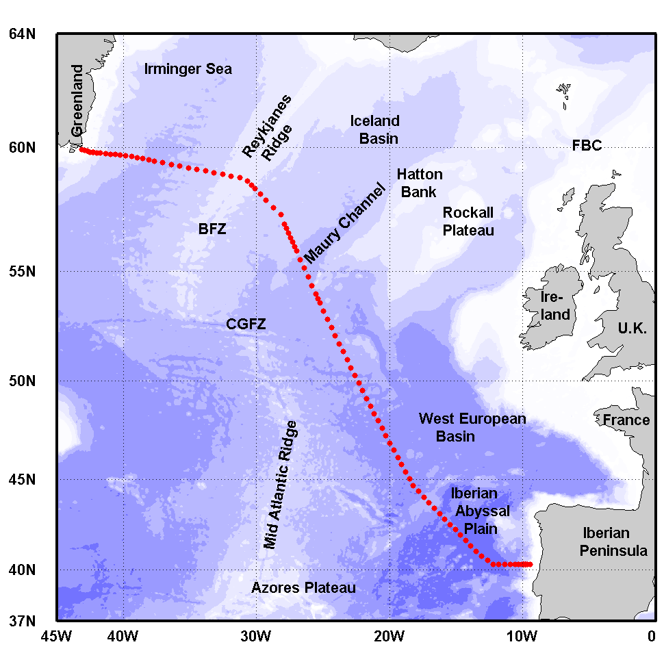
The Greenland-Portugal A25 OVIDE line is carried out biennially since 2002. The section is composed of 98 stations where hydrographic, biogeochemical and current measurements are carried out down to the bottom. OVIDE is a contribution to the international programs Go-Ship, IOCCP, and CLIVAR. This data set contains the final (adjusted) CTDO2 data.
-
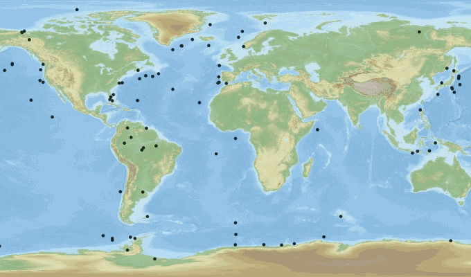
This dataset is an aggregation of all availale in situ data from Coriolis and Copernicus in situ data centres, observed in the French DCSMM area. It contains 5167 NetCDF CF files from 1903 to 2017. Each file contains the observations of a specific platform (e.g. vessel, mooring site, sea level station). Observed parameters are temperature, salinity, pressure, oxygen, nitrate, chlorophyll (and other bio-geo-chemicals), current, wave, sea level, river flow.
-

As part of the marine water quality monitoring of the “Pertuis” and the “baie de l’Aiguillon” (France), commissioned by the OFB and carried out by setec énergie environnement, three monitoring stations were installed. Two of them were set up at the mouths of the Charente and Seudre rivers on February 6 and 27, 2019, respectively, while a third was deployed in the Bay of Aiguillon on March 24, 2021. The dataset presented here concerns the station installed in the Charente estuary. Measurements are organized into .csv files, with one file per year. Data is collected using a SAMBAT multiparameter probe, which records the following parameters: - Temperature (-5 to 35 °C) - Conductivity (0 to 10 mS/cm) - Pressure (0 to 10 m) - Turbidity (0 to 300 NTU) - Dissolved Oxygen (0 to 20 mg/L & 0 to 200 %) - Fluorescence (0 to 50 µg/l) - PH (0/14)
-

As part of the marine water quality monitoring of the “Pertuis” and the “baie de l’Aiguillon” (France), commissioned by the OFB and carried out by setec énergie environnement, three monitoring stations were installed. Two of them were set up at the mouths of the Charente and Seudre rivers on February 6 and 27, 2019, respectively, while a third was deployed in the Bay of Aiguillon on March 24, 2021. The dataset presented here concerns the station installed in the Bay of Aiguillon. Measurements are organized into .csv files, with one file per year. Data is collected using a WiMO multiparameter probe, which records the following parameters: • Temperature (-2 to 35 °C) • Conductivity (0 to 100 mS/cm) • Pressure (0 to 30 m) • Turbidity (0 to 4000 NTU) • Dissolved Oxygen (0 to 23 mg/L & 0 to 250 %) • Fluorescence (0 to 500 ppb)
-
There are at least a dozen small hyper-turbid estuaries facing the Bay of Biscay, geographically situated between the two major estuaries of the Gironde and the Loire. MAGEST and SYVEL high-frequency multi-site monitoring revealed that the Loire, and to a lesser extent the Gironde, are subject to summer hypoxia. These observations raised the question of the potential occurrence of hypoxia in the small estuaries in between, motivating an investigation of dissolved oxygen in one of them, the Charente estuary. Oxygen and salinity sensors were placed at L'Houmée (2019), Tonnay-Charente (2018; 2019), Rochefort (2020; 2021; 2022), Martrou (2020) during summer, the most critical period for dissolved oxygen; a multiparameter probe was placed at Tonnay-Charente from April to November 2020. Longitudinal investigations along the estuary axis were also carried out during the summers of 2018 and 2019. All the measurements were acquired at 0.5 ± 0.2 meters below the surface. The dataset enabled us to identify the occurrence of summer hypoxia and an oxygen depletion zone in the Charente estuary. These results resulted in the implementation of high-frequency monitoring at Tonnay-Charente, operational since November 2020.