 Catalogue PIGMA
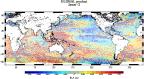
Hauteur de la surface de la mer
Type of resources
Available actions
Topics
Provided by
Years
Formats
Representation types
Update frequencies
status
Scale
Resolution
-
Monomission altimeter satellite along-track sea surface heights computed with respect to a twenty-year mean. Previously distributed by Aviso+, no change in the scientific content. All the missions are homogenized with respect to a reference mission which is currently OSTM/Jason-2. The sla is computed with an optimal and centered computation time window (6 weeks before and after the date). Two kinds of datasets are proposed: filtered (nominal dataset) and unfiltered.
-
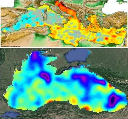
Produit altimétrique combiné (multimissions) régional comprenant les hauteurs de surface (anomalies de hauteurs de mer, topographie dynamique) et variables dérivées (anomalies de courants géostrophiques et courants géostrophiques aboslus) calculées par rapport à une moyenne sur vingt ans.
-
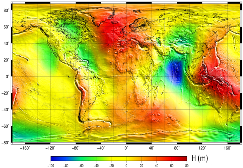
La surface moyenne océanique (Mean Sea Surface MSS, en anglais) est un élément important en océanographie physique, en géophysique et en géodésie. Elle correspond à la hauteur moyenne stable, de la surface de l'océan.. Le produit MSS CNES CLS est un produit altimétrique auxiliaire représentant la hauteur moyenne de l'océan par rapport à l'ellipsoïde de référence T/P ou WGS84. Cette surface est fournie sur une grille régulière (1/60°x1/60°). Une grille d'erreur d'estimation est également fournie.
-

-

-

Les variations barystatiques et manométriques du niveau marin représentent la composante de masse des variations du niveau marin aux échelles globale et régionale respectivement. Les variations barystatiques et manométriques du niveau marin sont estimées ici à partir de la gravimétrie, issues des mesures des missions de gravimétrie spatiale GRACE et GRACE - Follow On. Deux produits sont distribués : - Les variations barystatiques du niveau de la mer à partir de la gravimétrie : séries temporelles mensuelles ; - Les variations manométriques du niveau de la mer à partir de la gravimétrie : grilles mensuelles 1x1°. Les missions GRACE et GRACE Follow-On surveillent les variations temporelles du champ de gravité de façon quasi continue depuis 2002. De nombreux centres distribuent des solutions temporelles du potentiel gravitationnel de la Terre, fournies sous forme de coefficients de Stokes, connues sous le nom de solutions de niveau-2. Les solutions de niveau-2 doivent être corrigées de plusieurs effets géophysiques et erreurs instrumentales, converties en anomalies de masse de surface et projetées sur l'ellipsoïde. Les grilles d'anomalies de masse de surface qui en résultent, après application des corrections appropriées, sont appelées solutions de niveau-3. Plusieurs sources d'erreurs affectent les solutions des niveaux 2 et 3, imposées par la configuration du satellite, les erreurs instrumentales et les incertitudes dans les corrections géophysiques utilisées pour traiter les mesures. L'approche ensembliste de Blazquez et al. (2018, https://doi.org/10.1093/gji/ggy293) est utilisée pour estimer de manière robuste les changements manométriques et barystatiques du niveau de la mer et leurs incertitudes.
-
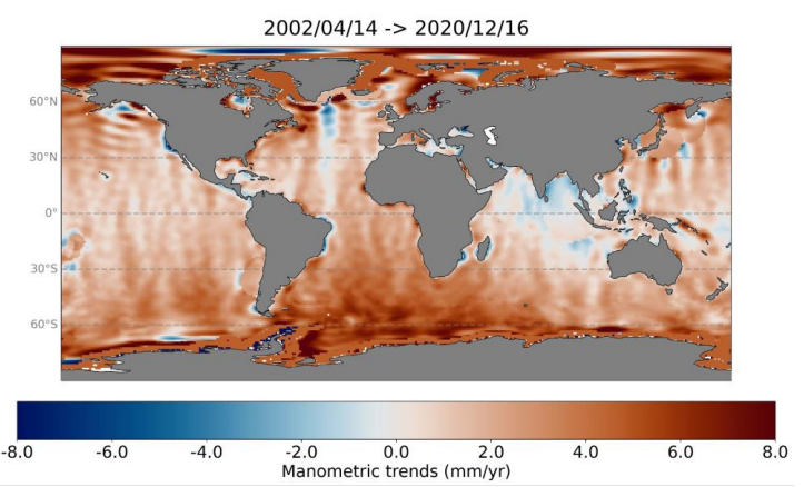
Les variations barystatiques et manométriques du niveau marin représentent la composante de masse des variations du niveau marin aux échelles globale et régionale respectivement. Les variations barystatiques et manométriques du niveau marin sont estimées ici à partir de la gravimétrie, issues des mesures des missions de gravimétrie spatiale GRACE et GRACE - Follow On. Deux produits sont distribués sur la période avril 2002 à août 2022 : - Les variations barystatiques du niveau de la mer à partir de la gravimétrie : séries temporelles mensuelles, - Les variations manométriques du niveau de la mer à partir de la gravimétrie : grilles mensuelles 1x1°.
-
Produits altimétriques monomissions OSTM/Jason-2. Ces produits ont été produits par CLS dans le cadre du projet Pistach, financé par le Cnes.
-

-
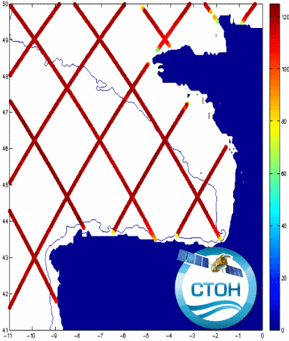
Produit de hauteurs de mer destiné à l’étude de 23 régions côtières, avec des données le long de la trace projetées sur la trace de référence avec un intervalle d'environ 6-7 km entre les points (1 seconde). Concerne les missions Topex/Jason-1/Jason-2/Jason-3 (+Topex Interleaved orbit (TPN)/Jason-1 Interleaved orbit (J1N)), SARAL/AltiKa, Envisat, Geosat Follow On. Un traitement spécifique (développé au LEGOS) a été appliqué en appliquant les dernières corrections disponibles.