Iberian Coast
Type of resources
Topics
Keywords
Contact for the resource
Provided by
Years
Representation types
Update frequencies
status
Scale
-

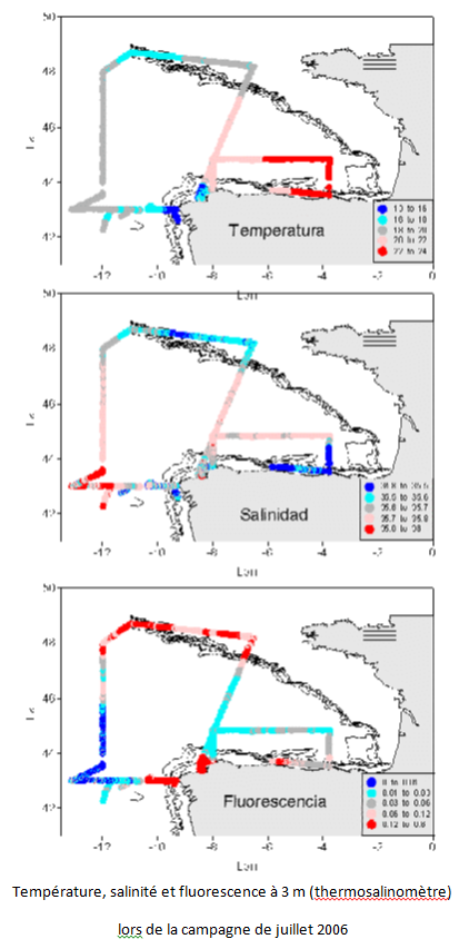
The aim of this project is to implement a sampling network in order to study climate variability in ocean water around the Iberian peninsula and the Bay of Biscay, to determine the flows of heat, freshwater, nutrients and C02 in wastewater, and relationship with NAO. This contributed to international climate change programmes and to the beginning of systematic study of the region. Furthermore, it facilitates the use of a digital model in the region. The main aim of the VACLAN project is to improve observation capacity and the use of the new tools available used to characterize climate change: remote sensing for the study of surface waters, drifting buoys for upper and mid waters, and moored instruments and hydrographic stations for studying the water column. The use of these tools along with digital modelling will make it possible to characterize CO2 flow and the physio-chemical flow in such a large area, where the border current is the Atlantic. Furthermore, once checked and validated, the data in this system will be made available for academic scientific communities and included in digital forecasting models.
-

EMODnet (European Marine Observation and Data Network) is the long term marine data initiative supported by the European Commission since 2009 to ensure that European marine data will become easily accessible, interoperable, and free on restrictions on use. EMODnet Chemistry provides access to standardized, harmonized and validated chemical data collections for water quality evaluation at a regional scale, as defined by the Marine Strategy Framework Directive (MSFD). The data portal has adopted and adapted SeaDataNet standards and services, establishing interoperability between the data sets from the many different providers (more than 60 in EMODnet Chemistry network). Concentration maps of nutrients, chlorophyll-a and dissolved oxygen are computed on a standard grid, providing information at a regular time interval, per season and over several vertical layers, including the deepest one. Dedicated OGC standard services for browsing, viewing and downloading chemistry observation, data and data products for the European waters have been developed, and are actively maintained and monitored.
 Catalogue PIGMA