Monitoring
Type of resources
Topics
Keywords
Contact for the resource
Provided by
Years
Representation types
Update frequencies
status
Scale
-
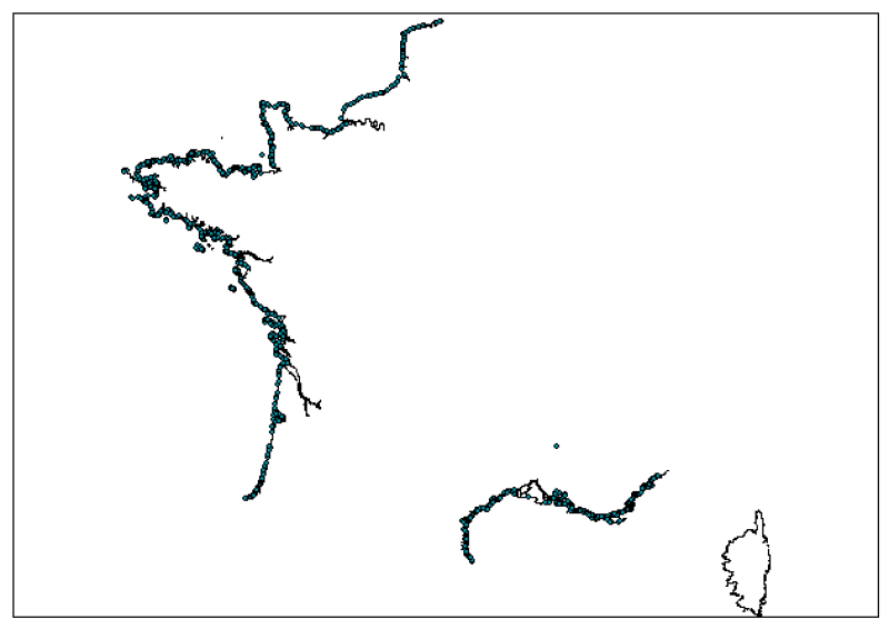
Monitoring locations used to ensure sanitary controls of swimming water by Regional Health Authorities (ARS). Data is taken from the Health Ministry’s "SISE-EAUX" information system, with data supplied by the ARS.
-
The Joint WMO-IOC Technical Commission for Oceanography and Marine Meteorology Observing Programmes Support Centre, provides technical coordination at international level for the sustained elements of the Global Ocean Observing System. The Centre monitors in real-time the status of the observing networks and provides a toolbox to evaluate their performance and optimize their implementation and data flow. Currently OceanOPS monitors the Argo profiling floats, the DBCP surface drifters, coastal and tropical moorings, ice buoys, tsunami buoys, the OceanSITES moorings time-series, the GO-SHIP hydrographic reference lines, the SOT mat/ocean ship based observations and the GLOSS sea level tide gauges. A number of other observing systems are being added gradually, including ocean gliders, polar systems, marine mammals and potentially HF radars.
-
The in-situ TAC integrates and quality control in a homogeneous manner in situ data from outside Copernicus Marine Environment Monitoring Service (CMEMS) data providers to fit the needs of internal and external users. It provides access to integrated datasets of core parameters for initialization, forcing, assimilation and validation of ocean numerical models which are used for forecasting, analysis and re-analysis of ocean physical and biogeochemical conditions. The in-situ TAC comprises a global in-situ centre and 6 regional in-situ centres (one for each EuroGOOS ROOSs). The focus of the CMEMS in-situ TAC is on parameters that are presently necessary for Copernicus Monitoring and Forecasting Centres namely temperature, salinity, sea level, current, waves, chlorophyll / fluorescence, oxygen and nutrients. The initial focus has been on observations from autonomous observatories at sea (e.g. floats, buoys, gliders, ferrybox, drifters, and ships of opportunity). The second objective was to integrate products over the past 25 to 50 years for re-analysis purposes... Gathering data from outsider organisations requires strong mutual agreements. Integrating data into ONE data base requires strong format standard definition and quality control procedures. The complexity of handling in situ observation depends not only on the wide range of sensors that have been used to acquire them but, in addition to that, the different operational behaviour of the platforms (i.e vessels allow on board human supervision, while the supervision of others should be put off until recovering or message/ping reception)°
-
EMODnet Physics provides a combined array of services and functionalities to obtain free-of-charge data, meta-data and data products on the physical conditions of European sea basins and oceans as recorded by more than 20.000 platforms (fixed stations, surface loads, ARGOs, HF radars, etc.) The system provides full interoperability with third-party software through WMS services, Web Services and Web catalogues in order to exchange data and products according to the most recent standards. EMODnet Physics builds on and is based on the cooperation and collaboration with the three established pillars of the European Oceanographic Community: 1) EuroGOOS and its Regional Operational Oceanographic Systems (ROOSs); 2) Copernicus Marine Environment Monitoring Service (CMEMS) , and in particular with the In Situ Thematic Assembly Center (INSTAC); 3) SeaDataNet network of National Oceanographic Data Centres (NODCs). Data are made available by EMODnet Physics, funded by the European Commission Directorate General for Maritime Affairs and Fisheries, in collaboration with Copernicus Marine Service (CMEMS) and EuroGOOS ROOSs INSTAC. Delayed mode data integrates the best available version of in situ data. These data are collected from national observing systems operated by EuroGOOS ROOS members, SeaDataNet NODCs completed by main global networks
-
The definitive coastal information system, Quadrige stores coastal observation and monitoring network data. In order to manage coastal monitoring data, Ifremer developed the Quadrige² information system. Quadrige is one element of the Water Information System (SIE) http:// www.eaufrance.fr, et à ce titre, contribue aux travaux du Secrétariat d'Administration National des Données Relatives à l'Eau (SANDRE) http://www.sandre.eaufrance.fr. Quadrige Marine Zones is a reference source unique to the Quadrige system. It is used to break down the coast of the French mainland and overseas territories into large areas and to connect each one with observation and monitoring locations.
 Catalogue PIGMA