Sea regions
Type of resources
Available actions
Topics
Keywords
Contact for the resource
Provided by
Years
Formats
Representation types
Update frequencies
status
Scale
Resolution
-
Data from a number of different sources have been integrated to provide new perspectives on fishing activities. Vessel Monitoring Systems (VMS) record and transmit the position and speed of fishing vessels at intervals of two hours or less. Fishing time can be calculated from the VMS data and combining this parameter with vessel logbook data, maps of fishing effort and intensity at different spatial and temporal scales can be calculated. The statistical software package “R” is used to extract the required information then re-interrogated to produce maps of fishing effort or intensity per month and year. The use of Automatic Identification System (AIS) data was not considered as combining AIS data with fisheries logbook data would pose issues namely; the ability of the AIS system to be switched off, only mandatory on vessels > 15 meters in length, cost involved to purchase data, and confidentiality.
-
The impact of fishing on benthic habitats has previously been investigated however; a conclusive classification of potentially sensitive habitats per gear type does not exist. Currently only qualitative estimates of fishery impact using Broad-scale habitat maps are possible. Here a sensitivity matrix using both fishing pressure (fishing Intensity) and habitat sensitivity is employed to define habitat disturbance categories. The predominant fishing activities associated with physical abrasion of the seafloor area are from bottom contacting towed fishing gear. The swept area of the aforementioned gear in contact with the seabed is generally considered a function of gear width, vessel speed and fishing effort (ICES. 2015). The varying characteristics of fishing gear, their interaction with the sea floor and species being targeted; provide scope for differing interactions with subsurface (infaunal) and surface (epifaunal) dwelling communities. An evaluation of the abrasion pressure and habitat sensitivity split into surface and subsurface pressure allows greater insight to the ecological effects. Fishing intensity was calculated annually and based on the area of sea floor being swept (or swept area ratio SAR) by gear type. Calculations are based on SAR’s of gear types per area, per year. Fishing pressure ranks and habitat sensitivity ranks obtained from WGSFD working group (01 WGSFD - Report of the Working Group on Spatial Fisheries Data 2015) can be incorporated within a GIS environment to existing ICES fisheries data to provide habitat disturbance maps (fishing pressure maps+ habitat sensitivity maps) ICES. 2015. Report of the Working Group on Spatial Fisheries Data (WGSFD), 8–12 June 2015, ICES Headquarters, Copenhagen, Denmark. ICES CM 2015/SSGEPI:18. 150 pp.
-
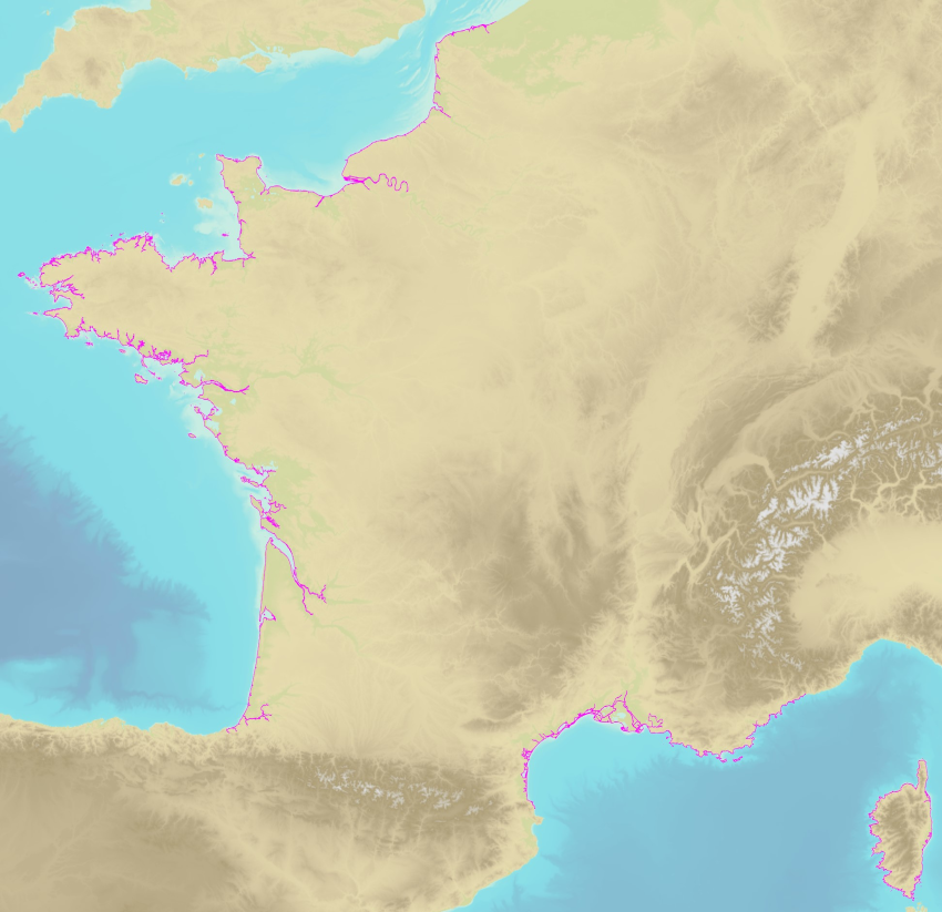
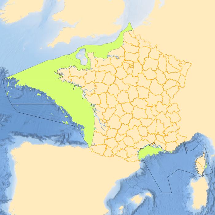
The land-sea limit corresponds to the Highest Astronomical Tide (HAT) in the case of a tide of coefficient 120 and under normal meteorological conditions (no offshore wind and mean atmospheric pressure of 1013 hPa). This geometric line is naturally defined as the intersection of a HAT model (extended to the coast and the top end of the upper estuary) based on the available Bathyelli surfaces, and a high-resolution digital terrain model of the coastal area. It corresponds to the highest limit of the intertidal area and takes into account, when they exist, the 3 administrative maritime limits which are: the transversal limit of the sea (LTM), the salt water limit (LSE) and the limit of maritime jurisdiction (LAM). This limit is measured (quoted) in relation to the local hydrographic chart datum and to the levels of reference for France (IGN69 and IGN78 for Corsica). Relations to other levels of reference (mean sea level and ellipsoid) are known. The land-sea limit product, mainly results from the exploitation of the two products Litto3D®/RGEALTI® and Bathyelli, and represents, with a metric resolution (1 to 5 metres), this theoretical entity by a set of 2D polylines describing the nature of the coast (artificial or natural, rocky or sandy, steep or flat, etc.). The method used for calculating the land-sea limit makes it possible to produce a continuous, homogeneous and spatially coherent limit on the entire French metropolitan coastal area.
-
-
-
-

The EEA coastline dataset is created for detailed analysis with a Minimum Mapping Unit of e.g. 1:100000, for geographical Europe. The coastline is a hybrid product obtained from satellite imagery from two projects: 1) EUHYDRO (Pan-European hydrographic and drainage database) [https://land.copernicus.eu/pan-european/satellite-derived-products/eu-hydro/view] and 2) GSHHG (A Global Self-consistent, Hierarchical, High-resolution Geography Database) [http://www.soest.hawaii.edu/pwessel/gshhg/]. The defining criteria was altitude level = 0 from EUDEM [https://land.copernicus.eu/pan-european/satellite-derived-products/eu-dem/view]. Outside the coverage of the EUDEM, the coastline from GSHHG was used without modifications. A few manual amendments to the dataset were necessary to meet requirements from EU Nature Directives, Water Framework Directive and Marine Strategy Framework Directive. In 2015, several corrections were made in the Kalogeroi Islands (coordinates 38.169, 25.287) and two other Greek little islets (coordinates 36.766264, 23.604318), as well as in the peninsula of Porkkala (around coordinates 59.99, 24.42). In this revision (v3, 2017), 2 big lagoons have been removed from Baltic region, because, according to HELCOM, are freshwater lagoons. This dataset is a polygon usable as a water-land mask.
-
 Catalogue PIGMA